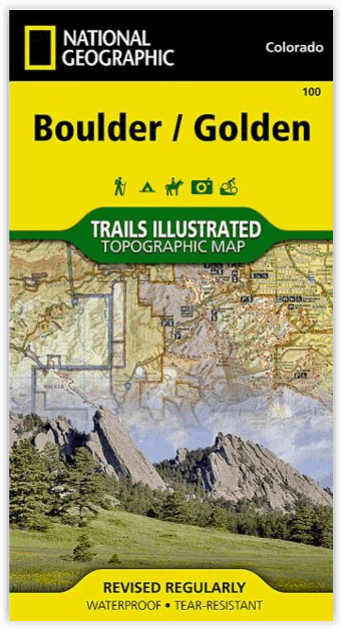
Wandelkaart 100 Boulder & Golden Colorado USA - Nat Geo
National Geographic's Trails Illustrated Colorado's Front Range
Korte omschrijving
Wandelkaart Boulder & Golden Colorado USA - Nat Geo Productomschrijving: National Geographic's Trails Illustrated kaart van Boulder en Golden combineert ongeëvenaarde details met nuttige inf...

Specificaties
- Uitgever: National Geographic
- ISBN-13: 9781566953351
- HOOFDCATEGORIEËN: Wandelkaart
- Activiteiten: Wandelen, Hiking & Trekking
- Regio: Colorado, USA
- Land: Verenigde Staten van Amerika (USA)
- Schaal: 1:50000
- Afmeting: 10x19
- Taal: Engels
Volledige omschrijving
Wandelkaart Boulder & Golden Colorado USA - Nat Geo
Productomschrijving: National Geographic's Trails Illustrated kaart van Boulder en Golden combineert ongeëvenaarde details met nuttige informatie om een onschatbaar hulpmiddel te bieden om het meeste uit uw verkenning van de centrale Colorado Front Range te halen. Deskundig onderzocht en gemaakt in samenwerking met lokale landbeheerders.
Met km duidelijk gemarkeerde paden, inclusief km tussen kruispunten, zal deze kaart van onschatbare waarde blijken bij uw verkenning van de regio, of u nu te voet, per fiets, te paard of per gemotoriseerd voertuig reist. Handige trail legendes zijn opgenomen voor White Ranch, Alderfer/Three Sisters, en Apex parken. De Lariat Loop scenic byway is aangegeven voor diegenen die met de auto van het landschap willen genieten. De kaartbasis bevat hoogtelijnen en hoogtes voor toppen, passen en vele meren. Veel recreatiemogelijkheden zijn aangegeven, waaronder campings, trailheads, interpretatieve paden, bootlanceringen, vismogelijkheden en zwemgebieden. Handig materiaal over het gebruik van de paden en etiquette, overlevingstips, en contactinformatie van de agentschappen wordt ook verstrekt.
Omvat: Boulder Mountain Park, Clear Creek, Golden Gate Canyon State Park, Alderfer/Three Sisters Park, Lookout Mountain, & the iconic Red Rocks amphitheater.
betrokken gemeentes: Lyons, Boulder, Golden, Morrison, Aspen Park, and Evergreen
Engelse omschrijving: National Geographic's Trails Illustrated map of Boulder and Golden combines unmatched detail with helpful information to offer an invaluable tool for making the most of your exploration of the central Colorado Front Range. Expertly researched and created in partnership with local land management agencies, this map features key points of interest including Boulder Mountain Park, Clear Creek, Golden Gate Canyon State Park, Alderfer/Three Sisters Park, Lookout Mountain, and the iconic Red Rocks amphitheater. The communities of Lyons, Boulder, Golden, Morrison, Aspen Park, and Evergreen are also covered on this map.
With miles of clearly marked trails that include mileage between intersections, this map will prove invaluable in your exploration of the region whether you're traveling on foot, bike, horse, or motorized vehicle. Handy trail legends are included for White Ranch, Alderfer/Three Sisters, and Apex parks. The Lariat Loop scenic byway is noted for those wishing to take in the scenery by car. The map base includes contour lines and elevations for summits, passes and many lakes. Many recreation features are noted including campgrounds, trailheads, interpretive trails, boat launches, fishing access, and swimming areas. Helpful material about trail use and etiquette, survival tips, and agency contact information is provided as well.
Every Trails Illustrated map is printed on "Backcountry Tough" waterproof, tear-resistant paper. A full UTM grid is printed on the map to aid with GPS navigation. Other features found on this map include: Arapaho National Forest, Boulder, Golden, Pike National Forest, Roosevelt National Forest, Superior, Thorodin Mountain.
Locatie op kaart
Artikelen uit dezelfde regio

Reisgids Colorado - Insight Guides ENG • 9781789198393
Reisgids Colorado USA - Insight Guides ENG Productomschrijving: Van het beslissen wanneer je gaat, tot het kiezen van wat te zien als je aankomt, deze gids voor Colorado is alles wat je nodig hebt om je perfecte reis te plannen, met insider informatie over must-see, top attracties zoals Denver Art Museum, Pikes Peak en het Old Fort National Historic Site, en culturele juweeltjes zoals de g…

Wandelkaart 208 Colorado National Monument - Natgeo • 9781566954013
TOPO Wandelkaart 208 - Colorado National Monument - Natgeo Productomschrijving: recreatie regio's doorheen Colorado's 'Grand Valley' omvatten de steden: Grand Junction, Fruita, Palisade & Loma. Dit veel gebruikte gebied is gekend onder de de mensen die in Colorado wonen. Dit gebied is nationaal bekend voor zijn speciale mountainbiketrails en evengoed gekend voor de start van het Kokepelli …

Wandelkaart 220 Dinosaur National Monument - Natgeo • 9781566954037
TOPO Wandelkaart 220 - Dinosaur National Monument - Nat Geo Productomschrijving: Dinosaur National Monument in de United States, gelegen op de zuidoostelijke kant van de Uinta Mountains op de grens tussen Colorado en Utah met invloeden van de Green & Yampa Rivieren. Ondanks dat het grootste deel ervan gelegen is in Moffat County, Colorado, is Dinosaur gelegen in Utah net ten noorden van de…

Wandelkaart 301 Longs Peak -Trails Illustrated N. Trails - Nat Geo • 9781566954310
Wandelkaart 301 Longs Peak - Nat Geo Productomschrijving: Engelse omschrijving: Towering over the Rocky Mountains stands the 14,259 foot high Longs Peak. National Geographic's Trails Illustrated map of Longs Peak and the surrounding south-east areas of Rocky Mountain National Park is designed to meet the needs of those who are looking for a phenomenal climbing experience as well as fo…

Wandelkaart 128 Maroon Bells- Redstond & Marble - Nat Geo • 9781566952484
TOPO Wandelkaart 128 - Maroon Bells- Redstond & Marble - National Geographic Productomschrijving: De Maroon Bells zijn 2 bergtoppen in de Elk Mountains, Maroon Peak & North Maroon Peak, met een dikke half kilometer gescheiden. De liggen liggen op de grens tussen Pitkin County & Gunnison County, Colorado, United States Engelse omschrijving: Colorado's Maroon Bells are the most photograp…


