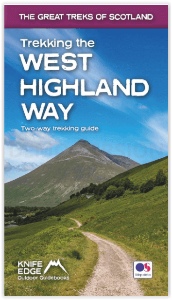
Wandelgids West Highland way trekking guide - Knife Edge
Both Northbound and Southbound routes are described
Korte omschrijving
West Highland way trekking guide - Knife Edge Productomschrijving: De West Highland Way, één van de "Great Trails" van Schotland, voert over een afstand van 96 mijl door een subliem landscha...

Specificaties
- Uitgever: Knife Edge Outdoor Limited
- ISBN-13: 9781912933112
- HOOFDCATEGORIEËN: Wandelgids
- Activiteiten: Wandelen, Hiking & Trekking
- Auteur: Andrew McCluggage
- Regio: Highlands, Schotland
- Land: Schotland
- Blz.: 142
- Afmeting: 12x21
- Editie: 1
- Taal: Engels
Volledige omschrijving
West Highland way trekking guide - Knife Edge
Productomschrijving: De West Highland Way, één van de "Great Trails" van Schotland, voert over een afstand van 96 mijl door een subliem landschap, van de buitenwijken van Glasgow naar Fort William. Tussendoor zijn er ontelbare prachtige bergen, prachtige valleien, glinsterende lochs en schijnbaar eindeloze kilometers paarse heide te beleven. De trekker doorkruist dit prachtig onbevolkte terrein op een nauwgezet aangegeven reeks paden en wegen, waarvan vele oude militaire wegen of veedrijverspaden zijn, die vele eeuwen geleden werden aangelegd. In dit deel van de Highlands bent u ver weg van de stedelijke centra van de regio.
Af en toe komt u een weg tegen of passeert u een klein dorp of gehucht (met niet veel meer dan een plaatselijke pub en een paar overnachtingsmogelijkheden), maar verder is de ervaring er een van rust. Dit is de Schotse Hooglanden op zijn best en het zal een avontuur zijn dat u nooit zult vergeten.
Engelse omschrijving: The definitive two-way guide to the West Highland Way: both northbound and southbound routes are described in full.
Real Maps: Full Ordnance Survey Explorer mapping inside (1:25,000) 17 different itineraries: schedules of 3, 4, 5, 6, 7, 8, 9, 10 and 11 days for hikers and runners. Includes both southbound and northbound itineraries. Difficult calculations of time, distance and altitude gain are done for you.
Also includes:
• Detailed information on equipment and travelling light
• Everything the trekker needs to know: route, costs, difficulty, weather, travel, and more
• Full accommodation listings: the best inns, B&Bs and hotels
• Detailed section on camping
• Essential info for both self-guided and guided trekkers
• Information on geology, history, plants and wildlife
• Numbered waypoints linking the Real Maps to our clear descriptions
The West Highland Way, which is one of ‘Scotland’s Great Trails’, travels 96 miles through sublime scenery, from the outskirts of Glasgow to Fort William. In between, there are countless magnificent mountains, exquisite glens, shimmering lochs and seemingly endless miles of purple heather to experience. The trekker negotiates this wonderfully unpopulated terrain on a meticulously waymarked series of paths and tracks, many of which are old military roads or drovers’ paths, built many centuries ago. In this part of the Highlands, you are far away from the region’s urban centres.
Occasionally, you will meet a road or pass through a small village or hamlet (with little more than a local pub and a few places to stay) but otherwise, the experience is one of tranquillity. This is the Scottish Highlands at their best and it will be an adventure that you will never forget.

Locatie op kaart
Artikelen uit dezelfde regio

Wandelgids The Great Glen Way - Trailblazer • 9781912716104
The Great Glen Way - Trailblazer Publications Productomschrijving: The Great Glen Wayfrom Fort William to Inverness. Het langeafstandswandelpad Great Glen Way begint waar de West Highland Way eindigt - in Fort William - en volgt de breuklijn van de Great Glen om na 79 mijl (127 km) te eindigen in Inverness. Het pad loopt langs Loch Lochy, Loch Oich en Loch Ness en volgt ook het jaagpad van…

Wandelkaart 385 Rannoch Moor & Ben Alder- Schotland - OSI • 9780319472514
Wandelkaart Rannoch Moor & Ben Alder - Loch Rannoch Schotland Omvat ook: Loch Rannoch. Productbeschrijving: Kaart nummer 385 omvat Rannoch Moor en Ben Alder. Hoogtepunten zijn Loch Rannoch, Loch Laidon en het Cairngorms National Park & Tay Forest Park. Omvat ook Blackwater Reservoir, Loch Ossian en Loch Eigheach. De OS Explorer kaart voor Rannoch Moor & Ben Alder is beschikbaar in zowe…

Wandelkaart 442 Assynt & Lochinver- Schotland - OSI • 9780319472941
Wandelkaart Assynt & Lochinver - Highland's Schotland Omvat ook: Kylesku & Inchnadamph. Productbeschrijving: Van Kylesku tot Lochinver en The Minch, het hele gebied werd aangewezen als een National Scenic Area. Er zijn 2 Munro's is dit gebied - Ben More Assynt staat met zijn 998m op kop. De OS Explorer kaart voor Assynt & Lochinver is beschikbaar in zowel als de standaard papieren vers…

Wandelkaart 416 Inverness Loch Ness & Culloden - OSI • 9780319472712
Wandelkaart Inverness- Loch Ness & Culloden Highland's Omvat ook: Fort Augustus & Drumnadrochit. Productbeschrijving: Deze twee-zijdige Explorer kaart nummer 416 heeft betrekking op de lengte van Loch Ness en de Highland hoofdstad van Inverness. Wandel de Great Glen way op de oevers van loch Ness, om te zien of u ter plaatse het legendarische monster kunt ontdekken, of ga op verkennin…

Wandelkaart OL38 Loch Lomond South & Dumbarton - OSI • 9780319469569
Wandelkaart Loch Lomond South & Dumbarton Omvat ook: Dumbarton & Helensburgh Drymen & Cove Productbeschrijving: Kaart nummer OL 38 omvat Loch Lomond Zuid, Helensburgh & Dumbarton. Hoogtepunten zijn de Loch Lomond, het Trossarchs National Park en het Argyll Forest National Park. Ook de koningin Elizabeth Forest Park, Arden en Balloch. Deze kaart vervangt de vorige OS Explorer kaart 347 …


