
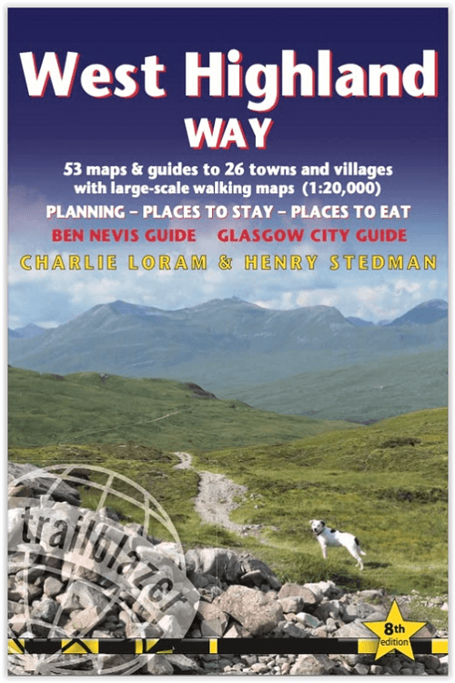
Wandelgids West Highland Way - Trailblazer
Milngavie to Fort William - 154.5 km
Korte omschrijving
The West Highland Way - Trailblazer Productomschrijving: De West Highland Way, loopt door één van de meest spectaculaire landschappen van Groot-Brittannië. Vanaf de rand van Glasgow slingert...

Specificaties
- Uitgever: Trailblazer Publications
- ISBN-13: 9781912716296
- HOOFDCATEGORIEËN: Wandelgids
- Activiteiten: Wandelen, Hiking & Trekking
- Auteur: Charlie Loram, Henry Stedman
- Regio: Highlands, Schotland
- Land: Schotland
- Blz.: 224
- Afmeting: 12x18
- Editie: 8
- Taal: Engels
Volledige omschrijving
The West Highland Way - Trailblazer
Productomschrijving: De West Highland Way, loopt door één van de meest spectaculaire landschappen van Groot-Brittannië. Vanaf de rand van Glasgow slingert de route zich over 95 mijl (152 km) langs de beboste oevers van Loch Lomond, over de wildernis van Rannoch Moor, over de bergen boven Glencoe naar een dramatische finish aan de voet van Ben Nevis - de hoogste berg van Groot-Brittannië - in het centrum van Fort William.
Engelse omschrijving: The West Highland Way, passes through some of the most spectacular scenery in all of Britain. From the outskirts of Glasgow it winds for 95 miles (152km) along the wooded banks of Loch Lomond, across the wilderness of Rannoch Moor, over the mountains above Glencoe to a dramatic finish at the foot of Ben Nevis – Britain's highest mountain – into the centre of Fort William.
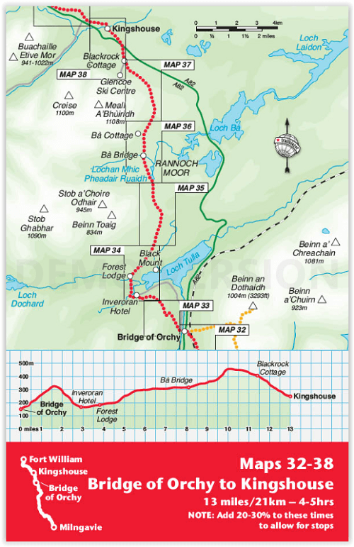
Extra colour mapping, in stage sections (one stage per page) also including trail profiles showing the climbs and descents to help you plan your walk each day
16pp colour introductory section - 67 maps – 4 town plans and 53 large-scale walking maps – at just under 1:20,000 – showing route times, gradients, where to stay, interesting features, fully-edited maps drawn by walkers for walkers. Itineraries for all walkers – whether walking the route in its entirety over one week, or sampling the highlights on day walks and short breaks.
Practical information for all budgets:
Glasgow through to Fort William: where to stay (campsites, hostels, B&Bs, pubs and hotels), where to eat, what to see. Public transport information for all budgets – all access points on the path. Fully updated - the entire route has been re-walked and all details re-checked for this new edition.
.png)
Artikelen uit dezelfde regio

Wandelkaart OL50 Ben Alder- Loch Ericht & Loch Laggan - OSI • 9780319469682
Wandelkaart Ben Alder- Loch Ericht & Loch Laggan - Highland's Omvat ook: Dalwhinnie Productbeschrijving: OS Explorer kaart OL 50 toont Loch Ericht, Loch Laggan en 16 van de omliggende Munros, evenals een deel van het Cairngorms National Park. Deze kaart vervangt de vorige OS Explorer kaart 393 voor dit gebied. De OS Explorer kaart voor Ben Alder, Loch Ericht & Loch Laggan is beschikbaa…

Wandelkaart 25 Glen Carron & Glen Affric Highland's- OSI • 9780319473481
Wandelkaart Glen Carron & Glen Affric - Highland's Schotland Productbeschrijving: Glen Carron en Glen Affric bevinden zich in de Schotse Hooglanden, beladen met enorme blauwe lochs, ruig terrein en uiteenlopende vogelsoorten. OS Landranger kaart 25 helpt u talrijke bospaden en off-road routes te ontdekken, die voldoen aan de verwachtingen van liefhebbers van wandel- en fietsroutes. Er is o…

Wandelgids The Great Glen Way - Trailblazer • 9781912716104
The Great Glen Way - Trailblazer Publications Productomschrijving: The Great Glen Wayfrom Fort William to Inverness. Het langeafstandswandelpad Great Glen Way begint waar de West Highland Way eindigt - in Fort William - en volgt de breuklijn van de Great Glen om na 79 mijl (127 km) te eindigen in Inverness. Het pad loopt langs Loch Lochy, Loch Oich en Loch Ness en volgt ook het jaagpad van…

Wandelkaart 439 Summer Isles & Coigach- Schotland - OSI • 9780319246825
Wandelkaart Summer Isles & Coigach - Highlands Schotland Productbeschrijving: Inverpolly 439 / Summer Isles, Highlands, Schotland - OS Explorer kaart 439 toont de nationale Scenic Area op het schiereiland Coigach plus de zomer eilanden.Dit gebied zal elke outdoor liefhebber een uitdaging geven. Het gebied is afgelegen, bergachtige en dunbevolkt. De meeste van de zomer-eilanden, met uit…

Wandelkaart 416 Inverness Loch Ness & Culloden - OSI • 9780319472712
Wandelkaart Inverness- Loch Ness & Culloden Highland's Omvat ook: Fort Augustus & Drumnadrochit. Productbeschrijving: Deze twee-zijdige Explorer kaart nummer 416 heeft betrekking op de lengte van Loch Ness en de Highland hoofdstad van Inverness. Wandel de Great Glen way op de oevers van loch Ness, om te zien of u ter plaatse het legendarische monster kunt ontdekken, of ga op verkennin…