
Wandelgids Snowdonia Way National park - Cicerone
Snowdonia NP is een bergachtig gebied in Noord Wales
Korte omschrijving
Wandelgids - Snowdonia Way National park - Cicerone Productomschrijving: Het Nationaal park Snowdonia is een bergachtig gebied in het noorden van Wales. Het park is genoemd naar Snowdon, en ...

Specificaties
- Uitgever: CICERONE Press
- ISBN-13: 9781852848569
- HOOFDCATEGORIEËN: Wandelgids
- Activiteiten: Wandelen, Hiking & Trekking
- Regio: North Wales
- Land: Wales
- Lange afstand wandelroutes: Snowdonia Way, Wales (122 miles)
- Nationale parken: Snowdonia NP, Wales UK
- Blz.: 176
- Afmeting: 12x17
- Editie: 1
- Taal: Engels
Volledige omschrijving
Wandelgids - Snowdonia Way National park - Cicerone
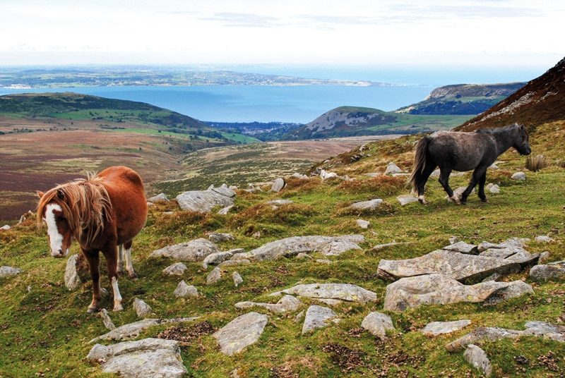
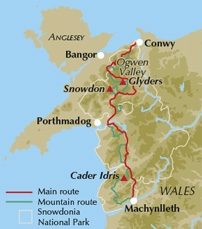
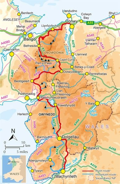
Productomschrijving: Het Nationaal park Snowdonia is een bergachtig gebied in het noorden van Wales. Het park is genoemd naar Snowdon, en is met 1085 meter de hoogste berg in Wales. De route is 97 miles lang en kan worden afgelegd in 6 etappes. De route loopt door het nationale park van Noord wales Snowdonia, en kan worden bestempeld als een schitterend mooi natuurpark vol speciale landschappen en natuurlijke kenmerken.
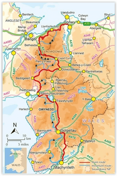
Product description: This guidebook describes the Snowdonia Way in Wales, a long-distance route through Snowdonia National Park from Machynlleth to Conwy. A low-level route of 97 miles (in 6 stages of between 13 and 21 miles) passes through the heart of Snowdonia’s stunning mountain scenery and includes Pass of Aberglaslyn, Ogwen Valley and Aber Falls. It is suitable for walkers of average fitness and stamina, though days are long. An alternative mountain route covers 122 miles in 9 stages of 12–18 miles giving a spectacular journey over the most famous peaks such as Cadair Idris, Snowdon and Glyders. The high-level route is more physically challenging and requires good navigation skills.
Seasons:
Both the main route and mountain route can be walked throughout the year, though in winter conditions the mountain route requires full winter mountaineering equipment.
Centres:
Machynlleth, Abergynolwyn, Dolgellau, Trawsfynydd, Penrhyndeudraeth, Beddgelert, Pen-y-Pass, Dolwyddelan, Capel Curig, Bethesda.
Difficulty:
Though the walking days are long, the main route is mostly easy to navigate and stays at a low level, only crossing passes when necessary. Walkers should be used to full days out. The mountain route requires good navigation and includes a considerable amount of ascent, sometimes with no path.
Must See:
Snowdon, Cadair Idris, The Glyders, Lake Trawsfynydd, The Ogwen Valley, The Vale of Ffestiniog, Aber Falls, The Pass of Aberglaslyn, The castles of Llewelyn the Great, The myth of King Arthur, Llyn Gwynant, Llyn Ogwen, Nantgwynant, Coed y Brenin, The Moelwyns, Moel Siabod, The Carneddau, Slate quarrying, Owain Glyndwr.
Locatie op kaart
Artikelen uit dezelfde regio

Wandelgids Ceredigion & Snowdonia coastal paths - Cicerone • 9781852847388
Wandelgids - Ceredigion & Snowdonia coastal paths - Cicerone Productomschrijving: Als onderdeel van het Wales Coast Path, traceren de Ceredigion Coast Path en het Snowdonia Coast Path een curve van 233km (145 mijl) van kust- en binnenwaterwegen langs Cardigan Bay. Deze gids beschrijft een 16-fasige gids over de wandeling van Porthmadog aan St. Dogmaels die betrekking hebben op de trail tus…
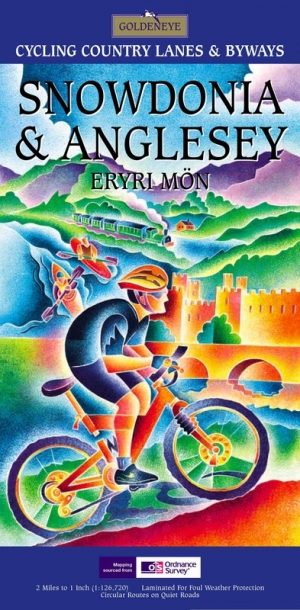
Fietskaart Snowdonia & Anglesey North Wales - Goldeneye • 9781859651278
Fietskaart - Snowdonia & Anglesey - North Wales Productomschrijving: Snowdonia is een bergachtig gebied in het noorden van Wales, en is een Nationaal Park met een omvang van ongeveer 2170 km². Het park is genoemd naar Snowdon met 1085 meter de hoogste berg in Wales (de hoogste berg van heel Groot-Brittannië is de Ben Nevis in Schotland met een hoogte van 1344 meter.) Deze bergtop kan m…
Wandelkaart 264 Vale of Clwyd & Dyffryn Clwyd - OSI • 9780319471364
Wandelkaart Vale of Clwyd & Dyffryn Clwyd - Wales Omvat ook: Rhyl, Denbigh & Ruthin. Productbeschrijving: Vanaf de kust stad van Rhyl (Y Rhyl) naar het Clocaenog bos, met OS Explorer kaart kunt 264 kunt u zandstranden ontdekken aan rustige bos routes om te wandelen en te paardrijden. Omvat de "North Wales Path" ,(Llwybr y Gogledd) en Clwydian Way (Taith Clwyd). De OS Explorer kaart voo…
Wandelkaart 255 Llangollen & Berwyn - North Wales - OSI • 9780319471272
Wandelkaart Llangollen & Berwyn - Denbighshire Wales Omvat ook: Ceiriog Valley. Productbeschrijving: Kaart getal 255 in de OS Explorer reeks beslaat een gebied in Noord Wales in het oosten van Snowdonia National Park. Hoogtepunten van het gebied zijn onder andere: Offa's Dyke Path nationale trail, Upper Ceirirog Trail en Llwybr Maelor Way. De OS Explorer kaart voor Llangollen & Berwyn …
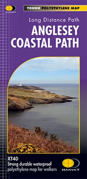
Wandelkaart XT40 Anglesey Coastal Path N. Wales - Harvey Maps • 9781851375851
Wandelkaart XT40 - Anglesey Coastal Path N. Wales - Harvey Maps Productomschrijving: Anglesey, is een eiland en bestuurlijk graafschap aan de noordwestkust van Wales. Het vormt een onderdeel van het ceremoniële behouden graafschap Gwynedd en is tevens een historisch graafschap. Deze kaart brengt u per wandelpad langs de kust van dit uitermate geschikt wandeleiland Nieuwe generatie HARV…