
Wandelgids Ceredigion & Snowdonia coastal paths - Cicerone
Volg de Ceredigion Coast Path en Snowdonia Coast Path voor 233km
Korte omschrijving
Wandelgids - Ceredigion & Snowdonia coastal paths - Cicerone Productomschrijving: Als onderdeel van het Wales Coast Path, traceren de Ceredigion Coast Path en het Snowdonia Coast Path een cu...

Specificaties
- Uitgever: CICERONE Press
- ISBN-13: 9781852847388
- HOOFDCATEGORIEËN: Wandelgids
- Activiteiten: Wandelen, Hiking & Trekking
- Auteur: John B Jones
- Regio: North Wales
- Land: Wales
- Nationale parken: Snowdonia NP, Wales UK
- Blz.: 176
- Afmeting: 12x17
- Editie: 1
- Taal: Engels
Volledige omschrijving
Wandelgids - Ceredigion & Snowdonia coastal paths - Cicerone
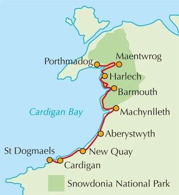
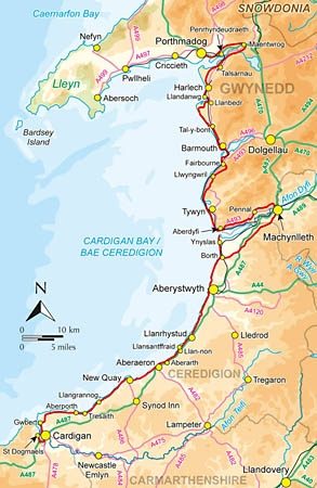
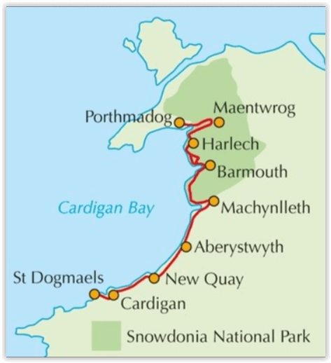
Productomschrijving: Als onderdeel van het Wales Coast Path, traceren de Ceredigion Coast Path en het Snowdonia Coast Path een curve van 233km (145 mijl) van kust- en binnenwaterwegen langs Cardigan Bay. Deze gids beschrijft een 16-fasige gids over de wandeling van Porthmadog aan St. Dogmaels die betrekking hebben op de trail tussen het Llyn-schiereiland en het Pembrokeshire Coast Path. In 16 dagstadia van Porthmadog St. Dogmaels, biedt deze gids alle wandelaars de nodige informatie.
Product description: As part of the Wales Coast Path, the Ceredigion Coast Path and Snowdonia Coast Path trace a curve of 233km (145 miles) of coastal and inland walking down Cardigan Bay. This guidebook describes a 16-stage guide to the walk from Porthmadog to St Dogmaels covering the trail between the Llyn Peninsula and the Pembrokeshire Coast Path. In 16 day stages from Porthmadog to St Dogmaels, this guidebook offers all the information walkers need to complete the 233km (145 miles) section of the Wales Coast Path that curve down Cardigan Bay, passing through a range of contrasting landscapes.
Seasons:
Technically, it is possible to trek this route at any time of the year. However, spring into summer tends to be the most favourable season for weather and also for the wild flowers. Early autumn can also be rewarding, especially for the quality of the light and autumnal colours.
Centres:
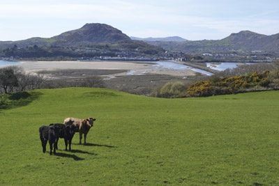
The walk passes through a number of attractive settlements, from towns such as Aberystwyth to villages such as Llangrannog.
Difficulty:
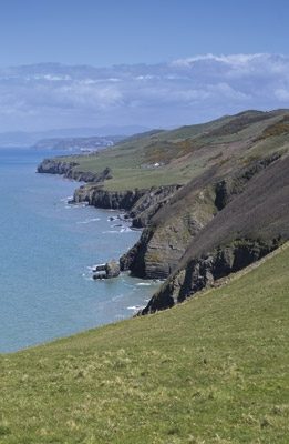
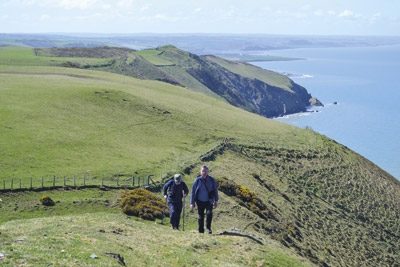
While many stretches of the Snowdonia Coast Path enable a fast walking pace, there are also some big climbs. The Ceredigian Coast Path is surprisingly challenging and a good level of fitness is required.
Must See:
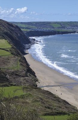
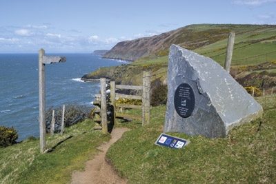
The Snowdonia and Ceredigian Coast Paths, part of the Welsh Coast Path, run some 230kms down Cardigan Bay. The walk crosses fine sandy beaches, rugged cliffs, salt marshes and hill country. There are great coastal and inland views, fascinating geology and history, and wide varieties of plants and wildlife.
Locatie op kaart
Artikelen uit dezelfde regio
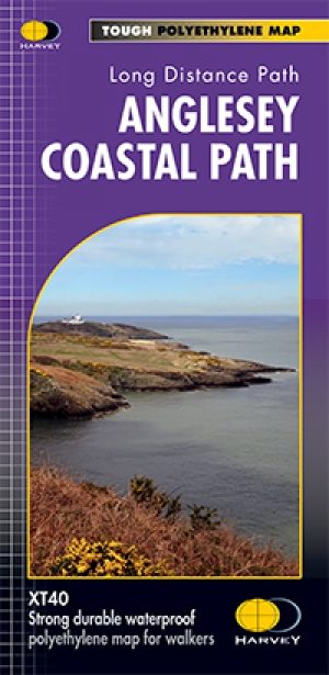
Wandelkaart XT40 Anglesey Coastal Path N. Wales - Harvey Maps • 9781851375851
Wandelkaart XT40 - Anglesey Coastal Path N. Wales - Harvey Maps Productomschrijving: Anglesey, is een eiland en bestuurlijk graafschap aan de noordwestkust van Wales. Het vormt een onderdeel van het ceremoniële behouden graafschap Gwynedd en is tevens een historisch graafschap. Deze kaart brengt u per wandelpad langs de kust van dit uitermate geschikt wandeleiland Nieuwe generatie HARV…
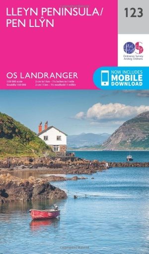
Wandelkaart 123 Lleyn Peninsula North Wales - OSI • 9780319262214
Wandelkaart Lleyn Peninsula - North Wales - OSI Productbeschrijving: Naast Anglesey in Noord-Wales, toont OS Landranger kaart 123 het Lleyn schiereiland (Pen Llyn), en omvat ook Dinas, Rhiw, Pwlleli, Rhoslan, Newborough, Boduan, Port Oer en de uiterst westelijke rand van het Snowdonia National Park. De OS Landranger kaarten reeks heeft betrekking op Groot-Brittannië met 204 gedetailleerde …

Wandelkaart 263 Anglesey East- North Wales - OSI • 9780319471357
Wandelkaart Anglesey East, North Wales (9780319471357) OSI Omvat ook: Beaumaris, Amlwch & Menai Bridge. Productbeschrijving: Kaart nummer 263 in de OS Explorer kaarten reeks heeft betrekking op het oosten van de Isle of Anglesey, Bangor, Beaumaris, Amlwch en Menai Bridge. Hoogtepunten van het gebied zijn onder meer: Caernarfon, Menai Straight, Cefni Reservoir, Anglesey AONB, Puffin eil…
Wandelkaart 255 Llangollen & Berwyn - North Wales - OSI • 9780319471272
Wandelkaart Llangollen & Berwyn - Denbighshire Wales Omvat ook: Ceiriog Valley. Productbeschrijving: Kaart getal 255 in de OS Explorer reeks beslaat een gebied in Noord Wales in het oosten van Snowdonia National Park. Hoogtepunten van het gebied zijn onder andere: Offa's Dyke Path nationale trail, Upper Ceirirog Trail en Llwybr Maelor Way. De OS Explorer kaart voor Llangollen & Berwyn …
Wandelkaart 265 Clwydian Range- Prestatyn- Mold - OSI • 9780319471371
Wandelkaart Clwydian Range - Prestatyn, Mold & Ruthin Omvat ook: Prestatyn, Mold & Ruthin. Productbeschrijving: Kaart nummer 265 in de OS Explorer reeks beslaat een gebied in Noord-Wales langs het Clwydian range. Dit gebied van uitzonderlijke natuurlijke schoonheid AONB hosts het nationale spoor van Offa's Dyke Path en de steden van Prestatyn, Mold en Ruthin. Andere hoogtepunten van he…