Wandelgids Part 1 South West Coast Path Map Booklet - Cicerone
Van Minehead tot St Ives - Noord-Devon en Cornwall
Korte omschrijving
Wandelgids Part 1 South West Coast Path Map Booklet - Cicerone Productomschrijving: Kaart boekje van het noordelijke deel (deel 3) van het 630 mijl (1014 km) lange South West Coast Path Nati...

Specificaties
- Uitgever: CICERONE Press
- ISBN-13: 9781786312181
- HOOFDCATEGORIEËN: Wandelgids
- Activiteiten: Wandelen, Hiking & Trekking
- Auteur: Paddy Dylan
- Regio: Cornwall, England, Devon, England, South & South East England
- Land: England
- Lange afstand wandelroutes: South West Coast Path - SWCP (1014 km)
- Nationale parken: Exmoor NP, Devon England
- Blz.: 112
- Schaal: 1:25000
- Afmeting: 12x17
- Editie: 2
- Taal: Engels
- Reeks: National Trails, UK
Volledige omschrijving
Wandelgids Part 1 South West Coast Path Map Booklet - Cicerone
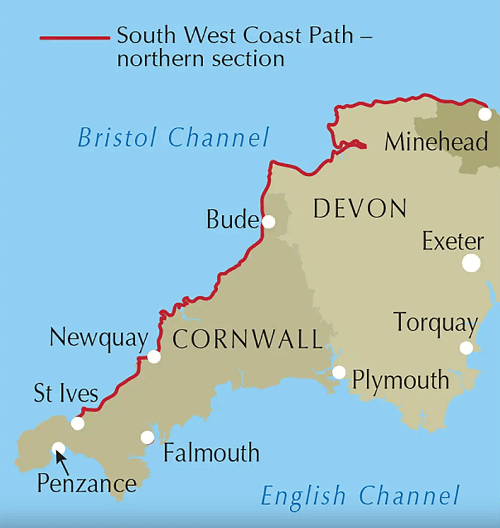
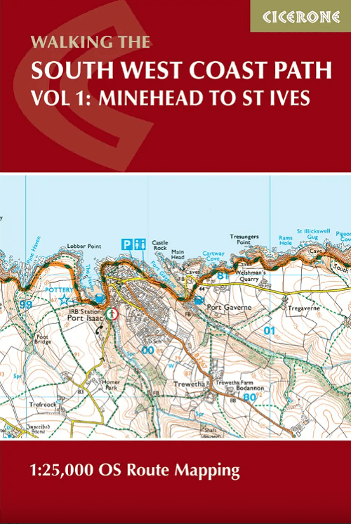
Productomschrijving: Kaart boekje van het noordelijke deel (deel 3) van het 630 mijl (1014 km) lange South West Coast Path National Trail. Omvat het pad van Minehead tot St Ives langs de kustlijn van Noord-Devon en Cornwall. Dit handige en compacte boekje met Ordnance Survey 1:25.000 kaarten toont de route en biedt alle kaarten die je nodig hebt om het pad in beide richtingen te lopen.
Engelse omschrijving: Map of the northern section of the 630 mile (1014km) South West Coast Path National Trail. Covers the trail from Minehead to St Ives along the north Devon and Cornish coastline. This convenient and compact booklet of Ordnance Survey 1:25,000 maps shows the route, providing all of the mapping you need to walk the trail in either direction.
Seasons:
This National Trail may be walked year-round: be aware that winter accommodation availability may be limited, while high summer will be extremely busy and the weather often hot.
Centres:
Many centres are passed along the route, including Minehead, Lynmouth, Westward Ho!, Clovelly, Bude, Padstow, Newquay, St Ives.
Difficulty:
The South West Coast path is a long walk! Most paths are easy to moderate, with some walks along rugged and exposed coastal cliff paths and some steep gradients.
Must See:
Exmoor National Park, Areas of Outstanding Natural Beauty, numerous Heritage Coasts, National and Local Nature Reserves, Sites of Special Scientific Interest and National Trust holdings.

Gekoppelde artikelen

Wandelgids The South West Coast Path - Cicerone Press • 9781786310682
standaard versieThe South West Coast Path - Cicerone Productomschrijving: Omvat spectaculaire plaatsen die dit deel van het Engelse landschap rijk is, zoals Exmoor National Park, met 5 AONB's of Areas of Outstanding Natural Beauty, de Jurassic Coast Natural World Heritage Site. Deze route bestaat al heel lang. De route start of eindigd natuurlijk in Minehead, in Somerset, loopt langs de kust richting de v…
Artikelen uit dezelfde regio

Wandelkaart Dartmoor National Park - Harvey maps • 9781851374649
Wandelkaart Dartmoor National Park - Harvey maps Productomschrijving: Deze Harvey kaart heeft de gehele Dartmoor op één kaart en wordt afgedrukt in samenwerking met de British Council van het alpinisme. Het omvat ook een geologische kaart van het gebied speciaal ontworpen door de British Geological Survey, klimcrags zijn ook gemarkeerd op de kaart. De kaart heeft ook tips over het gebruik …

Mountainbikegids South Downs - 26 off road routes - Cicerone • 9781852846459
Mountainbikegids South Downs - 26 off road routes - Cicerone Productomschrijving: Een gids voor berg (MTB) fietsroutes op de South Downs van Hampshire en Sussex, tussen Winchester, Brighton en Eastbourne. De 26 routes beschreven in dit boek nemen deel aan achtbanen, toegewijde bos singletrack en grote afdalingen. Ritten worden gequoteerd voor alle vaardigheden met informatie over plaatseli…

Reisgids Devon & Cornwall - Top 10 - DK Eyewitness • 9780241408568
Devon & Cornwall - DK Eyewitness Productomschrijving: Bewonder de historische kathedraal van Exeter, doorkruis te voet de uitgestrekte wildernis van Dartmoor, geniet van prachtige stranden op de Isles of Scilly, ontdek een bloeiende kunstscene in St-Ives of bewonder de spectaculaire reusachtige kassen van het Eden Project. Van de Top 10 stranden tot de Top 10 treinreizen - ontdek het beste…

Wandelkaart OL22 New Forest- Southampton & Ringwood - OSI • 9780319475782
Wandelkaart New Forest national park - Southampton - OSI Productomschrijving: Kaart nummer OL22 in de OS Explorer kaartenserie is de perfecte kaart voor vakantiegangers en dagjesmensen om te gebruiken bij een bezoek aan het New Forest Nationaal Park in West Engeland. Het nationale park is beroemd om zijn uitstekende wandelingen en ritten en is de thuisbasis van New Forest pony's en heidela…

Wandelgids The Pilgrim's Way - Cicerone • 9781852847777
Wandelgids - The Pilgrim's Way - Cicerone Productomschrijving: Een samenstelling van alle route gegevens van deze uitermate gekende St-jacobs/bedevaart wandelroute in hartje Engeland. Product description: This guidebook details the Pilgrims' Way, an historic pilgrimage route to Canterbury Cathedral in Kent, home of the shrine of the martyred archbishop, St Thomas Becket. The route is…


