
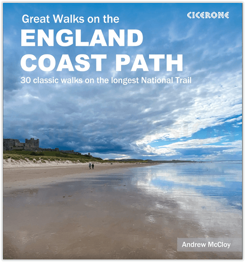
Wandelgids Great Walks on the England Coast Path - Cicerone
30 classic walks on the 4500 km long National Trail
Korte omschrijving
Great Walks on the England Coast Path - Cicerone Engelse omschrijving: At around 4500 km (2800 miles), the England Coast Path is the longest coastal trail in the world. This inspirational la...

Specificaties
- Uitgever: CICERONE Press
- ISBN-13: 9781852849894
- HOOFDCATEGORIEËN: Wandelgids
- Activiteiten: Wandelen, Hiking & Trekking
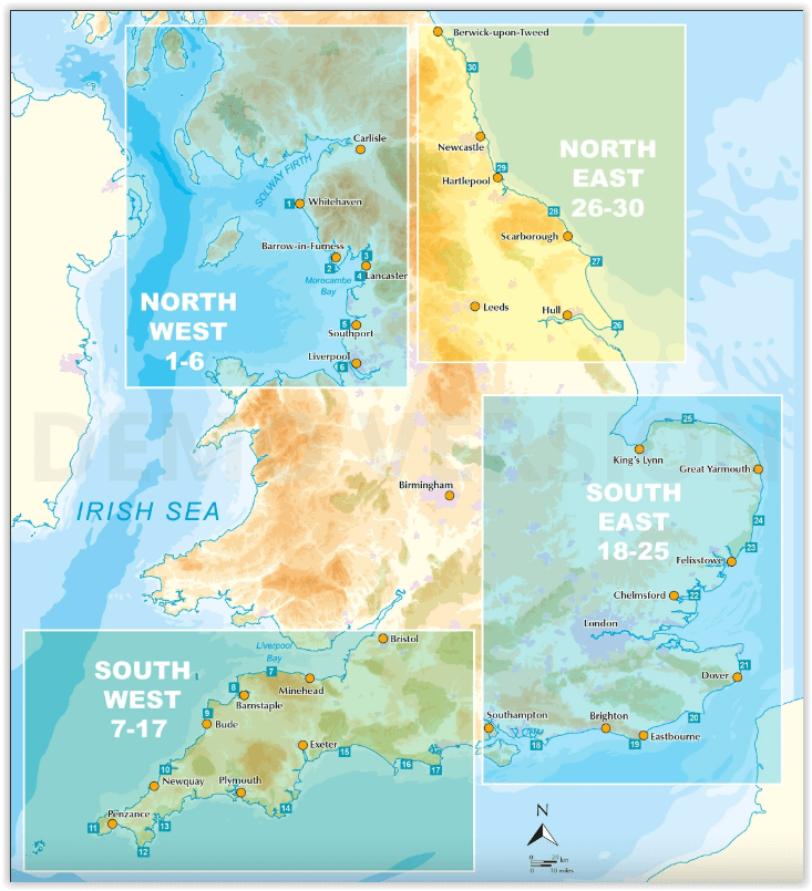
- Regio: North & North East England, North West England, South East England, South West England
- Land: England
- Lange afstand wandelroutes: England Coast Path (4500 km)
- Blz.: 208
- Afmeting: 12x17
- Editie: 1
- Taal: Engels
Volledige omschrijving
Great Walks on the England Coast Path - Cicerone
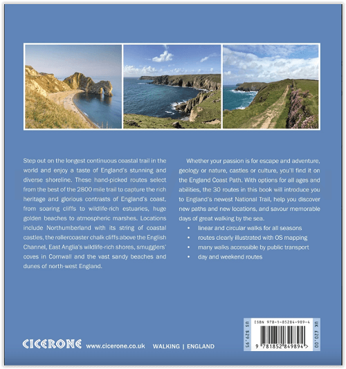
Engelse omschrijving: At around 4500 km (2800 miles), the England Coast Path is the longest coastal trail in the world. This inspirational large-format guide presents a handpicked selection of 30 highlight sections, offering a taste of England's stunning and diverse shoreline. Routes range from 9 to 45km, spanning between 3 hours and 2 days, offering options to suit all abilities. They can be accessed by public transport and are walkable year round (weather permitting!).
Route descriptions are accompanied by 1:50,000 OS map extracts. Included in each walk are comprehensive listings of public transport, toilets and places to eat and drink, which highlight the excellent walking infrastructure available in many areas. Overview information on terrain, distance and timing facilitates easy planning, a route summary table helps you to choose an appropriate route, and there are also GPX files available for free download. Fascinating snippets of history and geology are interspersed throughout, and the appendices contain useful websites and further reading.
Incorporating beautiful photography of England's coastline, the guide will encourage you to explore both well-loved and less well-known parts of the English shoreline, from soaring cliffs to wildlife-rich estuaries, from huge golden beaches to atmospheric marshes. Capturing the rich heritage and glorious contrasts of England's coast, the routes offer something for everyone, whether your passion is for escape or adventure, geology or nature, castles or culture. The sea has defined England's history and the coast is a dynamic and exciting place to walk, so let these 30 routes introduce you to great walking by the sea on England's newest National Trail.
Artikelen uit dezelfde regio

Wandelkaart South West Coast Path 3 - Harvey Maps • 9781851376834
South West Coast Path - Harvey Maps Productomschrijving: Het South West Coast path is een dikke 1014 km lang en omvat het volledige South-West-England met daarin Devon & Corwall. Het pad is een National trail en behoort tot de langste routes van Engeland. De route start in Minehead in Somerset en loopt de volledige kust af tot in Poole in Dorset. OPGELET: deze kaart omvat het laatste deel …

Wandelgids The Coast to Coast Map Booklet - Cicerone • 9781852849269
Wandelgids - The Coast to Coast Map Booklet - Cicerone Productomschrijving: Deze wandelgids toont u de 300km lange Coast to Coast Walk, een populaire interlokale trail in Noord-Engeland, die vertrekt uit St Bees Head in Cumbria naar Robin Hood's Bay aan de kust van Yorkshire. Product description: This map booklet shows the 190 mile (300km) Coast to Coast Walk, a popular long distance …

Wandelgids Forest of Bowland walking guide - Cicerone • 9781852842512
Wandelgids - Forest of Bowland walking guide - Cicerone Productomschrijving: Gids voor wandelingen in het Forest of Bowland, Lancashire, Noord-Engeland, een Area of Outstanding Natural Beauty. 30 routes in het hele Forest met inbegrip van de zachte uitlopers in het zuiden en noorden, op de top van de moerassen en in de valleien. De Forest of Bowland, is een wilde en dunbevolkte regio van z…

Wandelkaart 103 Blackburn Burnley & Clitheroe - OSI • 9780319474266
Wandelkaart Blackburn- Burnley & Clitheroe - OSI Productbeschrijving: Kaart blad nummer 103 in de reeks van de OS Landranger kaarten, is de ideale kaart om te gebruiken bij het plannen van een dag uit rond het noordwesten van Engeland. Onderdeel van de Walliser Way in het oosten van de kaart, samen met de onderste rand van het Yorkshire Dales National Park. Andere plaatsen die zijn opgenom…

Wandelkaart 287 West Pennine Moors & Blackburn - OSI • 9780319471593
Wandelkaart West Pennine Moors & Blackburn - North West Omvat ook: Blackburn, Darwen & Accrington. Productbeschrijving: Kaart nummer 287 in de OS Explorer kaarten reeks beslaat een gebied ten westen van de Pennines, met inbegrip van een deel van de Forest of Bowland. Hoogtepunten van het gebied zijn onder andere: Witton Weavers Way, Rossendale Way en Ribble Way, samen met de steden van…