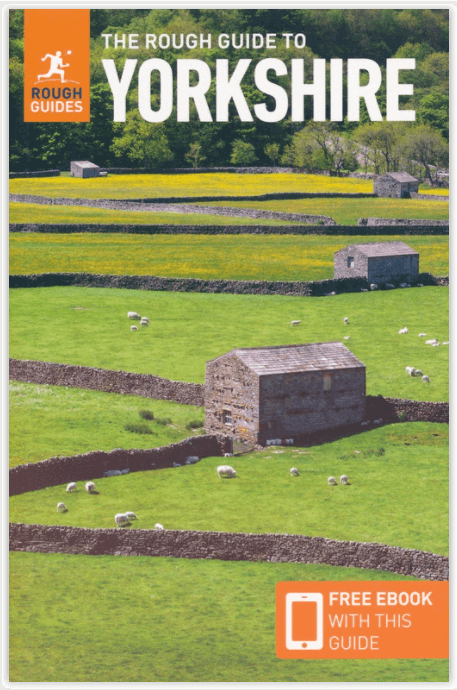
Reisgids Yorkshire England - Rough Guides
The Rough Guide to Yorkshire is unique all on it's own
Korte omschrijving
Reisgids Yorkshire England - Rough Guides Productomschrijving: The Rough Guide to Yorkshire was the first comprehensive guidebook to England’s largest county. Detailed coverage of the rugged...

Specificaties
- Uitgever: Rough Guides
- ISBN-13: 9781789194159
- HOOFDCATEGORIEËN: Reisgids
- Activiteiten: Toerisme
- Regio: Yorkshire, England
- Land: England
- Blz.: 336
- Afmeting: 13x20
- Editie: 3
- Taal: Engels
Volledige omschrijving
Reisgids Yorkshire England - Rough Guides
Productomschrijving: The Rough Guide to Yorkshire was the first comprehensive guidebook to England’s largest county. Detailed coverage of the ruggedly beautiful Dales and Moors, the magnificent North Sea coast and historic York rubs shoulders with penetrating insights into the multi-cultural cities of Leeds and Sheffield, the resurgent port of Hull, and the many industrial conurbations, market towns and rural villages in between.
Take your pick of great stately homes to visit, of cathedrals and churches and monastic ruins, of steam railways and seaside resorts, of world-class historical and industrial museums, of hotels and places where you can consume good Yorkshire food and ale. Full-colour sections cover Yorkshire’s varied landscape and world-famous writers and artists. Whether you’re on holiday, on business, visiting family and friends or just passing through – even if you’ve lived in Yorkshire all your life – The Rough Guide to Yorkshire will ensure that you don’t miss a thing.
Locatie op kaart
Artikelen uit dezelfde regio

Wandelkaart 298 Nidderdale AONB- Yorkshire - OSI • 9780319245507
Wandelkaart Nidderdale AONB - Yorkshire England Omvat ook: Fountains Abbey, Ripon & Pateley Bridge Productomschrijving: Kaart nummer 298 in de OS Explorer kaarten serie heeft een oppervlakte van North Yorkshire rond Nidderdale. De Nidderdale way en Ripon Rowel lopen door dit pittoreske gebied, die ook een deel van het Yorkshire Dales National Park heeft. Hoogtepunten van het gebied zij…

Wandelgids Nidderdale short walks - Cicerone • 9781786311542
Nidderdale short walks - Cicerone Productomschrijving: Jon Fallis heeft 15 van de beste korte wandelingen rond Nidderdale in de Yorkshire Dales voor u uitgezocht. Onze gids is voorzien van goed leesbare Ordnance Survey-kaarten en duidelijke routebeschrijvingen, perfect als u voor het eerst gaat wandelen of iets zoekt waar u met het hele gezin van kunt genieten. We hebben informatie opgenom…

Wandelkaart OL27 North York Moors- Eastern area - OSI • 9780319469453
Wandelkaart North York Moors - Yorkshire England Omvat de: "Eastern area" Productbeschrijving: OS Explorer kaart OL27 omvat het North York Moors National Park, met inbegrip van de Cleveland Hills en The Hambleton Hills. Ook zijn op deze kaart de Celeveland way National Trail & de Tabular Hills way, Cleveland Street, Esk Valley Walk en het noordelijke uiteinde van Ebor way beschreven. D…

Wandelkaart 295 Bridlington Driffield & Hornsea - OSI • 9780319245477
Wandelkaart Bridlington- Driffield & Hornsea - Yorkshire Productbeschrijving: 295 / Bridlington, Driffield & Hornsea, East Riding of Yorkshire, England - Van Hornsea langs de kust naar Bridlington en de binnenvaart tot Driffield. OS Explorer kaart 295 is de perfecte partner voor al uw outdoor avonturen. Het omvat ook delen van vier recreatieve paden: landtong way, Hornsea Rail Trail,…

Wandelgids Yorkshire Dales guide - Cicerone • 9781852844813
Wandelgids - Yorkshire Dales guide - Cicerone Productomschrijving: Gids met 50 van Jack Keighleys favoriete wandelingen in de Yorkshire Dales. Alle wandelingen zijn circulaire wandelingen, en variëren van 4,5 tot bijna 8 mijl in lengte. Ze variëren van eenvoudige Dalwandelingen (ideaal als halve dag 'familie rambles') tot inspannende expedities. Handgeschreven en met overvloedig geïllustre…


