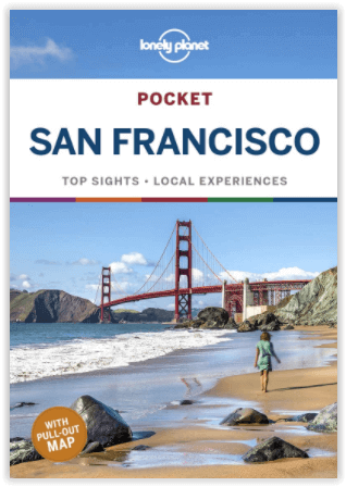
Reisgids San Francisco pocket guide - Lonely Planet
Get to the heart of the best of San Francisco and begin your jour
Korte omschrijving
San Francisco pocket guide - Lonely Planet Coverage Includes: Golden Gate Bridge, The Marina, Fisherman’s Wharf, North Beach, Chinatown, Downtown, SoMa, Hayes Valley, Civic Center, The Missi...

Specificaties
- Uitgever: Lonely Planet Publications
- ISBN-13: 9781787014114
- HOOFDCATEGORIEËN: Reisgids
- Activiteiten: Toerisme
- Auteur: Alison Bing, Ashley Harrell
- Regio: Californië, USA
- Land: Verenigde Staten van Amerika (USA)
- Blz.: 192
- Afmeting: 11x15
- Editie: 7
- Taal: Engels
- Reeks: POCKET-guide Lonely Planet
Volledige omschrijving
San Francisco pocket guide - Lonely Planet
Coverage Includes: Golden Gate Bridge, The Marina, Fisherman’s Wharf, North Beach, Chinatown, Downtown, SoMa, Hayes Valley, Civic Center, The Mission, The Haight, Golden Gate Park, and more
Product description: Lonely Planet Pocket San Francisco is your passport to the most relevant, up-to-date advice on what to see and skip, and what hidden discoveries await you. Watch fog creep beneath the Golden Gate Bridge, ride a cable car past stately Victorians, or taste the best of California cuisine at the Ferry Buildin, all with your trusted travel companion. Get to the heart of the best of San Francisco and begin your journey now!
Inside Lonely Planet Pocket San Francisco:
- Full-color maps and images throughout
- Highlights and itineraries help you tailor your trip to your personal needs and interests
- Insider tips to save time and money and get around like a local, avoiding crowds and trouble spots
- Essential info at your fingertips - hours of operation, phone numbers, websites, transit tips, prices
- Honest reviews for all budgets - eating, sleeping, sight-seeing, going out, shopping, hidden gems that most guidebooks miss
- Free, convenient pull-out San Francisco map (included in print version), plus over 17 color neighborhood maps
- User-friendly layout with helpful icons, and organised by neighborhood to help you pick the best spots to spend your time
Locatie op kaart
Artikelen uit dezelfde regio

Reisgids Los Angeles - Gallimard • 9782742462612
Reisgids Los Angeles California - Gallimard Productomschrijving: Van Hollywood tot Beverly Hills, van Santa Monica tot Pasadena, van Sunset Boulevard tot Rodeo Drive, van het Getty Center tot de Walt Disney Concert Hall, de City of Angels kan in een oogwenk worden verkend met een gids als geen ander. Franse omschrijving: De Hollywood à Beverly Hills, de Santa Monica à Pasadena, d…

Reisgids California - Lonely Planet • 9781838691813
Reisgids California - Lonely Planet Productomschrijving: Van mistige Noord-Californische sequoiawouden tot zonovergoten Zuid-Californische stranden, in de betoverende Golden State lijkt Disneyland heel gewoon. Lonely Planet brengt je naar het hart van Californië, met geweldige reiservaringen en het beste planningsadvies. Lonely Planet California is je paspoort voor het meest relevante,…

Wandelkaart 226 Joshua Tree NP - California - Nat Geo • 9781566953009
TOPO Wandelkaart 226 - Joshua Tree NP- California - Nat Geo Productomschrijving: Het Joshua Tree National Park is een nationaal park in het zuiden van de staat Californië in de Verenigde Staten, ten oosten van het gebied tussen Los Angeles en San Diego en ten noorden van Palm Springs. De afmetingen zijn ongeveer 100 km van oost naar west, en 50 km van noord naar zuid. Engelse omschrij…

Reisgids Californië- Arizona- Nevada & Utah - Gottmer • 9789025779139
Californië- Arizona- Nevada & Utah van Gottmer Productomschrijving: Of je nu nieuwsgierig bent naar cultuurbepalende wereldsteden als San Francisco en Los Angeles dan wel je juist graag terugtrekt in de natuur: de zuidwestelijke hoek van de VS is voor iedereen een gebied vol hoogtepunten. Californië trekt het grootste aantal bezoekers, gevolgd door de Grand Canyon in Arizona, de nationale …

Reisgids San Francisco & Northern California - DK Eyewitness • 9780241360071
San Francisco & Northern California Omvat: Presidio, Pacific Heights and the Marina, Fisherman's Wharf and North Beach, Chinatown and Nob Hill, Financial District and Union Square, Civic Center, Haight Ashbury and the Mission, Golden Gate Park and Land's End, and sights beyond the city, plus major parts of Northern California including Carmel, Mendocino, Napa Wine Country, Lake Tahoe & Yos…


