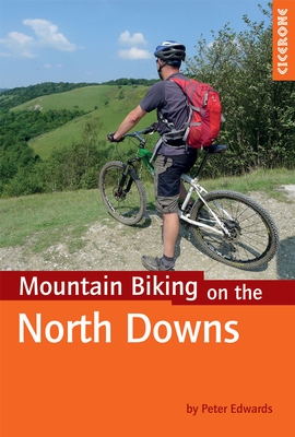
North Downs mountainbiking - cicerone
20 MTB routes door de Guilford in de North Downs
Korte omschrijving
Mountainbikegids - North Downs mountainbiking - cicerone Productomschrijving: Mountainbiken op de North Downs beslaat 21 routes over de North Downs, een gebied met een aantal van de mooiste ...

Specificaties
- Uitgever: CICERONE Press
- ISBN-13: 9781852847029
- HOOFDCATEGORIEËN: Fietsgids
- Activiteiten: Fietsen / VTT / MTB
- Regio: South & South East England
- Land: England
- Blz.: 208
- Afmeting: 12x17
- Editie: 1
- Taal: Engels
Volledige omschrijving
Mountainbikegids - North Downs mountainbiking - cicerone
Productomschrijving: Mountainbiken op de North Downs beslaat 21 routes over de North Downs, een gebied met een aantal van de mooiste routes ten zuidoosten van Engeland. Inbegrepen is een 59km lange MTB-route op de Downs, die de North Downs aan de South Downs aaneensluit in Shoreham-by-Sea. Ritten tellen voor moeilijkheid, en geïllustreerd met OS kaartextracten en hoogteprofielen.
Engelse omschrijving: This guidebook covers 21 routes across the North Downs, an area boasting some of south east England's finest trails. Included is a 59km MTB route on the Downs Link which joins the North Downs to the South Downs at Shoreham-by-Sea. Rides are graded for difficulty, and illustrated with OS map extracts and height profiles.
Seasons:
The North Downs are excellent for mountain biking all year round, though from late autumn to late spring some trails can be extremely muddy and claggy; popular trails are much busier during summer, especially at weekends.
Centres:
Guildford, Peaslake, Abinger, Dorking, Reigate, Redhill, Bearsted, Wrotham, Ightam, Chartham, Chilham, Ashford, Elham, Temple Ewell.
Difficulty:
Routes are intended for mountain bikers with some experience and a reasonable degree of fitness; routes are graded 'moderate', 'hard' and 'very hard' with 'difficult' or 'technical' sections indicated; the profusion of tree roots, jumps and flinty tracks make full-suspension bikes a serious consideration; body armour and full face helmets may be advisable for 'downhilling' enthusiasts.
Must See:
Excellent woodland singletrack in the Surrey Hills; numerous challenging climbs and exhilarating descents on the North Downs' steep southern escarpment; stimulating routes on chalk, sand and earth trails criss-crossing the beautiful rolling, wooded downland of Surrey and Kent; picturesque villages, great country pubs and fine countryside at every turn.
Locatie op kaart
Artikelen uit dezelfde regio

Wandelgids 15 Short Walks in the Surrey Hills - Cicerone • 9781786311535
The Surrey Hills - 15 simple Short Walks - Cicerone Productomschrijving: Onze auteurs hebben 15 van de beste korte wandelingen rond Guildford, Dorking en het zuiden van Surrey uitgekozen. Elke wandeling is voorzien van goed leesbare Ordnance Survey-kaarten, een duidelijke routebeschrijving en veel foto's, plus informatie over mooie plekjes en smakelijke versnaperingen. Geen moeilijk terrei…

Wandelgids Thames Valley walking guide - Cicerone • 9781852845704
Wandelgids - Thames Valley walking guide - Cicerone Productomschrijving: Deze handige gids biedt 25 avontuurlijke dagwandelingen in de Thames Valley, die betrekking hebben op de North Hampshire Downs, Berkshire en de zuidelijke Chilterns met gemakkelijke toegang tot Londen. De circulaire wandelingen variëren van 10 tot 18 mijl, waaronder een twee-daagse trot, evenals kortere route opties v…

Wandelgids London to Walsingham Camino - Trailblazer • 9781912716319
Camino London to Walsingham England - Trailblazer Productomschrijving: Camino van Londen naar Walsingham - De pelgrimsgids - Voordat Hendrik VIII in 1538 de bedevaart en de verering van heiligen verbood, was de route van Londen naar het heiligdom van Walsingham in Norfolk de populairste pelgrimstocht in Engeland. Deze gids volgt een nieuw herontdekte route tussen de hoofdstad en het ou…

Wandelgids Part 1 South West Coast Path Map Booklet - Cicerone • 9781786312181
Wandelgids Part 1 South West Coast Path Map Booklet - Cicerone Productomschrijving: Kaart boekje van het noordelijke deel (deel 3) van het 630 mijl (1014 km) lange South West Coast Path National Trail. Omvat het pad van Minehead tot St Ives langs de kustlijn van Noord-Devon en Cornwall. Dit handige en compacte boekje met Ordnance Survey 1:25.000 kaarten toont de route en biedt alle kaarten…

Reisgids Zuid-Engeland - Lannoo • 9789401458290
Reisgids - Zuid-Engeland - Lannoo Productomchrijving: De onmisbare gids voor echte trotters - Zuid-Engeland, de streek die je als eerste tegenkomt als je in Dover van de ferry afrijd. De streeks heeft in het miiden een AONB plaats liggen, een Area of Outstanding Natural Beauty, of een gebied van uitmund natuurschoon. De aangegeven plaatsen in deze gids zijn stuk voor stuk gevuld tot aan de…


