
Wandelkaart OL24 Peak District & White Peak area - OSI
Een nationaal park van formaat
Korte omschrijving
Wandelkaart Peak District & White Peak area - Engels Productomschrijving: Kaart nummer OL 24 in de OS Explorer-serie beslaat het Peak District-gebied rond Buxton, Bakewell, Matlock en Dove D...

Specificaties
- Uitgever: Ordnance Survey
- ISBN-13: 9780319475720
- HOOFDCATEGORIEËN: Wandelkaart
- Activiteiten: Wandelen, Hiking & Trekking
- Regio: Derbyshire, England
- Land: England
- Waterafstotende kaart: Ordnance Survey ACTIVE Explorer Weatherproof Maps
- Nationale parken: Peak District NP, Derbyshire UK
- Schaal: 1:25000
- Afmeting: 13x24
- Taal: Engels
- Reeks: Landranger ACTIVE series OSI
Volledige omschrijving
Wandelkaart Peak District & White Peak area - Engels
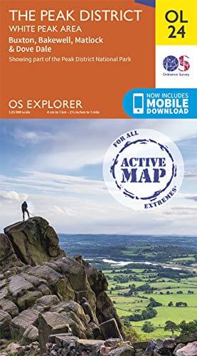
Productomschrijving: Kaart nummer OL 24 in de OS Explorer-serie beslaat het Peak District-gebied rond Buxton, Bakewell, Matlock en Dove Dale en is de perfecte kaart om te gebruiken bij het verkennen van het White Peak-gebied. Het landschap is een traktatie voor buitenenthousiasten die de ontsluitingen van lichtgekleurde kalksteen kunnen zien die het gebied zijn naam geven.
Engelse omschrijving: Map sheet number OL 24 in the OS Explorer series covers the Peak District area surrounding Buxton, Bakewell, Matlock and Dove Dale and is the perfect map to use when exploring the White Peak area. The scenery is a treat for outdoors enthusiasts who will be able to see the outcrops of light coloured limestone that give the area its name.
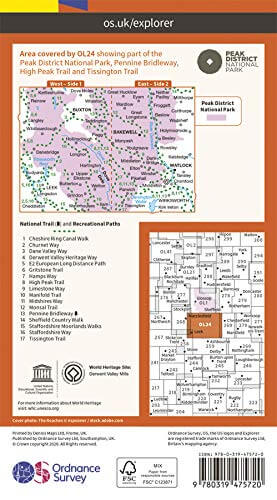
Highlights include: Castle rock, Middleton Dale, Derbyshire Dales, The Roaches, Buxton, Bakewell, Matlock, Dovedale, Chatsworth House, limestone caves, and the thermal springs at Middleton Stoney.
The OS Explorer map for The Peak District - White Peak Area is available in both the standard paper version and weatherproof 'Active' version. Whether you’re a seasoned outdoor expert or a leisurely sightseer, with the OS Explorer OL24 map of the White Peaks to hand, you’ll be on the right track no matter where your adventure takes you. Trusted by outdoor enthusiasts from all walks of life, this easy-to-follow fold-up map is the perfect companion for all your excursions in the White Peaks area of the Peak District, from days out, to week-long hikes. Taking its name from its limestone landscape, this part of the Peaks is full of fascinating caves and dry river valleys to explore. If walking’s what you’ve set out to do, why not tackle the 25-mile long White Peaks Challenge?
Using the pretty town of Stoney Middleton as a base, serious climbers can take on ‘Our Father’, a challenging climb up Windy Buttress. Alternatively, head underground to explore over 3 000 metres of caves at the limestone gorge of Middleton Dale. There are bustling towns in the white peak area of the Peak District including Buxton and Matlock, or you could treat yourself to one of Bakewell's legendary tarts. Whether you’re passionate about cycling and sightseeing, or rambling and riding, you’ll get the most out of your days out in the White Peaks with the OS Explorer OL24 map to guide you. You’ll find every fine detail covered, from rivers to rights of way, as well as a wealth of information you won’t find on other maps.
Locatie op kaart
Artikelen uit dezelfde regio

Wandelkaart XT40 Pennine Way Noord - Harvey Maps • 9781851376155
Wandelkaart XT40 - Pennine Way Noord - Harvey Maps Productomschrijving: Een goede week wandelen op één kaart De Pennine Way is een wandelroute van 429km (268 mile) die van Edale in Derbyshire tot Kirk Yetholm in het Schotse grensgebied loopt. De route volgt de ruggengraat van Engeland, langs enkele van de mooiste hoge landschappen van het Peak District National Park, langs de Pennine ridge…

Wandelkaart 269 Chesterfield & Alfreton- Derbyshire- OSI • 9780319244661
Wandelkaart Chesterfield & Alfreton - Derbyshire England Productbeschrijving: Sutton in Ashfield & Bolsover. 269 / Chesterfield & Alfreton, Derbyshire, England - OS Explorer kaart 269 dekt Chesterfield, Sutton in Ashfield en Alfreton. Hier zijn een aantal parken om te ontdekken, evenals deel van de Trans Pennine Trail. De five pits Trail te Grassmoor is open voor fietsers, wandelaars e…

Wandelgids Derbyshire walking guide - Cicerone • 9781852846336
Wandelgids - Derbyshire walking guide - Cicerone Productomschrijving: Een handige gids die 60 circulaire dagwandelingen beschrijft, variërend van eenvoudig tot matig, in termen van moeilijkheden en terrein, die geschikt zijn voor het hele gezin. Derbyshire beschikt over een interessante geschiedenis die ook door middel van deze routes onderzocht kan worden, en elk thema rond een specifieke…

Fietsgids Peak District cycling - Cicerone • 9781852848781
Fietsgids - Peak District cycling - Cicerone Productomschrijving: Fietsgids over het Peak district, die routes beschrijft in- en rond het National Park, op de weg of op de talrijke fietsroutes. 20 dag routes en één meerdaags fietsroute door het Peak District. Allemaal gemakkelijk toegankelijke routes vanuit Sheffield en Manchester, met routes vanaf het charmante Derbyshire, met steden zoal…

Wandelkaart OL1 Peak District & Dark Peak area - OSI • 9780319475652
Wandelkaart Peak District & Dark Peak area - Derbyshire Engeland Productomschrijving: Kaart nummer OL1 in de OS Explorer-serie is ideaal voor het verkennen van alles wat het Dark Peak-gebied van het Peak District te bieden heeft. Bezoekers van dit gebied zullen genieten van hoge gritstone heuvels, steile valleien en heidevelden. Hoogtepunten van het gebied zijn: Kinder Scout, The Pennine W…