
Wandelkaart Apache Creek & Juniper Mesa Wilderness Area - Nat Geo
Voor de echte avonturier
Korte omschrijving
Apache Creek - Juniper Mesa Arizona - Nat Geo Productomschrijving: De perfecte gezelschap voor al uw outdoor avonturen in Arizona. Met Prescott & Kaibab National Forests Op deze kaart st...

Specificaties
- Uitgever: National Geographic
- ISBN-13: 9781566955164
- HOOFDCATEGORIEËN: Wandelkaart
- Activiteiten: Wandelen, Hiking & Trekking
- Regio: Arizona, USA
- Land: Verenigde Staten van Amerika (USA)
- Schaal: 1:70000
- Afmeting: 10x19, 11x24
- Taal: Engels
Volledige omschrijving
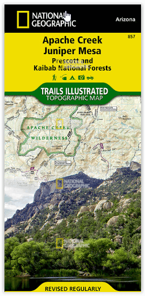
Apache Creek - Juniper Mesa Arizona - Nat Geo
Productomschrijving: De perfecte gezelschap voor al uw outdoor avonturen in Arizona. Met Prescott & Kaibab National Forests
Op deze kaart staat ook: Big Chino Valley, Chino Valley, Granite Mountain, Granite Mountain (AZ) Wilderness, Juniper Mesa Wilderness, Juniper Mountains, Kaibab National Forest, Lonesome Valley, Prescott National Forest, Prescott Valley, Santa Maria Mountains.
Engelse omschrijving: Outdoor enthusiasts adventuring through the northern half of Prescott National Forest will find National Geographic's Trails Illustrated map of Apache Creek and Juniper Mesa an essential travel companion. Covering the area with unmatched detail, this comprehensive map was expertly researched and created in cooperation with the U.S. Forest Service and others. Some of the recreation hotspots shown are Apache Creek, Juniper Mesa, Woodchute and Granite Mountain Wilderness areas, Upper Verde River State Wildlife Area, Black Hills and Verde Wild and Scenic River.
Explore the area by following mapped trails, clearly labeled for motorized or non-motorized use, including parts of the Great Western Trail, which are highlighted. To aid in your navigation, the map displays contour lines, elevations, labeled peaks, summits and mesas, water features, areas of wooded cover, selected waypoints, numbered Forest Service roads and clearly marked areas of public and private land. Additionally shown is a complete road network including scenic byways, as well as the Chino Valley area. Other recreation features pinpointed are trailheads, campgrounds, ATV areas, motorcycle trails, shooting ranges, boat launches, picnic areas and scenic viewpoints. Background information about the various public lands, a recreation overview, safety tips and essential contact information are also provided.
Every Trails Illustrated map is printed on "Backcountry Tough" waterproof, tear-resistant paper. A full UTM grid is printed on the map to aid with GPS navigation.
Other features found on this map include: Big Chino Valley, Chino Valley, Granite Mountain, Granite Mountain (AZ) Wilderness, Juniper Mesa Wilderness, Juniper Mountains, Kaibab National Forest, Lonesome Valley, Prescott National Forest, Prescott Valley, Santa Maria Mountains.
Locatie op kaart
Artikelen uit dezelfde regio

Reisgids USA Southwest & National Parks - DK Eyewitness • 9780241365519
USA Southwest & National Parks Omvat: Arizona, Las Vegas, Southern Utah, the Four Corners & New Mexico. Productomschrijving: Staar naar de diepten van de Grand Canyon, ervaar de glitter en glamour van de Las Vegas strip, beklim de rotsachtige overspanningen van Arches National Park of wandel door het historische Santa Fe: alles wat u moet weten is overzichtelijk weergegeven in kleurgec…

Wandelkaart 262 Grand Canyon East NP- Arizona - Nat Geo • 9781566954945
TOPO Wandelkaart 262 - Grand Canyon East NP - Arizona Productomschrijving: De Grand Canyon is een zeer brede en diepe kloof in het noorden van de Amerikaanse staat Arizona. In de loop van miljoenen jaren heeft het water van de Colorado deze kloof in het landschap doen ontstaan. Deze extreme erosie werd mogelijk doordat het gebied waarin de kloof ligt steeds verder omhoog rees. Engelse…

Wandelkaart 263 Grand Canyon West NP- Arizona - Nat Geo • 9781566954969
TOPO Wandelkaart 263 - Grand Canyon West NP - Arizona Productomschrijving: De Grand Canyon is een zeer brede en diepe kloof in het noorden van de Amerikaanse staat Arizona. In de loop van miljoenen jaren heeft het water van de Colorado deze kloof in het landschap doen ontstaan. Deze extreme erosie werd mogelijk doordat het gebied waarin de kloof ligt steeds verder omhoog rees. Engelse …

Reisgids Arizona & the Grand Canyon - Insight Guides ENG • 9781839053122
Arizona & the Grand Canyon - Insight Guides Productomschrijving: Van het beslissen wanneer te vertrekken, tot het kiezen wat je wil zien als je er aankomt. Deze Insight Guides boek is alles wat je nodig hebt om uw reis te plannen en ervaar het beste van Arizona en de GrandCanyon, met diepgaande insider informatie over must-see, top attracties zoals Monument Valley, en verborgen culturele …

Reisgids Californië- Arizona- Nevada & Utah - Gottmer • 9789025779139
Californië- Arizona- Nevada & Utah van Gottmer Productomschrijving: Of je nu nieuwsgierig bent naar cultuurbepalende wereldsteden als San Francisco en Los Angeles dan wel je juist graag terugtrekt in de natuur: de zuidwestelijke hoek van de VS is voor iedereen een gebied vol hoogtepunten. Californië trekt het grootste aantal bezoekers, gevolgd door de Grand Canyon in Arizona, de nationale …