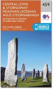
Wandelkaart 459 Central Lewis & Stornaway- Schotland - OSI
De Isle of Lewis en Stornoway
Korte omschrijving
Wandelkaart Central Lewis & Stornaway - Outer hybrids Schotland Omvat ook: Eye Peninsula & Callanish. Productbeschrijving: Kaart nummer 459 omvat de Isle of Lewis en Stornoway. Hoogtepun...

Specificaties
- Uitgever: Ordnance Survey
- ISBN-13: 9780319473115
- HOOFDCATEGORIEËN: Wandelkaart
- Activiteiten: Wandelen, Hiking & Trekking
- Regio: Buiten Hebriden (Outer Hybrids), Schotland
- Land: Schotland
- Waterafstotende kaart: Ordnance Survey ACTIVE Explorer Weatherproof Maps
- Schaal: 1:25000
- Afmeting: 13x24
- Taal: Engels
- Reeks: Explorer ACTIVE Series OSI
Volledige omschrijving
Wandelkaart Central Lewis & Stornaway - Outer hybrids Schotland
Omvat ook: Eye Peninsula & Callanish.
Productbeschrijving: Kaart nummer 459 omvat de Isle of Lewis en Stornoway. Hoogtepunten zijn "the Eye Peninsula" en "Calanais". Omvat ook Beinn Mholach, Liurbost en Stacaiseal. De OS Explorer kaart voor centrale Lewis & Stornoway is beschikbaar in zowel de standaard papieren versie als de weerbestendige 'Actief' versie.
Productdiscription: Map sheet number 459 covers the Isle of Lewis and Stornoway. Highlights include the Eye Peninsula and Calanais. Also includes Beinn Mholach, Liurbost and Stacaiseal. The OS Explorer map for Central Lewis & Stornoway is available in both the standard paper version and weatherproof 'Active' version.
Locatie op kaart
Gekoppelde artikelen

Wandelkaart 459 Central Lewis & Stornoway Outer hybrides - OSI • 9780319247105
standaard versieWandelkaart Central Lewis & Stornoway - Outer hybrids Schotland Productbeschrijving: Eye Peninsula & Callanish. 459 / Central Lewis & Stornoway, Outer hybrids, Schotland - Kaart nummer 459 behandelt de Isle of Lewis & Stornoway. Hoogtepunten zijn de Eye schiereiland en Calanais. Omvat ook Beinn Mholach, Liurbost en Stacaiseal. De OS Explorer kaart voor centrale Lewis & Stornoway is bes…

Wandelkaart 459 Central Lewis & Stornaway- Schotland - OSI • 9780319473115
weatherproof versieWandelkaart Central Lewis & Stornaway - Outer hybrids Schotland Omvat ook: Eye Peninsula & Callanish. Productbeschrijving: Kaart nummer 459 omvat de Isle of Lewis en Stornoway. Hoogtepunten zijn "the Eye Peninsula" en "Calanais". Omvat ook Beinn Mholach, Liurbost en Stacaiseal. De OS Explorer kaart voor centrale Lewis & Stornoway is beschikbaar in zowel de standaard papieren versie als…
Artikelen uit dezelfde regio

Wandelkaart 456 North harris & Loch Seaforth- OSI • 9780319473085
Wandelkaart North harris & Loch Seaforth - Outer Hybrids Schotland Productbeschrijving: OS Explorer kaart 456 toont North Harris (Na Hearadh), Scarp en Loch Seaforth in de Buiten-Hebriden. Het grootste deel van dit gebied is een nationale Scenic Area, met verspreide dorpen en aanzienlijke pieken. Er zijn maar enkele wegen, en de meeste van hen zijn slechts sporen, waardoor veel ruimte is v…

Reisgids Outer Hybrids - Western Isles of Scotland - Bradt • 9781784775964
Outer Hebrides - Western Isles of Scotland - Bradt Productomschrijving: Deze nieuwe, grondig bijgewerkte tweede editie van Bradt's Outer Hebrides: The Western Isles of Scotland, from Lewis to Barra van de ervaren schrijver en journalist Mark Rowe is de enige full-size gids die zich uitsluitend richt op de eilanden Lewis, Harris, St Kilda, North Uist, Benbecula, South Uist, Eriskay, Barra e…

Wandelkaart 452 Barra- Vatersay & Barraigh- Schotland -OSI • 9780319473047
Wandelkaart Barra- Vatersay & Barraigh - Outer hybrids Schotland Omvat ook: Eriskay & Mingulay. Productbeschrijving: Kaart nummer 452 omvat Barra en Sao. Hoogtepunten zijn South Uist Machair en Castlebay. Omvat ook Mingulay en Eriskay. De OS Explorer kaart voor Barra & Sao is beschikbaar in zowel de standaard papieren versie als de weerbestendige 'Actief' versie. Productdiscription…

Wandelkaart 13 West Lewis & North Harris Outer Hybrids - OSI • 9780319473368
Wandelkaart West Lewis & North Harris - Outer Hybrids Schotland Productbeschrijving: Kaart OS Landranger 13 omvat West Lewis & North Harris op de Outer Hybrids, en omvat ook Stacaiseal, Tiorga Mor, Griomabhal, Suaianeabhal, Loch Reasort en Loch Langabhat. De OS Landranger kaarten reeks heeft betrekking op Groot-Brittannië met 204 gedetailleerde kaarten, perfect voor dagtochten en korte pau…

Wandelkaart 53 Benbecula & South Uist Schotland - OSI • 9780319473054
Wandelkaart Benbecula & South Uist - Outer hybrids Schotland Productbeschrijving: OS Explorer kaart 453 toont Beinn na Faoghla (Beinn na Faoghla) en South Uist (Uibhist a Deas) in de Buiten-Hebriden. Het gebied omvat veel natuurreservaten en de South Uist Mahair nationale Scenic Area. De OS Explorer kaart voor Beinn na Faoghla & South Uist is beschikbaar in zowel de standaard papieren vers…


