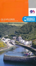
Wandelkaart 424 Buckie & Keith Granpian - OSI
Spey Bay Dufftown te Charlestown van Aberlour
Korte omschrijving
Wandelkaart Buckie & Keith - Granpian Schotland Productbeschrijving: Dufftown & Charlestown of Aberlour. 424 / Buckie & Keith, Granpian, Schotland - OS Explorer kaart 424 toont Buckie in...

Specificaties
- Uitgever: Ordnance Survey
- ISBN-13: 9780319246566
- HOOFDCATEGORIEËN: Wandelkaart
- Activiteiten: Wandelen, Hiking & Trekking
- Regio: Grampian East Schotland
- Land: Schotland
- Schaal: 1:25000
- Afmeting: 13x23
- Taal: Engels
- Reeks: Explorer Series OSI
Volledige omschrijving
Wandelkaart Buckie & Keith - Granpian Schotland
Productbeschrijving: Dufftown & Charlestown of Aberlour.
424 / Buckie & Keith, Granpian, Schotland - OS Explorer kaart 424 toont Buckie in het zuiden Spey Bay Dufftown te Charlestown van Aberlour.Ook opgenomen is veel van de Speyside way en de rivier Spey. De OS Explorer kaart voor Buckie & Keith is beschikbaar in zowel de standaard papieren versie als de weerbestendige 'Actief' versie.
424 / Buckie & Keith, Granpian, Schotland - OS Explorer map 424 shows Buckie on the Spey Bay south to Dufftown and Charlestown of Aberlour.Also included in much of the Speyside Way following the River Spey. The OS Explorer map for Buckie & Keith is available in both the standard paper version and weatherproof 'Active' version.
Locatie op kaart
Gekoppelde artikelen

Wandelkaart 424 Buckie & Keith Granpian - OSI • 9780319246566
standaard versieWandelkaart Buckie & Keith - Granpian Schotland Productbeschrijving: Dufftown & Charlestown of Aberlour. 424 / Buckie & Keith, Granpian, Schotland - OS Explorer kaart 424 toont Buckie in het zuiden Spey Bay Dufftown te Charlestown van Aberlour.Ook opgenomen is veel van de Speyside way en de rivier Spey. De OS Explorer kaart voor Buckie & Keith is beschikbaar in zowel de standaard papie…

Wandelkaart 242 Buckie & Keith Schotland - OSI • 9780319472767
weatherproof versieWandelkaart Buckie & Keith - Grampian Schotland Omvat: Dufftown & Charlestown of Aberlour. Productbeschrijving: OS Explorer kaart 424 toont Buckie in het zuiden Spey Bay Dufftown te Charlestown of Aberlour. Ook opgenomen in veel van de Speyside way, is de rivier Spey. De OS Explorer kaart voor Buckie & Keith is beschikbaar in zowel de standaard papieren versie als de weerbestendige 'Ac…
Overzichtskaarten

OSI Explorer & Explorer Active - Noord Schotland & The Cairngorms
OSI Explorer & Explorer Active - Noord Schotland & The Cairngorms

Producten op de overzichtskaart
Klik op een product om naar de detailpagina te gaan.
- Wandelkaart 342 Glasgow Schotland - OSI
- Wandelkaart 348 Campsie Fells- Glasgow - Schotland - OSI
- Wandelkaart 349 Falkirk- Cumbernauld & Livingston - OSI
- Wandelkaart 350 Edinburgh - East Schotland - OSI
- Wandelkaart 351 Dunbar & North Berwick - Edinburgh - OSI
- Wandelkaart 366 Stirling & Ochil Hills West - OSI
- Wandelkaart 367 Dunfermline- Kirkcaldy & Glenrothes - OSI
- Wandelkaart 369 Perth & Kinross - Schotland - OSI
- Wandelkaart 370 Glenrothes North- Falkland & Lomond Hills - OSI
- Wandelkaart 371 St-Andrews & East Fife- Schotland - OSI
- Wandelkaart 379 Dunkeld & Aberfeldy- Glen Almond - OSI
- Wandelkaart 380 Dundee & Sidlaw Hills- Fife - OSI
- Wandelkaart 381 Blairgowrie & Kirriemuir - OSI
- Wandelkaart 382 Arbroath- Montrose & Carnoustie - OSI
- Wandelkaart 385 Rannoch Moor & Ben Alder- Highland's - OSI
- Wandelkaart 389 Forfar- Brechin & Edzell- Tayside - OSI
- Wandelkaart 396 Stoneheaven- Inverbervie & Laurencekirk - OSI
- Wandelkaart 406 Aberdeen & Banchory- Schotland - OSI
- Wandelkaart 416 Inverness & Loch Ness - OSI
- Wandelkaart 417 Monadhliath Mountains North - OSI
- Wandelkaart 421 -llon & Inverurie- Aberdeenshire - OSI
- Wandelkaart 422 Nairn & Cawdor- Inverness - OSI
- Wandelkaart 423 Elgin- Forres & Lossiemouth - OSI
- Wandelkaart 424 Buckie & Keith- Granpian - OSI
- Wandelkaart 425 Huntly & Cullen- Aberdeenshire - OSI
- Wandelkaart 426 Banff- Macduff & Turriff- Aberdeenshire - OSI
- Wandelkaart 427 Peterhead & Fraserburgh- Aberdeenshire - OSI
- Wandelkaart 431Glen Urquhart & Strathglass - OSI
- Wandelkaart 432 Black Isle & Munlochy - OSI
- Wandelkaart OL46 Trossachs- Callander & Aberfoyle - OSI
- Wandelkaart OL49 Pitlochry & Loch Tummel- perth & Kinross - OSI
- Wandelkaart OL50 Ben Alder- Loch Ericht & Loch Laggan - OSI
- Wandelkaart OL51 Atholl- Glen Tilt & Beinn Dearg - OSI
- Wandelkaart OL52 Glen Shee- Braemar & Cairnwell - OSI
- Wandelkaart OL53 Lochnagar- Glen Muick & Glen Clova - OSI
- Wandelkaart OL54 Glen Esk- Glen Tanar & Aboyne - OSI
- Wandelkaart OL55 Loch Laggan & Creag Meagaidh - OSI
- Wandelkaart OL56 Loch Laggan & Creag Meagaidh - OSI
- Wandelkaart OL57 Cairn Gorm- Aviemore & Loch Morlich - OSI
- Wandelkaart OL58 Braemar- Tomintoul & Glen Avon - OSI
Artikelen uit dezelfde regio

Wandelkaart 423 Elgin Forres & Lossiemouth Schotland - OSI • 9780319472750
Wandelkaart Elgin- Forres & Lossiemouth - Grampian Schotland Omvat ook: Burghead & Findhorn. Productbeschrijving: Aan de zuidkust van de Moray Firth toont OS Explorer kaart 423 Burghead en Lossiemouth tot in het binnenland naar Elgin, Forres en Dallas. It incudes het noordelijke uiteinde van de Dava way, en de rivieren Findhorn en Lossie. De OS Explorer kaart voor Elgin, Forres & Lossi…

Wandelkaart OL53 Lochnagar Glen Muick & Glen Clova - OSI • 9780319469712
Wandelkaart Lochnagar- Glen Muick & Glen Clova - Schotland Omvat ook: Ballater & Balmoral Productbeschrijving: OS Explorer kaart OL53 toont de centraal zuidelijke Cairngorms National Park, van de Backwater Resevoir, Balmoral tot Ballater. Deze kaart vervangt de vorige OS Explorer kaart 388 voor dit gebied. Hier zijn 11 Munros te vinden, evenals een aantal andere pieken, evenals Deeside…


