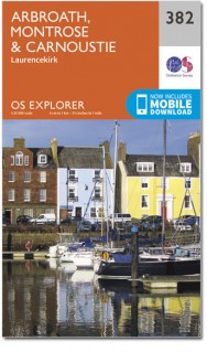
Wandelkaart 382 Arbroath- Montrose & Carnoustie - OSI
Omvat de kust van Arbroath tot Montrose en Johnshaven
Korte omschrijving
Wandelkaart Arbroath- Montrose & Carnoustie - Schotland Omvat ook: Laurencekirk. Productbeschrijving: Deze kaart volgt de kust van het oosten van Arbroath tot Montrose en Johnshaven, en...

Specificaties
- Uitgever: Ordnance Survey
- ISBN-13: 9780319472484
- HOOFDCATEGORIEËN: Wandelkaart
- Activiteiten: Wandelen, Hiking & Trekking
- Regio: Tayside, Schotland
- Land: Schotland
- Waterafstotende kaart: Ordnance Survey ACTIVE Explorer Weatherproof Maps
- Schaal: 1:25000
- Afmeting: 13x24
- Taal: Engels
- Reeks: Explorer ACTIVE Series OSI
Volledige omschrijving
Wandelkaart Arbroath- Montrose & Carnoustie - Schotland
Omvat ook: Laurencekirk.
Productbeschrijving: Deze kaart volgt de kust van het oosten van Arbroath tot Montrose en Johnshaven, en omvat OS Explorer kaart 382 de Lunan Bay, Montrose Bay en beide mondingen van de rivier de Esk. De OS Explorer kaart voor Arbroath, Montrose & Carnoustie is beschikbaar in zowel de standaard papieren versie als de weerbestendige 'Actief' versie.
Productdiscription: Following the East Coast from Arbroath up to Montrose and Johnshaven, OS Explorer map 382 includes the Lunan Bay, Montrose Bay and both the mouths of the River Esk. The OS Explorer map for Arbroath, Montrose & Carnoustie is available in both the standard paper version and weatherproof 'Active' version.
Locatie op kaart
Gekoppelde artikelen

Wandelkaart 382 Arbroath- Montrose & Carnoustie - OSI • 9780319246283
standaard versieWandelkaart Arbroath- Montrose & Carnoustie - Schotland Productbeschrijving: Laurencekirk 382 - Arbroath, Montrose & Carnoustie, Tayside Schotland - Volg de kust van het oosten van Arbroath tot Montrose en Johnshaven, en omvat de Lunan Bay, Montrose Bay en beide de mondingen van de rivier Esk. De OS Explorer kaart voor Arbroath, Montrose & Carnoustie is beschikbaar in zowel de standaar…

Wandelkaart 382 Arbroath- Montrose & Carnoustie - OSI • 9780319472484
weatherproof versieWandelkaart Arbroath- Montrose & Carnoustie - Schotland Omvat ook: Laurencekirk. Productbeschrijving: Deze kaart volgt de kust van het oosten van Arbroath tot Montrose en Johnshaven, en omvat OS Explorer kaart 382 de Lunan Bay, Montrose Bay en beide mondingen van de rivier de Esk. De OS Explorer kaart voor Arbroath, Montrose & Carnoustie is beschikbaar in zowel de standaard papieren v…
Artikelen uit dezelfde regio

Wandelkaart 389 Forfar Brechin & Edzell Schotland - OSI • 9780319472521
Wandelkaart Forfar- Brechin & Edzell - Tayside Schotland Omvat ook: Strathmore East. Productbeschrijving: OS Explorer kaart 389 toont Forfar, Brechin en Edzell. Hoogtepunten van het gebied omvatten North Esk en Zuid-Esk rivieren, en de zuidelijke rand van de Cairgorms. De OS Explorer kaart voor Forfar, Brechin & Edzell is beschikbaar in zowel de standaard papieren versie als de weerbes…

Wandelkaart 380 Dundee & Sidlaw Hills- Tayside - OSI • 9780319472460
Wandelkaart Dundee & Sidlaw Hills - Tayside West Schotland Productbeschrijving: Dubbel zijdig OS Explorer kaart 380 omvat Dundee, the Sidlaw Hills, de Firth of Tay en een deel van het kustpad van Fife. Hoogtepunten van het gebied zijn evenals de industriestad van Dundee, Broughty Ferry en de Sidlaws. De OS Explorer kaart voor Dundee & Sidlaw Hills is beschikbaar in zowel de standaard papie…

Wandelgids Mary Queen of Scots Way - Rucksack readers • 9781898481485
Wandelgids Mary Queen of Scots Way - Schotland Productomschrijving: Deze nieuwe route doorkruist Centraal Schotland van kust tot kust, en is verbonden met vele plaatsen die geassocieerd zijn met Mary Queen of Scots. Het loopt voor 107 mijl (172 km) van Arrochar op Loch Long naar St Andrews op de kust van Fife, Loch Lomond kruist met de veerboot naar Inversnaid en gaat dan via Aberfoyle, Ca…

Wandelkaart 389 Forfar Brechin & Edzell Tayside - OSI • 9780319246320
Wandelkaart Forfar- Brechin & Edzell - Tayside Schotland Productbeschrijving: Strathmore East. 389 / Forfar, Brechin & Edzell, Tayside, Schotland - OS Explorer kaart 389 toont Forfar, Brechin en Oudewater. Hoogtepunten van het gebied omvatten North Esk en Zuid-Esk rivieren, en de zuidelijke rand van de Cairgorms. De OS Explorer kaart voor Forfar, Brechin & Edzell is beschikbaar in zowe…

Wandelgids The Rob Roy Way - Tayside - Rucksack readers • 9781898481478
Wandelgids Rob Roy Way - Tayside Schotland Productomschrijving: Deze lange wandeling van Drymen naar Pitlochry is mede-ontwikkeld door Rucksack Readers in 2001 en is nu algemeen erkend als een grote trail. Het loopt voor 77 mijl (124 km) langs enkele van Schotland's beste lochs en glens, met behulp van historische wandelpaden, een cycleway, een niet meer gebruikte spoorlijnbedding, en lang…


