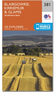
Wandelkaart 381 Blairgowrie- Kirriemuir & Glamis - OSI
Omvat de vallei rond Blairgowrie & Rattray
Korte omschrijving
Wandelkaart Blairgowrie- Kirriemuir & Glamis - Schotland Omvat ook: Strathmore West. Productbeschrijving: OC Explorer kaart 381 toont een breed scala aan landschappen. Van de beschutte v...

Specificaties
- Uitgever: Ordnance Survey
- ISBN-13: 9780319472477
- HOOFDCATEGORIEËN: Wandelkaart
- Activiteiten: Wandelen, Hiking & Trekking
- Regio: Perth and Kinross, Schotland
- Land: Schotland
- Waterafstotende kaart: Ordnance Survey ACTIVE Explorer Weatherproof Maps
- Schaal: 1:25000
- Afmeting: 13x24
- Taal: Engels
- Reeks: Explorer ACTIVE Series OSI
Volledige omschrijving
Wandelkaart Blairgowrie- Kirriemuir & Glamis - Schotland
Omvat ook: Strathmore West.
Productbeschrijving: OC Explorer kaart 381 toont een breed scala aan landschappen. Van de beschutte vallei rond Blairgowrie & Rattray (nog steeds één van de belangrijkste zacht fruit groeiende gebieden in Schotland) tot de glooiende heuvels erond. Deze kaart toont ook deel van de Cateran-Trail. De OS Explorer kaart voor Blairgowrie, Kirriemuir & Glamis is beschikbaar in zowel de standaard papieren versie als de weerbestendige 'Actief' versie.
Productdiscription: OC Explorer Map 381 shows a wide range of landscapes. From the sheltered valley around Blairgowrie & Rattray (still one of the main soft fruit growing areas in Scotland) to the gentle hills surrounding it. This map also shows part of the Cateran Trail. The OS Explorer map for Blairgowrie, Kirriemuir & Glamis is available in both the standard paper version and weatherproof 'Active' version.
Locatie op kaart
Gekoppelde artikelen

Wandelkaart 381 Blairgowrie & Kirriemuir - OSI • 9780319246276
standaard versieWandelkaart Blairgowrie & Kirriemuir - East Schotland Productbeschrijving: Strathmore West. 381 / Blairgowrie, Kirriemuir & Glamis, East Schotland - OC Explorer kaart 381 toont een breed scala aan landschappen. Van de beschutte vallei rond Blairgowrie & Rattray (nog steeds één van de belangrijkste zacht fruit groeiende gebieden in Schotland) op de glooiende heuvels er rond. Deze kaart…

Wandelkaart 381 Blairgowrie- Kirriemuir & Glamis - OSI • 9780319472477
weatherproof versieWandelkaart Blairgowrie- Kirriemuir & Glamis - Schotland Omvat ook: Strathmore West. Productbeschrijving: OC Explorer kaart 381 toont een breed scala aan landschappen. Van de beschutte vallei rond Blairgowrie & Rattray (nog steeds één van de belangrijkste zacht fruit groeiende gebieden in Schotland) tot de glooiende heuvels erond. Deze kaart toont ook deel van de Cateran-Trail. De OS E…
Artikelen uit dezelfde regio

Wandelkaart 52 Pitlochry & Crieff Perth & Kinross - OSI • 9780319473757
Wandelkaart Pitlochry & Crieff - Perth & Kinross Schotland Productbeschrijving: OS Landranger kaart 52 omvat de steden Pitlochy, Crieff, Aberfeldy, Strathtay en Dunkeld. Pitlochry was populair als wandelgebied in de 19e eeuw, en blijft dus vandaag ook even gekend. De OS Landranger kaarten reeks heeft betrekking op Groot-Brittannië met 204 gedetailleerde kaarten, perfect voor dagtochten en …

Wandelkaart OL49 Pitlochry & Loch Tummel Perth & Kinross - OSI • 9780319469675
Wandelkaart Pitlochry & Loch Tummel - perth & Kinross Oomvat ook: Aberfeldy, Kinloch Rannoch & Schiehallion. Productbeschrijving: OS Explorer kaart OL 49 toont Loch Tummel, Oost-Loch Rannoch en de omliggende dorpen van Kinloch Rannoch, Pitlochry en Aberfeldy. Loch Tummel (en de Clunie Damn) zijn een populair gebied bij bezoekers, met de prachtige "Queens View", één van de meest bezocht…

Wandelkaart 53 Blairgowrie & Forest of Alyth Schotland - OSI • 9780319261514
Wandelkaart Blairgowrie & Forest of Alyth - Schotland Productbeschrijving: OS Landranger kaart 53 toont het marktstadje Blairgowrie en omvat Alyth, Newtyle, Meigle, Errol, Scone, Bankfoot, Stanley, Craigie, Luncarty en het Park Tay Forest. Bezoek de 30m hoge beuken hedge funds in Meikleour, of wandel langs de Cateran Trail, en volg in de voetsporen van Highland runderen. Blairgowrie ligt i…

Wandelkaart 43 Braemar & Blair Athol - Perth & Kinross - OSI • 9780319261415
Wandelkaart Braemar & Blair Athol - Schotland Productbeschrijving: Genesteld in de wildernis van het Cairngorms National Park, en getoont op OS Landranger kaart 43, is het dorp van Braemar omringd door ruige bergen en natuurlijke bossen, rijk aan natuur en gevoel van avontuur zijn. De OS Landranger kaarten reeks heeft betrekking op Groot-Brittannië met 204 gedetailleerde kaarten, perfe…

Wandelkaart 379 Dunkeld & Aberfeldy Glen Almond - OSI • 9780319246252
Wandelkaart Dunkeld- Aberfeldy - Glen Almond Schotland Productbeschrijving: 379 / Dunkeld, Aberfeldy, Glen Almond, Perth and Kinross, Schotland - Kaart nummer 379 dekt Dunkeld, Aberfeldy en Glen Almond. Hoogtepunten zijn Ben Chonzie, Tay Forest Park en de rivier de Tay. Omvat ook Hoil Loch, Loch Freuchie en Glen Cochill. De OS Explorer kaart voor Dunkeld, Aberfeldy & Glen amandel is b…


