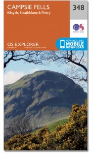
Wandelkaart 348 Campsie Fells Glasgow Schotland - OSI
Omvat een deel van de central Schotisch forest
Korte omschrijving
Wandelkaart Campsie Fells - Glasgow & Stirling Schotland Omvat ookk: Kilsyth, Strathblane & Fintry. Productbeschrijving: OS Explorer kaart 348 toont de Campsie Fells, met de piek van Ear...

Specificaties
- Uitgever: Ordnance Survey
- ISBN-13: 9780319472194
- HOOFDCATEGORIEËN: Wandelkaart
- Activiteiten: Wandelen, Hiking & Trekking
- Regio: Glasgow, Schotland
- Land: Schotland
- Waterafstotende kaart: Ordnance Survey ACTIVE Explorer Weatherproof Maps
- Schaal: 1:25000
- Afmeting: 13x24
- Taal: Engels
- Reeks: Explorer ACTIVE Series OSI
Volledige omschrijving
Wandelkaart Campsie Fells - Glasgow & Stirling Schotland
Omvat ookk: Kilsyth, Strathblane & Fintry.
Productbeschrijving: OS Explorer kaart 348 toont de Campsie Fells, met de piek van Earls Seat op 578m. Het omvat ook een deel van de centrale Schotisch forest, de West Highland Way en Carron Valley Reservoir. De OS Explorer kaart voor Campsie Fells is beschikbaar in zowel de standaard papieren versie als de weerbestendige 'Actief' versie.
Productdiscription: OS Explorer map 348 shows the Campsie Fells, with the peak of Earls Seat at 578m. It also shows part of the Central Scotland Forest, the West Highland Way and Carron Valley Reservoir. The OS Explorer map for Campsie Fells is available in both the standard paper version and weatherproof 'Active' version.
Locatie op kaart
Gekoppelde artikelen

Wandelkaart 348 Campsie Fells- Glasgow - Schotland - OSI • 9780319245996
standaard versieWandelkaart Campsie Fells - Glasgow Schotland Productbeschrijving: Kilsyth, Strathblane & Fintry. 348 / Campsie Fells, Glasgow, Schotland - OS Explorer kaart 348 toont de Campsie Fells, met de piek van Earls op 578m. Het laat ook een deel van de centrale Schotland bos, de West Highland Way en Carron Valley Reservoir zien. De OS Explorer kaart voor Campsie Fells is beschikbaar in zowel…

Wandelkaart 348 Campsie Fells Glasgow Schotland - OSI • 9780319472194
weatherproof versieWandelkaart Campsie Fells - Glasgow & Stirling Schotland Omvat ookk: Kilsyth, Strathblane & Fintry. Productbeschrijving: OS Explorer kaart 348 toont de Campsie Fells, met de piek van Earls Seat op 578m. Het omvat ook een deel van de centrale Schotisch forest, de West Highland Way en Carron Valley Reservoir. De OS Explorer kaart voor Campsie Fells is beschikbaar in zowel de standaard pa…
Artikelen uit dezelfde regio

Reisgids Glasgow pocket guide - Lonely Planet • 9781788680967
Glasgow van Lonely Planet Productomschrijving: Lonely Planet's Pocket Glasgow is je paspoort voor het meest relevante, actuele advies over wat je moet zien en overslaan, en welke verborgen ontdekkingen er op je wachten. Verken de rijkdom van de stad aan schilderijen, te beginnen bij de Kelvingrove Art Gallery & Museum, ga naar een band in King Tut's Wah Wah Hut en ontdek het architectonisc…

Wandelkaart 342 Glasgow Schotland - OSI • 9780319245941
Wandelkaart Glasgow - Schotland Omvat ook: Paisley, Rutherglen & Kirkintilloch Productomschrijving: Gecentreerd in de regio Glasgow, met OS Explorer kaart 342 ziet u de omliggende gebieden te verkennen rond de stad. Het omvat de Clyde Walkway & Kelvin Walkway en delen van de centrale Schotisch Forest. De OS Explorer kaart van Glasgow is beschikbaar in zowel de standaard papieren versie…

Reisgids Glasgow - Gallimard • 9782742464500
Glasgow de Gallimard Productomschrijving: Van George Square tot de Burrell Collection, van de Glasgow School of Art tot de Mackintosh Art Nouveau herenhuizen, de grootste stad van Schotland kan in een oogwenk worden verkend met een gids als geen ander. Franse omschrijving: De George Square à la Burrell Collection, de la Glasgow School of Art aux demeures Art nouveau signées Mackintosh,…

Wandelkaart 429 Glen Carron & West Monar Schotland - OSI • 9780319472811
Wandelkaart Glen Carron & West Monar - Glasgow Schotland Omvat ook: Trathcarron & Attadale Forest. Productbeschrijving: Kaart nummer 429 covers Glen Carron en West Monar. Hoogtepunten zijn Attadale Forest, Strathcarron en Loch Dùghaill. Omvat ook Carn Breac, Loch Sgamhain, Ben Killilan en Achnashellach. De OS Explorer kaart voor Glen Carron & West Monar is beschikbaar in zowel de stand…

Reisgids Glasgow en quelques jours - Lonely Planet • 9782816179330
Glasgow en quelques jours - Lonely Planet Déscription de produits: Un guide tout en couleurs, concis et ultrapratique pour découvrir Glasgow. Après Édimbourg, une nouvelle destination écossaise dans la collection En quelques jours : Glasgow ! La plus grande ville d’Écosse offre nombre de bijoux architecturaux (dont les œuvres de Mackintosh, chantre du Glasgow Style, branche écossaise d…


