
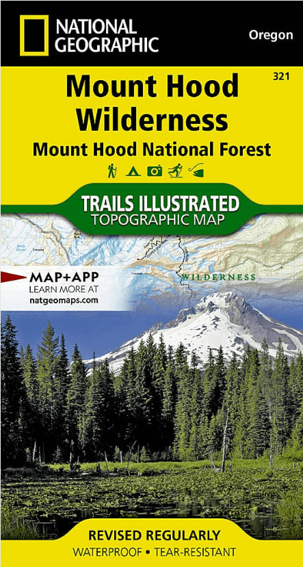
Wandelkaart 321 Mount Hood National Forest & Wilderness - Nat Geo
Barlow Pass- Hunchback Mountain- Mount Hood- Mount Hood Wildernes
Korte omschrijving
Wandelkaart Mount Hood National Forest & Wilderness - Nat Geo Productomschrijving: 2 prachtige gebieden vol bos, rivieren, bergen en gletjers. Omvat: Barlow Pass, Hunchback Mountain, Mou...

Specificaties
- Uitgever: National Geographic
- ISBN-13: 9781566956673
- HOOFDCATEGORIEËN: Wandelkaart
- Activiteiten: Wandelen, Hiking & Trekking
- Regio: Oregon, USA
- Land: Verenigde Staten van Amerika (USA)
- Regionale parken: Mount Hood National Forest, USA, Mount Hood Wilderness Area, USA
- Schaal: 1:35000
- Afmeting: 10x19
- Taal: Engels
- Reeks: National Geographic's Trails Illustrated map
Volledige omschrijving
Wandelkaart Mount Hood National Forest & Wilderness - Nat Geo
Productomschrijving: 2 prachtige gebieden vol bos, rivieren, bergen en gletjers.
Omvat: Barlow Pass, Hunchback Mountain, Mount Hood, Mount Hood Wilderness, Mt. Hood National Forest, Salmon-Huckleberry Wilderness, Zigzag Mountain.
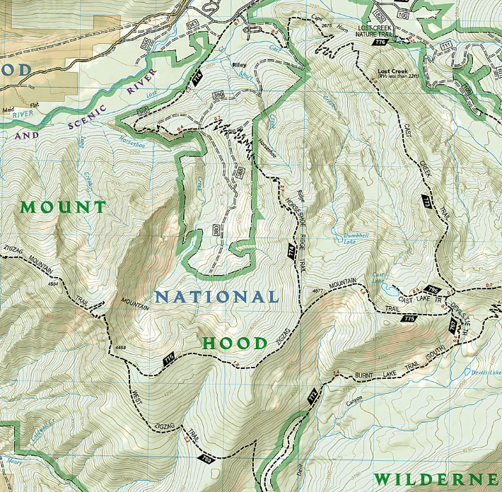
Engelse omschrijving: With its snow-covered peak, Mount Hood is an American icon and a premier destination for outdoor enthusiasts. The area's mountains, forests, wildernesses and rivers, provide an abundance of recreation activities. National Geographic's Trails Illustrated map of Mount Hood Wilderness and National Forest is expertly researched and created in partnership with the U.S. Forest Service and others, to provide unparalleled detail for anyone wishing to explore this magnificent area, Coverage includes Mount Hood Wilderness, National Forest and Recreation Area: Sandy, Salmon and Zigzag Wild and Scenic Rivers, Salmon-Huckleberry and Badger Creek Wilderness Areas, Richard L. Kohnstamm Memorial Area, and Mount Hood Scenic Byway.
Explore the area by following along precisely mapped trails, with mileage markers between intersections. The Pacific Crest Trail and the Oregon National Historic Trail are both highlighted. To aid in your navigation, the map includes contour lines with elevations, labeled peaks and summits, glaciers and crevasses, water features, numbered Forest Service roads and clear color-coded boundaries between areas of different land management agencies. Among the many recreation and adventure features noted are areas for camping, boat launches, canoe access, rock climbing, alpine skiing, fishing, wildlife viewing and swimming. Also included are permit, background information and safety tips for climbing Mount Hood, wilderness area descriptions and general safety information.
Every Trails Illustrated map is printed on "Backcountry Tough" waterproof, tear-resistant paper. A full UTM grid is printed on the map to aid with GPS navigation.
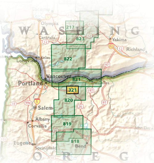
Overzichtskaarten

NAT GEO Oregon trails map
NAT GEO Oregon trails map

Producten op de overzichtskaart
Klik op een product om naar de detailpagina te gaan.
Artikelen uit dezelfde regio
Reisgids Pacific Northwest USA - DK Eyewitness • 9780241411513
DK Eyewitness Pacific Northwest USA Omvat: Portland, Oregon, Seattle, Washington, Vancouver and British Columbia Productomschrijving: Tour de Wine Country van de North Willamette Valley, ga wandelen in het Mount Rainier National Park of verken het natuurschoon van Vancouver Island: alles wat u moet weten is overzichtelijk weergegeven in kleurgecodeerde hoofdstukken. Ontdek het beste v…

Wandelgids Rocky Mountains & Pacific Northwest NP - Lonely Planet • 9781838696085
Rocky Mountains & Pacific Northwest NP - Lonely Planet Productomschrijving: Lonely Planet's Rocky Mountains and the Pacific Northwest's National Parks is uw paspoort voor het meest actuele advies over wat je moet zien en overslaan. Beklim Grand Teton, bespioneer wilde dieren en kampeer bij Crater Lake, allemaal met je vertrouwde reisgenoot. Duik in het hart van de Rocky Mountains en de nat…

Wandelgids Hiking the Pacific Crest Trail - Cicerone • 9781852849207
Hiking the Pacific Crest Trail - PCT - Cicerone Productomschrijving: Een wandelgids over de Pacific Crest Trail (PCT), een epische wandeling van 3300 km van de Mexicaanse grens naar het Canadese British Columbia. Een van 's werelds beste wandelingen, de route loopt door Californië, Oregon en de staat Washington, langs de Mojave-woestijn, High Sierras, Cascades en talloze meer wilde bergen …

Wandelkaart 820 Mount Hood & Willamette National Forest • 9781566954723
TOPO Wandelkaart 820 - Mount Hood & Willamette National Forest - Oregon USA - National Geographic Productomschrijving: Het Willamette National Forest is een National bos gelegen in het centrale deel van de Cascade Range in de U.S. satta van Oregon. Met een dikke 6,790.75 km². Een deel van 1,540 km² is echte wildernis waarin 7 grote pieken zijn vertegenwoordigd. Engelse omschrijving: W…

Reisgids West Coast USA - Insight Guides ENG • 9781786718310
West Coast USA - Insight Guides Productomschrijving: Deze reisgids is een rijk geïllustreerde inspirerende versie over de westkust van de VS en een prachtig souvenir van uw reis. Perfect voor reizigers die op zoek zijn naar een diepere duik in de geschiedenis en cultuur van de bestemming en ideaal om u te inspireren en te helpen bij het plannen van uw reis. Met zijn grote selectie van…