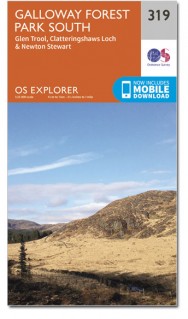
Wandelkaart 319 Galloway Forest Park South - OSI
Omvat het zuidelijke deel van het Galloway Forest park
Korte omschrijving
Wandelkaart Galloway Forest Park South - Schotland Omvat ook: Glen Trool & Clatteringshaws Loch Newton Stewart. Productbeschrijving: OS Explorer kaart 319 toont het zuidelijke deel van h...

Specificaties
- Uitgever: Ordnance Survey
- ISBN-13: 9780319471913
- HOOFDCATEGORIEËN: Wandelkaart
- Activiteiten: Wandelen, Hiking & Trekking
- Regio: Dumfries & Galloway, Schotland
- Land: Schotland
- Waterafstotende kaart: Ordnance Survey ACTIVE Explorer Weatherproof Maps
- Regionale parken: Galloway Forest park, Schotland
- Schaal: 1:25000
- Afmeting: 13x24
- Taal: Engels
- Reeks: Explorer ACTIVE Series OSI
Volledige omschrijving
Wandelkaart Galloway Forest Park South - Schotland
Omvat ook: Glen Trool & Clatteringshaws Loch Newton Stewart.
Productbeschrijving: OS Explorer kaart 319 toont het zuidelijke deel van het Galloway Forest park, Clatteringshaws Loch, Southern Upland Way, E2 Europese Long Distance pad, Loch Grannoch en Loch Ken. De OS Explorer kaart voor Galloway Forest Park South is beschikbaar in zowel de standaard papieren versie als de weerbestendige 'Actief' versie.
Productdiscription: OS Explorer Map 319 shows the Southern part of the Galloway Forest, Clatteringshaws Loch, Southern Upland Way, E2 European Long Distance Path, Loch Grannoch and Loch Ken. The OS Explorer map for Galloway Forest Park South is available in both the standard paper version and weatherproof 'Active' version.
Locatie op kaart
Gekoppelde artikelen

Wandelkaart 319 Galloway Forest Park South - OSI • 9780319245712
standaard versieWandelkaart Galloway Forest Park South - Ayrshire Schotland Productbeschrijving: Glen Trool & Clatteringshaws Loch Newton Stewart. 319 / Galloway Forest Park South, Ayrshire, Schotland - OS Explorer kaart 319 toont het Zuidelijke deel van het Galloway Forest, Clatteringshaws Loch, Southern Upland Way, E2 Europese Long Distance pad, Loch Grannoch en Loch Ken. De OS Explorer kaart voor …

Wandelkaart 319 Galloway Forest Park South - OSI • 9780319471913
weatherproof versieWandelkaart Galloway Forest Park South - Schotland Omvat ook: Glen Trool & Clatteringshaws Loch Newton Stewart. Productbeschrijving: OS Explorer kaart 319 toont het zuidelijke deel van het Galloway Forest park, Clatteringshaws Loch, Southern Upland Way, E2 Europese Long Distance pad, Loch Grannoch en Loch Ken. De OS Explorer kaart voor Galloway Forest Park South is beschikbaar in zowel…
Artikelen uit dezelfde regio

Wandelkaart 318 Galloway Forest Park North - OSI • 9780319471906
Wandelkaart Galloway Forest Park North - Schotland Omvat ook: Glen Trool & Loch Doon St John’s Town of Dalry. Productbeschrijving: OS Explorer kaart nummer 318 toont het noordelijk deel van het Gallowway Forest Park, Doon Loch, Loch Trool, de Southern Upland Way en de E2 Europese Long Distance pad. De OS Explorer kaart voor Galloway Forest Park North is beschikbaar in zowel de standaar…

Wandelkaart 312 Kirkcudbright & Castle Douglas- Schotland • 9780319471845
Wandelkaart Kirkcudbright & Castle Douglas - Dumfries & Galoway Omvat ook: Gatehouse of Fleet. Productbeschrijving: Tonen de mondingen van de rivieren de Dee en The Fleet, omvat OS Explorer kaart 312 Castle Douglas, Hôtel Crocus Caen het Mémorial van Fleet en Kinkcudbright zelf. Hoogtepunten zijn onder andere de Galloway Forest Park en Fleet Valley National Scenic Area, De OS Explorer …

Wandelkaart 320 Castle Douglas & Loch Ken - OSI • 9780319471920
Wandelkaart Castle Douglas- Loch Ken - New Galloway Schotland Omvat ook: St John’s Town of Dalry & Moniaive. Productbeschrijving: Deze kaart omvat het gebied rond new Galloway, inclusief Luch Ken, Loch Urr, Lochinvar en het bos Laurieston, de OS Explorer kaart 320 gaat zo ver naar het zuiden als Castle Douglas. Ook weergegeven zijn delen van de Southern Upland Way en de E2 Europese Lon…

Reisgids Go Slow - Dumfries & Galloway - Bradt guides • 9781784776107
Reisgids Dumfries & Galloway Schotland - Bradt Productomschrijving: Dumfries en Galloway is een gebied met landelijke charme en opvallende landschappen, waar een langzamer tempo van leven en reizen vanzelfsprekend is. Bradts 'Slow Travel' Dumfries and Galloway is de eerste uitgebreide reisgids voor dit gebied en behandelt de regio in detail, van Eskdale tot Schotlands zuidpunt bij de Mull …

Wandelkaart 83 Newton Stewart & Kirkcudbright- Schotland - OSI • 9780319261811
Wandelkaart Newton Stewart & Kirkcudbright - Schotland Productbeschrijving: Newton Stewart zit in het geografische centrum van de glooiende heuvels van Galloway en Forest Park, en is aangegeven op kaart OS Landranger 83. Gelegen aan de monding van de rivier de Dee ligt de oude visserij stad van Kirkcudbright. Deze kaart bevat ook Loch Ken, Whithorn, kleine, Carsluith, poortgebouw van vloot…


