
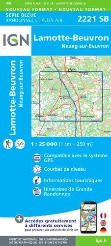
Wandelkaart 2221 SB Lamotte-Beuvron - IGN
Lamotte-Beuvron is gelegen in de Loir-et-Cher
Korte omschrijving
Wandelkaart 2221 SB - Lamotte-Beuvron Omvat eveneens Neung-sur-Beuvron Productomschrijving: Lamotte-Beuvron is een gemeente in het Franse departement Loir-et-Cher in de regio Centre-Val ...

Specificaties
- Uitgever: Institut Géographique National
- ISBN-13: 9782758539209
- HOOFDCATEGORIEËN: Wandelkaart
- Activiteiten: Wandelen, Hiking & Trekking
- Regio: Centre Val de Loire, Frankrijk
- Land: Frankrijk
- Departement: Loir-et-Cher (41)
- Schaal: 1:25000
- Afmeting: 11x22
- Editie: 1
- Taal: Frans
- Reeks: IGN Cartes Série Bleue
Volledige omschrijving
Wandelkaart 2221 SB - Lamotte-Beuvron
Omvat eveneens Neung-sur-Beuvron
Productomschrijving: Lamotte-Beuvron is een gemeente in het Franse departement Loir-et-Cher in de regio Centre-Val de Loire. De plaats maakt deel uit van het arrondissement Romorantin-Lanthenay. In het dorp werd in het jaar 1889 bij ongeluk een beroemd gebleven nagerecht gecreëerd, de tarte tatin, een omgekeerde appeltaart bedekt met karamel. Een gekende lekkernij plaats dus voor de fanatiekers van taart.
Desciptive produits: Une nouvelle cartographie pour une lisibilité optimale, avec une meilleure précision géométrique et des informations touristiques enrichies. Un nouveau format deux fois plus grand : le format des nouvelles SERIE BLEUE est équivalent à celui des TOP 25 et le nombre de références sera ainsi divisé par 2. Pour la plupart des cartes, la zone couverte correspond à l’assemblage des anciennes SERIE BLEUE Est et Ouest.
Locatie op kaart
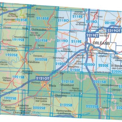
Overzichtskaarten
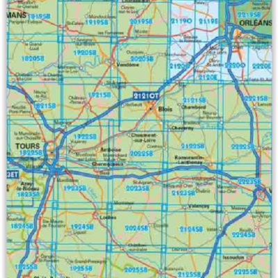
10--IGN TOP25 reeks, ET, OT & SB
10--IGN TOP25 reeks, ET, OT & SB

Producten op de overzichtskaart
Klik op een product om naar de detailpagina te gaan.
- Wandelkaart 1819 SB Bouloire & Le Grand-Lucé - IGN
- Wandelkaart 1919 SB St-Calais & Droué - IGN
- Wandelkaart 2019 SB Cloyes-sur-le-Loir - IGN
- Wandelkaart 2219 SB Orléans & Jargeau - IGN
- Wandelkaart 1820 SB Château-du-Loir & La Chartre-sur-Loir - IGN
- Wandelkaart 1920 SB Vendôme & Montoire-sur-le-Loir - IGN
- Wandelkaart 2020 SB Selommes & St-Ouen - IGN
- Wandelkaart 1821 SB -Château-du-Loir & Neuillé-Pont-Pierre - IGN
- Wandelkaart 1921 SB Château-Renault & St-Amand-Longpré - IGN
- Wandelkaart 2121 OT Blois- Chambord & Cheverny - IGN
- Wandelkaart 2221 SB Lamotte-Beuvron - IGN
- Wandelkaart 1822 SB Tours & Langeais - IGN
- Wandelkaart 1823 SB Chambray-les-Tours & Langeais - IGN
- Wandelkaart 1923 SB Bléré- Chenonceaux & Veigné - IGN
- Wandelkaart 2123 SB Selles-sur-Cher & Chabris - IGN
- Wandelkaart 2223 SB Vierzon & Mennetou-sur-Cher - IGN
- Wandelkaart 1824 SB Ste-Maure-de-Touraine & L'Ile-Bouchard IGN
- Wandelkaart 1924 SB Loches & Ligueil - IGN
- Wandelkaart 2224 SB Vatan & Chârost - IGN
- Wandelkaart 1825 SB Châtellerault & Descartes - IGN
- Wandelkaart 1925 SB Preuilly-sur-Claise & le Grand-Pressigny
- Wandelkaart 2025 SB Buzançais & Mézières-en-Brenne - IGN
- Wandelkaart 2225 SB Issoudun & Neuvy-Paillouxt - IGN
IGN TOP25 Wandelkaarten Loire Centre - Oostenlijk gedeelte Orleans - Tours
IGN TOP25 Wandelkaarten Loire Centre - Oostenlijk gedeelte Orleans - Tours
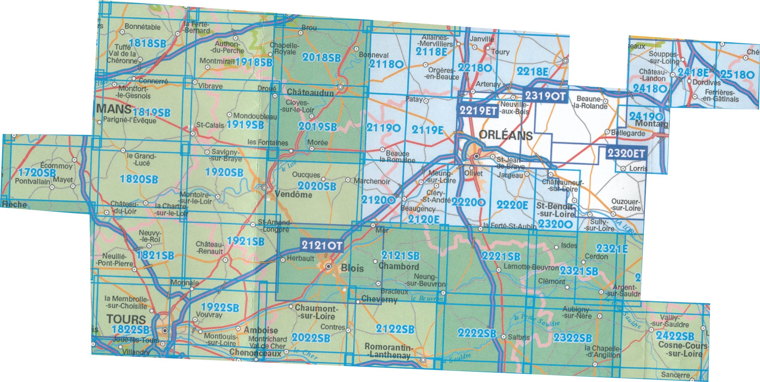
Producten op de overzichtskaart
Klik op een product om naar de detailpagina te gaan.
- Wandelkaart 1720 SB Ecommoy & Cérans-Fouilletourte - IGN
- Wandelkaart 1723 ET Chinon- Langeais & Azay-le-Rideau - IGN
- Wandelkaart 1819 SB Bouloire & Le Grand-Lucé - IGN
- Wandelkaart 1820 SB Château-du-Loir & La Chartre-sur-Loir- IGN
- Wandelkaart 1821 SB Château-du-Loir & Neuillé-Pont-Pierre- IGN
- Wandelkaart 1822 SB Tours & Langeais - IGN
- Wandelkaart 1918 SB Authon-du-Perche & La Bazoche-Gouët - IGN
- Wandelkaart 1919 SB St-Calais & Droué - IGN
- Wandelkaart 1920 SB Vendôme & Montoire-sur-le-Loir - IGN
- Wandelkaart 1921 SB Château-Renault & St-Amand-Longpré - IGN
- Wandelkaart 1922 SB Amboise & Montlouis-sur-Loire - IGN
- Wandelkaart 2018 SB Châteaudun & Brou - IGN
- Wandelkaart 2019 SB Cloyes-sur-le-Loir - IGN
- Wandelkaart 2020 SB Selommes & St-Ouen - IGN
- Wandelkaart 2023 SB Montrichard & St-Aignan - IGN
- Wandelkaart 2118 SB Orgères-en-Beauce & Sancheville - IGN
- Wandelkaart 2119 SB Patay & Ouzouer-le-Marché - IGN
- Wandelkaart 2120 SB Beaugency- Mer & St-Laurent-Nouan - IGN
- Wandelkaart 2218 SB Neuville-aux-Bois & Artenay - IGN
- Wandelkaart 2219 SB Orléans & Jargeau - IGN
- Wandelkaart 2220 SB Olivet- La Ferté-St-Aubin & Jargeau - IGN
- Wandelkaart 2221 SB Lamotte-Beuvron - IGN
- Wandelkaart 2222 SB Salbris & La Ferté-Imbault - IGN
- Wandelkaart 2319 SB Vitry-aux-Loges & Bellegarde - IGN
- Wandelkaart 2320 SB Châteauneuf-sur-Loire & Sully-sur-Loire
- Wandelkaart 2321 SB Argent & Brinon-sur-Sauldre - IGN
- Wandelkaart 2322 SB Aubigny-sur-Nère & Souesmes - IGN
- Wandelkaart 2418 SB Château-Landon & Corbeilles - IGN
- Wandelkaart 2518 SB Lorrez-le-Bocage-Préaux & Chéroy - IGN
Artikelen uit dezelfde regio
Wandelkaart 2424 SB - Nérondes & Avord - IGN • 9782758553915
Wandelkaart 2424 SB - Nérondes & Avord - IGN Productomschrijving: Nérondes & Avord zijn gemeentes in het Franse departement Cher, in de regio Centre-Val de Loire. De plaats maakt deel uit van het arrondissement Saint-Amand-Montrond. Omvat: Nérondes, Avord, Baugy, Etréchy, Annoix, Savigny-en-Septaine, Moulins-sur-Yèvre, Sainte-Solange, Farges-en-Septaine, Raymond, Villabon, Osmoy, Jussy…
Wandelkaart 2832 SB Montbrison & Veauche - IGN • 9782758548904
Wandelkaart - Montbrison & Veauche Productomschrijving: Montbrison & Veauche zijn gemeentes in het Franse departement Loire in de regio Auvergne-Rhône-Alpes. De plaats maakt deel uit van het arrondissement Montbrison. Tussen 2014 en 2020 vernieuwt IGN haar volledige collectie serie blauw. Een nieuwe toewijzing voor optimale leesbaarheid, met een grotere mate van geometrische nauwkeurig…

Fietsgids Eurovelo 6 - DEEL Frankreich Ost - Bikeline • 9783711101426
Eurovelo 6 route - DEEL Frankrijk Oost - Bikeline Productomschrijving: EuroVelo 6 maakt deel uit van de Europese fietsroute in Frankrijk. Aan het begin van deze tocht is de Loire je metgezel en de prachtige renaissancekastelen onderweg zijn een lust voor het oog. Later baant het Canal du Centre zich een weg door de mooie regio Bourgondië. Je komt door beroemde wijngebieden en stukken o…

Wandelkaart 2118 SB Orgères-en-Beauce & Sancheville - IGN • 9782758548379
Wandelkaart 2118 SB - Orgères-en-Beauce & Sancheville Productomschrijving: Orgères-en-Beauce & Sancheville zijn gemeentes in het Franse departement Eure-et-Loir in de regio Centre-Val de Loire. De plaats maakt deel uit van het arrondissement Châteaudun. Tussen 2014 en 2020 vernieuwt IGN haar volledige collectie serie blauw. Een nieuwe toewijzing voor optimale leesbaarheid, met een grot…

Wandelkaart 2026 SB Saint-Gaultier & Rosney - IGN • 9782758553830
Wandelkaart Saint-Gaultier & Rosney - IGN Productomschrijving: Saint-Gaultier & Rosney zijn gemeentes in het Franse departement Indre, in de regio Centre-Val de Loire. De plaats maakt deel uit van het arrondissement Le Blanc. Omvat: Lingé, Nuret-le-Ferron, Ruffec, Douadic, Rosnay, Saint-Michel-en-Parc Naturel de la Brenne, Le Blanc, Vendoeuvres, Migné, Mézières-en-Parc Naturel de la Br…