
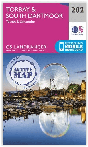
Wandelkaart 202 Torbay & South Dartmoor - OSI
Totnes- Salcombe- Totcross- Brixham- Paignton & Torquay
Korte omschrijving
Wandelkaart Torbay & South Dartmoor - OSI Productomschrijving: De Landranger kaart nummer 202 is een kaart voor alle doeleinden, boordevol informatie om u te helpen een gebied echt te leren ...

Specificaties
- Uitgever: Ordnance Survey
- ISBN-13: 9780319475829
- HOOFDCATEGORIEËN: Wandelkaart
- Activiteiten: Wandelen, Hiking & Trekking
- Regio: Devon, England
- Land: England
- Waterafstotende kaart: Ordnance Survey ACTIVE Landranger Weatherproof Maps
- Nationale parken: Dartmoor NP, Devon England
- Schaal: 1:50000
- Afmeting: 13x23
- Taal: Engels
- Reeks: Landranger ACTIVE series OSI
Volledige omschrijving
Wandelkaart Torbay & South Dartmoor - OSI
Productomschrijving: De Landranger kaart nummer 202 is een kaart voor alle doeleinden, boordevol informatie om u te helpen een gebied echt te leren kennen. Elke kaart bestrijkt een gebied van 40 km bij 40 km.
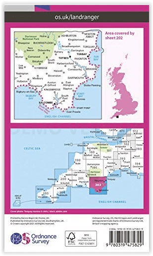
Omvat ook: Totnes, Salcombe, Totcross, Brixham, Paignton, Torquay, Newton Abbot, Ivybridge, Holbeton, Cornwood, een deel van het Dartmoor National Park en een deel van het South Wets Coast Path.
Engelse omschrijving: The Landranger map number 202 is an all purpose map packed full of information to help you really get to know an area. Each map covers an area of 40 km by 40 km (25 miles by 25 miles).
This map of Torbay & South Dartmoor also includes: Totnes, Salcombe, Totcross, Brixham, Paignton, Torquay, Newton Abbot, Ivybridge, Holbeton, Cornwood, part of the Dartmoor National Park and part of the South Wets Coast Path.

Locatie op kaart
Overzichtskaarten

OSI Landranger & Landranger Active - Land's End - Devon - Cornwall
OSI Landranger & Landranger Active - Land's End - Devon - Cornwall

Producten op de overzichtskaart
Klik op een product om naar de detailpagina te gaan.
- Wandelkaart 180 Barnstable & Ilfracombe- Devon England - OSI
- Wandelkaart 180 Barnstaple & Ilfracombe- Devon England - OSI
- Wandelkaart 181 Minehead & Brendon Hills- England - OSI
- Wandelkaart 181 Minehead & Brendon Hills- England - OSI
- Wandelkaart 182 Weston-super-Mare & Bridgwater- England - OSI
- Wandelkaart 182 Weston-super-Mare- Somerset England - OSI
- Wandelkaart 190 Bude & Clovelly- Cornwall England - OSI
- Wandelkaart 190 Bude- Clovelly & Boscastle - OSI
- Wandelkaart 191 Okehampton & North Dartmoor NP - OSI
- Wandelkaart 191 Okehampton & North Dartmoor NP - OSI
- Wandelkaart 192 Exeter & Sidmouth- Devon - OSI
- Wandelkaart 192 Exeter- Sidmouth & Exmouth - OSI
- Wandelkaart 193 Taunton & Lyme Regis- England - OSI
- Wandelkaart 193 Taunton & Lyme Regis- Somerset - OSI
- Wandelkaart 200 Newquay- Bodmin & Camelford - OSI
- Wandelkaart 200 Newquay & Bodmin Cornwall - OSI
- Wandelkaart 201 Plymouth & Launceston England - OSI
- Wandelkaart 201 Plymouth & Launceston England - OSI
- Wandelkaart 202 Torbay - South Dartmoor NP - OSI
- Wandelkaart 202 Torbay & South Dartmoor - OSI
- Wandelkaart 204 Truro- Falmouth & Roseland - OSI
- Wandelkaart 203 Land's End & Isles of Scilly - OSI
- Wandelkaart 203 Land's End & Isles of Scilly - OSI
- Wandelkaart 204 Truro & Falmouth- Cornwall England - OSI
Artikelen uit dezelfde regio

Reisgids Devon & Cornwall - Top 10 - DK Eyewitness • 9780241408568
Devon & Cornwall - DK Eyewitness Productomschrijving: Bewonder de historische kathedraal van Exeter, doorkruis te voet de uitgestrekte wildernis van Dartmoor, geniet van prachtige stranden op de Isles of Scilly, ontdek een bloeiende kunstscene in St-Ives of bewonder de spectaculaire reusachtige kassen van het Eden Project. Van de Top 10 stranden tot de Top 10 treinreizen - ontdek het beste…

Wandelkaart 126 Clovelly & Hartland Devon - OSI • 9780319243220
Wandelkaart Clovelly & Hartland - Devon England - OSI Productbeschrijving: - Bideford & Bradworthy. 126 / Clovelly & Hartland, Devon, England - Kaart blad nummer 126 in de OS Explorer reeks omvat Clovelly, Bideford, Hartland, Bradworthy en great Torrington. Hoogtepunten van het gebied zijn onder andere: Noord-Devon en Cornwall AONB, rivier Torridge en Tamar, Hartland punt, Barnstaple e…

Fietskaart Dartmoor National Park - Harvey maps • 9781851374540
Fietskaart - Dartmoor National Park - Harvey maps Productomschrijving: Eén zijde voor mountainbiken, en één zijde voor cyclustoeren, deze stevige, duurzame en waterdichte kaart van Dartmoor en het omliggende gebied is specifiek gemaakt voor het buitenleven. Gemaakt in samenwerking met Dartmoor National Park autoriteit, toont de berg vele off-road fietsroutes. De cyclustouringszijde toont h…

Wandelgids The South West Coast Path - Cicerone Press • 9781786310682
The South West Coast Path - Cicerone Productomschrijving: Omvat spectaculaire plaatsen die dit deel van het Engelse landschap rijk is, zoals Exmoor National Park, met 5 AONB's of Areas of Outstanding Natural Beauty, de Jurassic Coast Natural World Heritage Site. Deze route bestaat al heel lang. De route start of eindigd natuurlijk in Minehead, in Somerset, loopt langs de kust richting de v…

Fietskaart Exmoor NP - North Devon - Goldeneye • 9781859652244
Fietskaart Exmoor NP - North Devon Omschrijving: Het nationale park Exmoor is een nationaal park bij het kanaal van Bristol, in het zuidwesten van Engeland. Het park ligt in twee counties, namelijk Somerset en een klein stuk in Devon. Het park beslaat 690 km² met vooral heidegebied en bos en 55 kilometer aan rotsige kust. Het park was vroeger koninklijk bezit en werd gebruikt als jachtgron…