
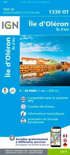
Wandelkaart 1330 OT Ile d'Oléron & Ile d'Aix - IGN
Île d'Oléron is een eiland bij de Franse kust

Korte omschrijving
TOPO Wandelkaart Ile d'Oléron & Ile d'Aix - IGN Productomschrijving: Île d'Oléron is een eiland bij de Franse kust dat deel uitmaakt van het departement Charente-Maritime in de regio Nouvell...

Stockactie
Specificaties
- Uitgever: Institut Géographique National
- ISBN-13: 9782758541080
- HOOFDCATEGORIEËN: Wandelkaart
- Activiteiten: Wandelen, Hiking & Trekking
- Regio: Nouvelle-Aquitaine, Frankrijk
- Land: Frankrijk
- Departement: Charente-Maritime (17)
- Schaal: 1:25000
- Afmeting: 11x24
- Editie: 5
- Taal: Frans
- Reeks: IGN Cartes TOP25
Volledige omschrijving
TOPO Wandelkaart Ile d'Oléron & Ile d'Aix - IGN
Productomschrijving: Île d'Oléron is een eiland bij de Franse kust dat deel uitmaakt van het departement Charente-Maritime in de regio Nouvelle-Aquitaine.
Franse omschrijving: Ces cartes topographiques d'une très grande précision contiennent tous les détails existant sur le terrain : voies de communication jusqu'au moindre sentier, constructions jusqu'au hangar, bois, arbre isolé, rivière, source... Sans oublier la représentation du relief par des courbes de niveau. Dimensions : 96 cm x 132 cm

Locatie op kaart
Overzichtskaarten

13--IGN TOP25 reeks, ET, OT & SB
13--IGN TOP25 reeks, ET, OT & SB

Producten op de overzichtskaart
Klik op een product om naar de detailpagina te gaan.
- Wandelkaart 1226 SB Le Poiré-sur-Vie- Aizenay & Les Achards
- Wandelkaart 1326 SB La Roche-sur-Yon & Bounezeau - IGN
- Wandelkaart 1426 SB Chantonnay - IGN
- Wandelkaart 1526 SB Moncoutant & La Chapelle-St-Laurent - IGN
- Wandelkaart 1626 SB Parthenay & Thénezay - IGN
- Wandelkaart 1726 SB Neuville-de-Poitou & Vouillé & Mirebeau- IGN
- Wandelkaart 1227 SB La Roche-sur-Yon & Moutiers-les-Mauxfaits
- Wandelkaart 1327 SB Luçon & St-Michel-en-l'Herm - IGN
- Wandelkaart 1427 SB Fontenay-le-Comte - IGN
- Wandelkaart 1527 SB Coulonges-sur-l'Autize & Secondigny - IGN
- Wandelkaart 1627 SB Mazières-en-Gâtine & Vasles - IGN
- Wandelkaart 1727 SB Poitiers & Coulombiers - IGN
- Wandelkaart 1328 OT La Tranche-s-Mer & l'Aiguillon's-Mer - IGN
- Wandelkaart 1428 SB Marans- Maillezais & Vix - IGN
- Wandelkaart 1528 SB Niort- Benet & Coulon - IGN
- Wandelkaart 1429 SB Surgères & Aigrefeuille-d'Aunis - IGN
- Wandelkaart 1529 SB Frontenay-Rohan & Mauzé - IGN
- Wandelkaart 1629 SB Melle France - IGN
- Wandelkaart 1330 OT Ile d'Oléron & Ile d'Aix - IGN
- Wandelkaart 1430 SB Rochefort & St-Porchaire - IGN
- Wandelkaart 1530 SB St-Jean-d'Angély & Tonnay-Boutonne - IGN
- Wandelkaart 1730 SB Ruffec & Villefagnan - IGN
- Wandelkaart 1531 SB Saintes & Burie - IGN
- Wandelkaart 1631 SB Matha - IGN
- Wandelkaart 1731 SB Mansle & Aigre - IGN
- Wandelkaart 1432 SB Saujon & Cozes - IGN
- Wandelkaart 1532 SB Pons & Pérignac - IGN
- Wandelkaart 1732 SB Angoulême & Ruelle-sur-Touvre - IGN
- Wandelkaart 1433 SB Lesparre-Medoc & Mortagne-sur-Gironde
- Wandelkaart 1533 SB Jonzac & Mirambeau - IGN
- Wandelkaart 1633 SB Barbezieux-St-Hilaire - IGN
- Wandelkaart 1733 SB Montmoreau-St-Cybard - IGN
Artikelen uit dezelfde regio

Wandelkaart 2333 SB Bort-les-Orgues & Neuvic - IGN • 9782758546238
Wandelkaart 2333 SB - Bort-les-Orgues & Neuvic Productomschrijving: Bort-les-Orgues & Neuvic zijn gemeentes in het Franse departement Corrèze in de regio Nouvelle-Aquitaine. De plaats maakt deel uit van het arrondissement Ussel. De locaties liggen pal naast het Europees gekende Parc Régional Naturèlles des Volcans d'auverge. Productomschrijving: Tussen 2014 en 2018 vernieuwt IGN haar v…

Wandelkaart 1741 SB Mézin - Montréal & Gabarret - IGN • 9782758541370
Wandelkaart 1741 SB - Mézin - Montréal & Gabarret Productomschrijving: Mézin, Montréal & Gabarret zijn gemeentes in het Franse departement Lot-et-Garonne in de regio Nouvelle-Aquitaine. De plaats maakt deel uit van het arrondissement Nérac. Een gloed nieuwe reeks IGN kaarten: de oude versies met de Est en Ouest (E en O aanduiding achter het nummer van de kaart) verdwijnen en worden ver…

Fietsgids Gironde à vélo boucles de 2H.. à un week-end! - Sud Est • 9782817711638
Fietsgids Gironde à vélo - Sud Ouest Editions Productomschrijving: Omvat 22 fietsroutes voor iedereen van 6 tot 88, de routes lopen langs de wijngaarden, de Baai van Arcachon, de meren, Entre-deux-Mers, Sud-Gironde, de Médoc, mooie dorpjes, de oevers van de Gironde en Garonne en het Canal des Deux-Mers te ontdekken...

Reisgids Dordogne & Périgord - Lannoo • 9789401449526
Reisgids - Dordogne & Périgord - Lannoo Productomschrijving: De onmisbare gids voor echte trotters - De Dordogne is een uitstekende plaats voor de jaarlijkse rust periode. Een rustige tipisch Franse omgeving, die u de een welverdiende rust biedt. De streek is gekend voor zijn terrasjes, zijn schaduwrijke zitplaatsen onder de bomen weggestoken van de zomerzon naast de één of andere petanke …

Wandelkaart 2029 SB Bessines-sur-Gartempe & Magnac-Laval - IGN • 9782758542728
Wandelkaart 2029 SB - Bessines-sur-Gartempe & Magnac-Laval Productomschrijving: Bessines-sur-Gartempe is een gemeente in het departement Haute-Vienne in Limousin in Frankrijk. Bessines-sur-Gartempe is vanaf 1995 een Village d'étape. Het Franse dorp heeft een kleine kern en het buiten het dorp gelegen meer Etang de Sagnat waar men kan zwemmen. Het is genoemd naar de rivier Gartempe, bekend …