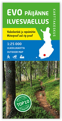
Wandelkaart 003 Evo Päijänne ilvesvaellus - Karttakeskus
Evo is among the most popular hiking areas in Finland
Korte omschrijving
Evo Päijänne ilvesvaellus - Karttakeskus Productomschrijving: De regio Evo is één van de populairste wandelgebieden in Zuid-Finland en biedt uitgebreide voorzieningen. Evo is ook een populai...

Specificaties
- Uitgever: Karttakeskus
- ISBN-13: 9789522663979
- HOOFDCATEGORIEËN: Wandelkaart
- Activiteiten: Wandelen, Hiking & Trekking
- Regio: Zuid Finland
- Land: Finland
- Schaal: 1:25000
- Afmeting: 10x22
- Taal: Engels
Volledige omschrijving
Evo Päijänne ilvesvaellus - Karttakeskus
Productomschrijving: De regio Evo is één van de populairste wandelgebieden in Zuid-Finland en biedt uitgebreide voorzieningen. Evo is ook een populaire plaats voor recreatief vissen. Het Nationaal Park Päijänne en zijn prachtige esker-eilanden zijn daarentegen bijzonder populaire vaar- en peddelbestemmingen. De outdoorkaart bestrijkt de wandelgebieden van Evo en Tarus, de studiegebieden van het Evo-bos van de HAMK Universiteit voor Toegepaste Wetenschappen, bijna het hele Päijänne Nationaal Park en uitgestrekte gebieden in hun omgeving. De kaart toont bijvoorbeeld de Ilvesvaellus-wandelpaden en de verbindingswegen van Aurinko-Ilves en Päijänne-Ilves van Evo naar Padasjoki en Vääksy.
Engelse omschrijving: The outdoor map Evo Päijänne Ilvesvaellus 1:25 000 is printed on synthetic material. The new durable Finnish outdoor maps can be identified by the yellow marking on the cover.
The region of Evo is among the most popular hiking areas in southern Finland, and it offers extensive services. Evo is also a popular place for recreational fishing. Päijänne National Park and its beautiful esker islands, on the other hand, are especially popular boating and paddling destinations. The outdoor map covers the hiking areas of Evo and Tarus, the Evo forest study areas of HAMK University of Applied Sciences, nearly all of Päijänne National Park and wide areas in their vicinity. The map shows, for instance, the Ilvesvaellus hiking trails and the connecting trails of Aurinko-Ilves and Päijänne-Ilves from Evo to Padasjoki and Vääksy.
The material of the map is fully waterproof and can withstand almost unlimited folding, and it will not rip in normal map use. The features are also retained during frost and heat. The print is crisp and the colours are bright. The map has a pleasant feel and is lighter than if printed on paper.
In addition to terrain details, e.g. routes and other hiking services, as well as dining and accommodation services, have been marked on the map. The map includes ten attractions or experiences in the area, which have been described in a few sentences at the edge of the map in Finnish and English. At the edge of the map, you can also find information about the magnetic declination. The scale of the map is 1:25 000 (1 cm on the map = 250 m of terrain).

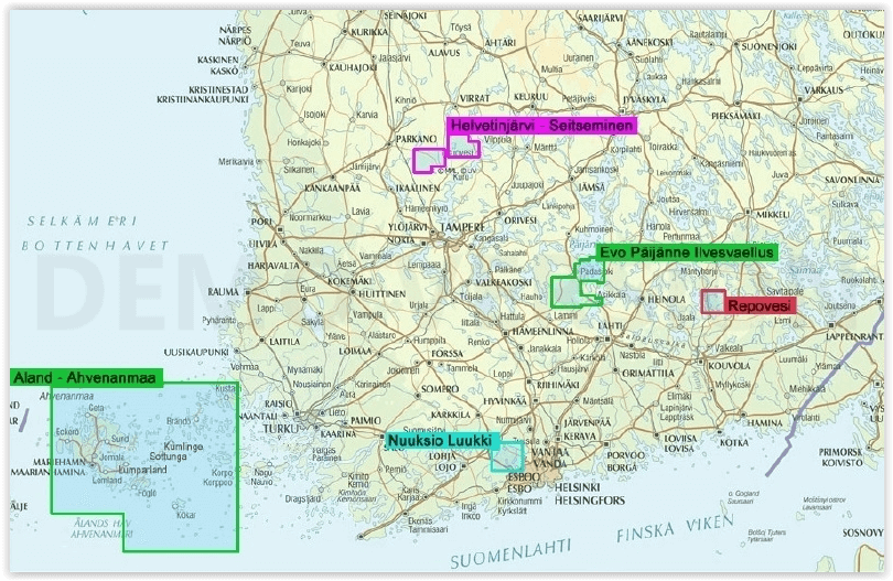
Overzichtskaarten

Karttakeskus Wandelkaarten -OM- Finland
Karttakeskus Wandelkaarten -OM- Finland

Producten op de overzichtskaart
Klik op een product om naar de detailpagina te gaan.
- Wandelkaart 001 Itäkaira Kemihaara Lokka - Karttakeskus
- Wandelkaart 002 Etela-Konnevesi - Karttakeskus
- Wandelkaart 003 Evo Päijänne ilvesvaellus - Karttakeskus
- Wandelkaart 004 Halti Kilpisjärvi - Karttakeskus
- Wandelkaart 005 Hammastunturi Etela - Inari - Karttakeskus
- Wandelkaart 006 Helvetinjärvi & Seitseminen NP - Karttakeskus
- Wandelkaart 007 Hossa NP - Finland - Karttakeskus
- Wandelkaart 008 Ropi Kalkkoaivi Munnikurkkio - Karttakeskus
- Wandelkaart 010 Lemmenjoki NP Finland - Karttakeskus
- Wandelkaart 011 Nuuksio NP & Luukki - Karttakeskus
- Wandelkaart 012 Pallas Hetta Olos - Karttakeskus
- Wandelkaart 015 Repovesi NP & Mäntyharju - Karttakeskus
- Wandelkaart 016 Ruka- Oulanka & Karhunkierros - Kartakeskus
- Wandelkaart 019 Sevettijärvi & Nuorgam - Karttakeskus
- Wandelkaart 021Teijo NP Finland - Karttakeskus
- Wandelkaart 023 Vuokatti ja Kainuun - Karttakeskus
- Wandelkaart 024 Ylläs & Levi Aakenus - Karttakeskus
- Wandelkaart 025 Pyna Luosto NP Finland - Karttakeskus
- Wandelkaart 026 Utsjoki- Kevo & Paistunturit NP - Karttakeskus
- Wandelkaart 027 Teijo NP & Kurjenrahka NP - Karttakeskus
Artikelen uit dezelfde regio

Wandelkaart 015 Repovesi NP & Mäntyharju - Karttakeskus • 9789522667168
Wandelkaart Repovesi Nationaal Park & Mäntyharju - Karttakeskus Productomschrijving: Het Nationaal park Repovesi, is een park in de regio's Kymenlaakso en Etelä-Savo in zuid-Finland. Het park werd opgericht in 2003 en is 15 km² groot. Het park bestaat dennen en berkbossen en meren. Deze nieuwe kaart om een schaal van 1:15.000 en 1:40.000 perfect dus voor wandelingen in detail, met een bete…


