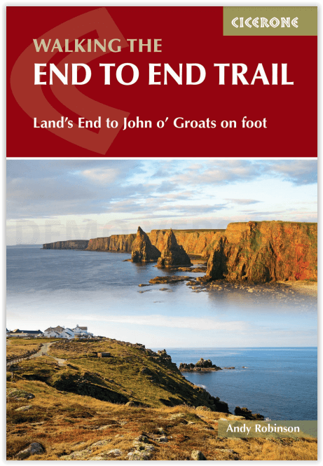
Wandelgids Walking the End to End Trail - Cicerone
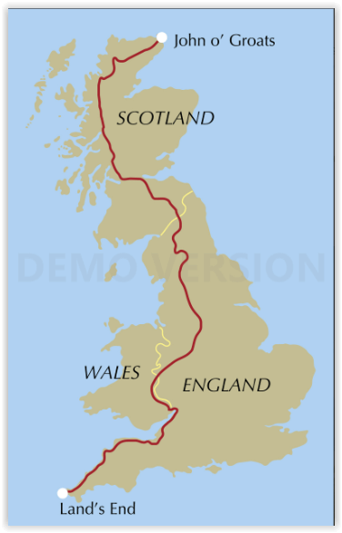
Land's End to John o' Groats on foot - 1956 km
Korte omschrijving
Walking the End to End Trail - Cicerone Productomschrijving: Land's End to John o' Groats on foot. Deze gids voor de ultieme uitdaging van het Verenigd Koninkrijk, de End to End, beschrijft ...

Specificaties
- Uitgever: CICERONE Press
- ISBN-13: 9781786311474
- HOOFDCATEGORIEËN: Wandelgids
- Activiteiten: Wandelen, Hiking & Trekking
- Auteur: Andy Robinson
- Land: England, Schotland
- Lange afstand wandelroutes: Pennine Way (420 km), South West Coast Path - SWCP (1014 km), West Highland Way, Schotland (152 km)
- Blz.: 416
- Afmeting: 12x17
- Editie: 3
- Taal: Engels
Volledige omschrijving
Walking the End to End Trail - Cicerone
Productomschrijving: Land's End to John o' Groats on foot. Deze gids voor de ultieme uitdaging van het Verenigd Koninkrijk, de End to End, beschrijft een wandelroute van 1956 km (1215 mijl) van Land's End in Cornwall naar John o' Groats in het uiterste noorden van Schotland.
De twee punten op het vasteland van Groot-Brittannië die het verst uit elkaar liggen. De aanbevolen route vermijdt zoveel mogelijk wandelen over de weg en maakt vaak gebruik van bestaande langeafstandspaden, waaronder het South West Coast Path, Pennine Way en West Highland Way. De route loopt soms door afgelegen terrein en is bedoeld voor ervaren bergwandelaars.
Engelse omschrijving: This guidebook to UK's ultimate challenge walk, the End to End, describes a 1956km (1215 mile) walking route from Land's End in Cornwall to John o' Groats in Scotland's far north - the two points on mainland Britain that are the furthest apart. The recommended route avoids road walking as much as possible and frequently takes advantage of existing long-distance trails, including the South West Coast Path, Pennine Way and West Highland Way. Passing through remote terrain at times and keeping to the hills where practical, it is intended for experienced hill-walkers.
The guide includes route description and maps, concentrating on the 'gaps' between the major long-distance trails covered in other Cicerone guides. There is also a wealth of advice to help you prepare for and undertake your walk, covering equipment, safety, supplies and facilities. Notes on history, geography and local sights, along with anecdotes from those who have successfully completed the journey, add interest and inspiration.
The route is presented in 61 daily stages (each averaging around 32km), divided into 6 sections; an alternative three-month schedule is also provided. The End to End Trail promises a magnificent adventure through some of the best the British countryside can offer, and a unique sense of achievement on completion of your walk.
Seasons:
April to June, heading north, works best for this walk. This avoids the summer heat and crowds in the southwest, and reduces the risks from midges and winter conditions in Scotland.
Centres:
Land's End, Barnstaple, Knighton, Hebden Bridge, Jedburgh, Fort William, John o' Groats
Difficulty:
A 1200-mile walk needs fitness and preparation. It is advisable to train beforehand with long days out, carrying the weight you plan to take, wearing the things you plan to wear. You will still hit problems along the way with both your body and your equipment, so plan contingency into both your schedule and your finances.
Must See:
the best of Britain's hill country, coastal scenery in Devon/Cornwall, the Peak District, the Highlands.


