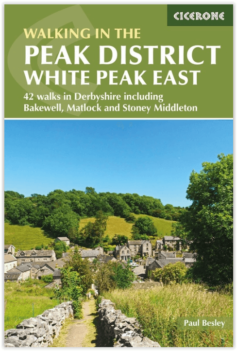
Wandelgids Walking in the Peak District - Cicerone
Omvat 35 wandelroutes tussen Edale- Matlock & Buxton
Korte omschrijving
Wandelgids - Walking in the Peak District - Cicerone Productomschrijving: Deze gids omvat 35 wandelroutes door de gritstone-hooglanden en heidevelden in de noordelijke valleien van de White ...

Specificaties
- Uitgever: CICERONE Press
- ISBN-13: 9781852849764
- HOOFDCATEGORIEËN: Wandelgids
- Activiteiten: Wandelen, Hiking & Trekking
- Auteur: Paul Besley
- Regio: Derbyshire & Peak District, England
- Land: England
- Nationale parken: Peak District NP, Derbyshire UK
- Blz.: 223, 232
- Afmeting: 12x17
- Editie: 3
- Taal: Engels
Volledige omschrijving
Wandelgids - Walking in the Peak District - Cicerone
Productomschrijving: Deze gids omvat 35 wandelroutes door de gritstone-hooglanden en heidevelden in de noordelijke valleien van de White Peak tussen Edale, Matlock en Buxton, in het midden van het Peak District National Park. De routes verkennen Bakewell en de Wye en zijn zijrivieren. Deze omvat slechts één van de twee Cicerone-gidsen naar de White Peak.
Product description: This guidebook describes 35 circular walks cross the gritstone uplands and moors in the northern dales of the White Peak between Edale, Matlock and Buxton, in the middle of the Peak District National Park. Routes explore Bakewell and the Wye and its tributary dales. One of two Cicerone guides to the White Peak.
Seasons:
The exquisite beauty of this landscape is fringed by and adorned with a multitude of wild flowers in spring and summer. Although modern clothing and equipment enable you to experience the thrill of wilder weather, responsible walker should seek to minimise their impact especially on heavily worn paths in the wetter seasons.
Centres:
Castleton, Hope, Bradwell, Hathersage, Baslow, Tideswell, Bakewell, Buxton, Monyash, Youlgrave, Winster, Matlock Spa and Cromford
Difficulty:
Easy, circular walks on good paths, well waymarked, between 3 and 8 miles long, easy to combine into longer routes - simple country walking with the odd citrus twist in the limestone dales! Modern walking boots will give good protection in such stony situations and walking poles lend reassurance in descent.

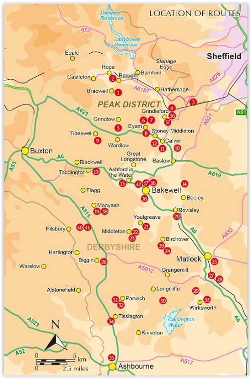
Locatie op kaart
Artikelen uit dezelfde regio

Wandelkaart White Peak - Peak District NP - Harvey maps • 9781851375134
Wandelkaart White Peak" Alle witte piekheuvels en dales op een enkele kaart. De achterzijde van de kaart omvat: Oost-Matlock en Noord naar Edale, geologische kaart. Productomschrijving: Nieuwe generatie HARVEY Superwalker, XT25 waterproof, werden ontworpen om de meest praktische tools te zijn voor GPS-navigatie. Het formaat geeft meer toewijzingen op het blad zonder de kaart zwaarder e…

Wandelgids Peak District - 50 walks guide - AA Publishing • 9780749583262
Peak District - 50 walks guide - AA Publishing Productomschrijving: Wandelen is een van de favoriete vrijetijdsbestedingen van Groot-Brittannië. Deze AA gids - 50 wandelingen in het Peak District, bevat een verscheidenheid aan uitgestippelde wandelingen van twee tot tien mijl, geschikt voor alle niveaus. Het boek bevat alle praktische details die je nodig hebt, vergezeld van fascinerende a…

Wandelgids Park Rangers Favourite Walks Peak District - Collins • 9780008439125
Park Rangers Favourite Walks Peak District - Collins Productomschrijving: Wandelgids voor het Peak District National Park, met 20 van de beste routes uitgekozen door de parkwachters. Elke wandeling varieert in lengte van 2 tot 10 km en kan worden voltooid in minder dan 4 uur. Engelse omschrijving: Walking guide to the Peak District National Park, with 20 best routes chosen by the park …

Wandelkaart 245 National Forest - OSI • 9780319475461
Wandelkaart National Forest - OSI Productomschrijving: The National Forest is een milieuproject in Midden-Engeland dat wordt beheerd door The National Forest Company. U kunt deze wel zeer speciale plaats terug vinden in- en rond de gehuchten van north Leicestershire, south Derbyshire and southeast Staffordshire. Engelse omschrijving: The National Forest is an environmental project in …

Wandelgids Derbyshire walking guide - Cicerone • 9781852846336
Wandelgids - Derbyshire walking guide - Cicerone Productomschrijving: Een handige gids die 60 circulaire dagwandelingen beschrijft, variërend van eenvoudig tot matig, in termen van moeilijkheden en terrein, die geschikt zijn voor het hele gezin. Derbyshire beschikt over een interessante geschiedenis die ook door middel van deze routes onderzocht kan worden, en elk thema rond een specifieke…


