
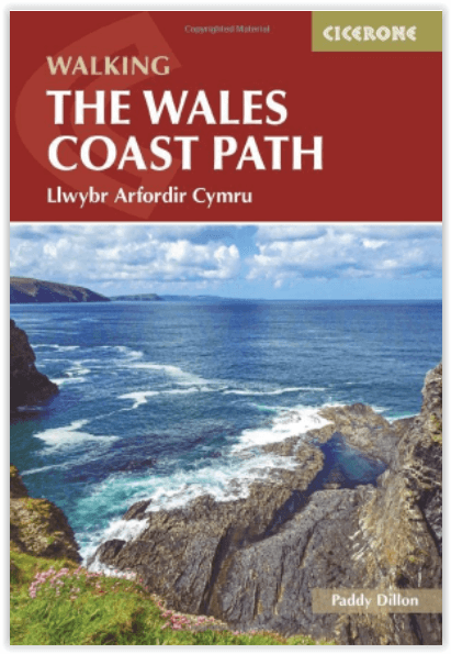
Wandelgids Wales coastal path - Cicerone
Llwybr Arfordir Cymru - 1400 km - from Chester to Chepstow
Korte omschrijving
Wales coast path - Cicerone Productomschrijving: Eén enkele gids over de complete route rond de kustlijn van Wales - 1400 km over de lengte van Wales van Chester tot Chepstow, Anglesey inbeg...

Specificaties
- Uitgever: CICERONE Press
- ISBN-13: 9781786310668
- HOOFDCATEGORIEËN: Wandelgids
- Activiteiten: Wandelen, Hiking & Trekking
- Auteur: Paddy Dylan
- Regio: Wales
- Land: Wales
- Blz.: 368
- Afmeting: 12x17
- Editie: 2
- Taal: Engels
Volledige omschrijving
Wales coast path - Cicerone
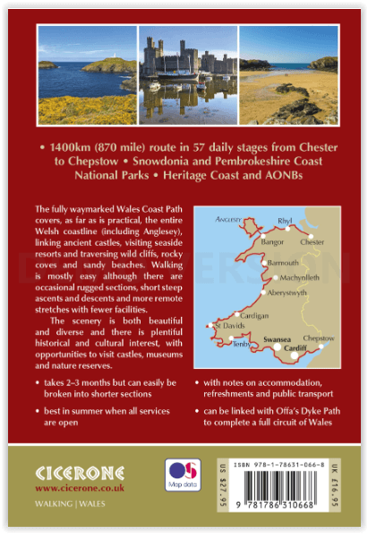
Productomschrijving: Eén enkele gids over de complete route rond de kustlijn van Wales - 1400 km over de lengte van Wales van Chester tot Chepstow, Anglesey inbegrepen, beschreven in 57 etappes. De route loopt door de Nationale Parken Snowdonia en Pembrokeshire en vele AONB's en kan gekoppeld worden aan het Offa's Dyke Pad voor een compleet rondje Wales.
Engelse omschrijving: A single guidebook to walking the whole Wales Coast Path - 1400km (870 miles) the length of Wales from Chester to Chepstow, including Anglesey, described in 57 stages. The route passes through the Snowdonia and Pembrokeshire National Parks and many AONB's and can be linked with the Offa's Dyke Path for a complete circuit of Wales.
Seasons:
In summer you'll get the best weather, with all services open; it's possible in spring and autumn, with cooler and wetter weather, but some places will be closed; not recommended in winter.
Centres:
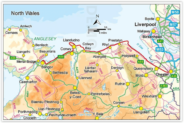
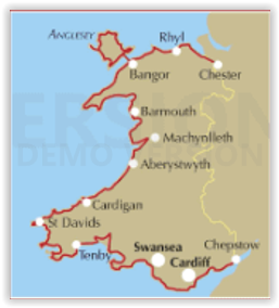
Chester, Llandudno, Bangor, Holyhead, Caernarfon, Pwllheli, Barmouth, Machynlleth, Aberystwyth, Cardigan, Fishguard, St David's, Pembroke, Tenby, Carmarthen, Swansea, Cardiff, Newport, Chepstow.
Difficulty:
Walkers need to be careful to cover comfortable distances, and not over-extend themselves; occasionally rugged and sometimes featuring short, steep ascents and descents; some remote stretches with few facilities; need to be aware of the weather forecast and tides.
Must See:
The entire coastline of Wales, the historic 'Ring of Steel' castles, holiday resort towns, wild cliffs, parts of the Snowdonia and Pembrokeshire National Parks, numerous AONB's and Heritage Coast.
Artikelen uit dezelfde regio

Reisgids L'essentiel de l'Angleterre et du Pays de Galle - LP • 9782816179422
L'essentiel de l'Angleterre et du Pays de Galle - LP Productomschrijving: De Lonely Planet-gids voor de basis, om het beste van Engeland en Wales te ontdekken - Een volledig opnieuw ontworpen versie, zodat je tijdens uw reis naar Engeland en Wales geen enkele must-haves hoeft te missen. Een kleurrijke gids, geïllustreerd met tientallen foto's. Onmisbare locaties (Londen, Stonehenge, Salisb…

Wales Hillwalking vol.1 - Arans & Dovey Hills - Cicerone • 9781852844677
Wales Hillwalking vol.1 - Arans & Dovey Hills - Cicerone Omvat: De Wail-backed bergkammen van de Black Mountains, en de Brecon Beacons & de Cwmdeuddwr hooglanden, Productomschrijving: De eerste van twee gidsen die wandeltrajecten beschrijft in Wales - covers Arans - Dovey heuvels. De routes - alle 166 van hen - zijn alfabetisch gerangschikt over de twee volumes. Het resultaat is niet a…

Wandelkaart 114 Anglesey- North West Wales - OSI • 9780319474372
Wandelkaart Anglesey - North West Wales - OSI Productbeschrijving: Kaart nummer 114 in de reeks van de OS Landranger kaarten bestrijkt het platteland Welsh eiland Anglesey. Het is omringd door zandstranden en rotsachtige grotten, met het binnenland dat deel is van het eiland wordt meestal landbouw geteelt. Anglesey is briljant geschikt voor toeristen met een ruime keuze aan accommodatie en…

Klimgids Ridges of England- Wales & Ireland - Cicerone • 9781852845391
Klimgids - Ridges of England- Wales & Ireland - Cicerone Productomschrijving: Een gids voor zomerscrambles, technische rockroutes en winterbeklimmingen op ruggen in het Lake District, Snowdonia, Peak District, Exmoor, het eiland Wight, Kerry en Connemara, die betrekking hebben op populaire klassiekers en duistere edelstenen, van scherpe rand naar skelet Ridges. Deze handleiding is met grot…

Wales Hillwalking vol.2 Ffestiniog - Tarrens - Cicerone • 9781852844684
Wales Hillwalking vol.2 Ffestiniog - Tarrens - Cicerone Productomschrijving: De tweede van twee gidsen die wandelen beschrijft in Wales - bespreekt de Ffestiniog heuvels naar de Tarrens. De routes zijn alfabetisch gerangschikt over de twee volumes. Het tweede boek in een tweedelige serie die alle 166 van de wandeltrajecten beschrijft in Wales. Detail: Het resultaat is niet alleen een g…