
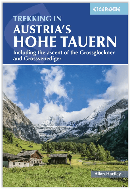
Wandelgids trekking in Austria's Hohe Tauern - Cicerone
De Reichen- Venediger- & Gross Glockner-groepen
Korte omschrijving
Trekking in Austria's Hohe Tauern - Cicerone Press Productomschrijving: Het Nationaal Park Hohe Tauern ligt in het hart van Oostenrijk en de oostelijke Alpen en heeft de internationale statu...

Specificaties
- Uitgever: CICERONE Press
- ISBN-13: 9781786310644
- HOOFDCATEGORIEËN: Wandelgids
- Activiteiten: Wandelen, Hiking & Trekking
- Auteur: Allan Hartley
- Regio: Karinthië, Oostenrijk, Salzburg, Tirol, Oostenrijk
- Land: Oostenrijk
- Toepasselijke bergketen: Höge Taurn, Karinthië Oostenrijk
- Nationale parken: Hohe Taurn NP, Oostenrijk
- Blz.: 296
- Afmeting: 12x17
- Editie: 2
- Taal: Engels
Volledige omschrijving
Trekking in Austria's Hohe Tauern - Cicerone Press
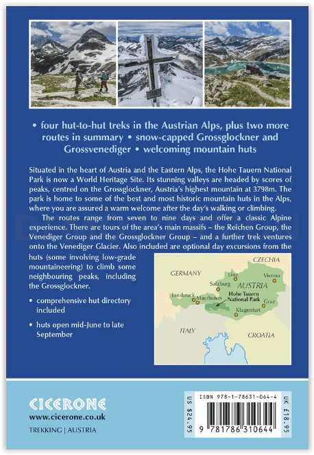
Productomschrijving: Het Nationaal Park Hohe Tauern ligt in het hart van Oostenrijk en de oostelijke Alpen en heeft de internationale status van werelderfgoed. De adembenemende valleien worden aangevoerd door tientallen bergtoppen die enkele van de beste hutten in de Alpen herbergen. Deze gids concentreert zich op drie gebieden, De Reichen-, Venediger- en Gross Glockner-groepen. In elk deel worden verschillende tochten van hut naar hut beschreven, samen met excursies en aanbevolen beklimmingen.
Omvat: Gross Glockner, Austria's highest peak, Gross Venediger, Rosskar Scharte, the Loebbentorl pass, the Obersulzbachkees glacier, Stocker Scharte, the walk around the head of the Virgental valley, Spitzbrett ridge, Kalser Tauern pass, the welcoming huts of the Austrian Alpine Club.
Engelse omschrijving: Situated in the heartland of Austria and the Eastern Alps the Hohe Tauern National Park has international status as a World Heritage Site. Its stunning valleys are headed by scores of peaks that are home to some of the best huts in the Alps. This guidebook concentrates on three areas – the Reichen, Venediger and Gross Glockner Groups. In each section, descriptions are provided for various hut-to-hut tours along with excursions and recommended climbs.
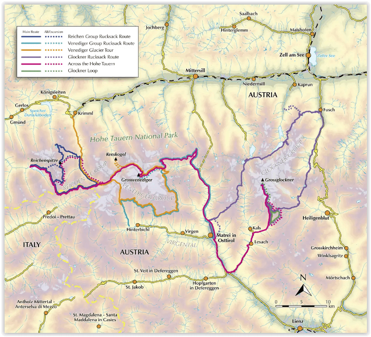
This guidebook describes five routes in the Reichen Group, the Venediger Group and the Gross Glockner, any of which would make an ideal introduction to the delights of Alpine trekking. There are 4 multi-day treks described and a 10-day traverse of the whole region from Mayrhofen, through the Reichen Group and across the Venediger to end with a climb on the Gross Glockner is outlined.
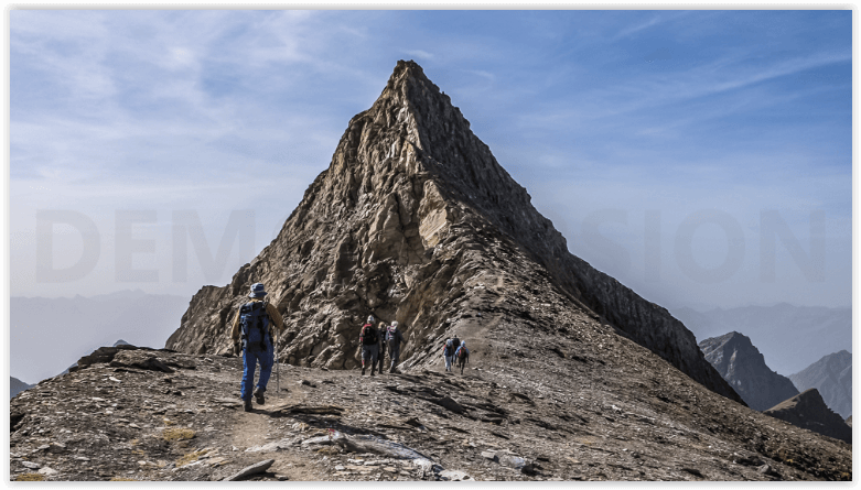
Routes described in this guidebook, such as on the Reichen Group Runde Tour and the Venediger Hohenweg, vary from traditional mountain paths to tracks across boulder fields and rough ground. There is also steep ground, late summer snow and fixed wire ropes here and there to aid stability.
The Hohe Tauern provides opportunities for all mountain enthusiasts, whatever their aspirations. It is ideal for the first time visitors to the Alps, particularly family groups with adventurous children, but it is even more so for aspiring alpinists, who would be wrong to see the Hohe Tauern as tame. These mountains can challenge even the most experienced alpinist, you will not be disappointed.
The tours are moderately strenuous and require the ability to carry a full pack for an average of six hours a day. In terms of alpine grading, the majority of the routes fall into the mountaineering grade of easy to moderate, comprising of sustained mountain walking, requiring the ability to negotiate steep ground, scramble over rocks, cross late summer snow, make use of fixed wire ropes and have a good head for heights.
Seasons:
The summer Alpine season starts when the huts open in mid-June and continues through to the end of September. Early season, snow can linger well into July. July through to August the weather is more settled and warmer, whereas September is cooler.
Centres:
The Hohe Tauern is easily accessed from Munich, Innsbruck and Salzburg, with regular local transport links to various trek starting points such as Matrei in Ost Tirol and Kals am Glockner.
Difficulty:
All tracks and trails are waymarked and frequently signposted. No special equipment is needed, nor additional climbing skills required unless you plan to cross glaciers or undertake the optional ascents of neighbouring peaks.
.png)
Artikelen uit dezelfde regio

Wandelkaart Seetaler Alpen & Seckauer Alpen - F&B • 9783850846813
Wandelkaart WK212 - Seetaler Alpen & Seckauer Alpen Omvat ook: Judenburg & Knittelfeld Productomschrijving: Wandelkaart van de Seetaler Alpen, de Seckauer Alpen, Judenburg en Knittelfeld te Oostenrijk, waar fietsroutes, wandelroutes en vrijetijds informatie is op aan getekend. Deze kaarten van Freytag & Berndt, zijn kwalitatief in hun sectie, en duurzaam gemaakt. Hierop vindt u wat u …

Wandelkaart Tennengebirge & Lammertal - F&B • 9783850847391
Wandelkaart WK 392 - Tennengebirge - Lammertal Omvat ook de Osterhorngruppe Productomschrijving: Wandelkaart van het Tennengebirge (gebergte), het Lammertal en de Osterhorngruppe te Oostenrijk, waar fietsroutes, wandelroutes en vrijetijds informatie is op aan getekend. Deze kaarten van Freytag & Berndt, zijn kwalitatief in hun sectie, en duurzaam gemaakt. Hierop vindt u wat u zoekt. D…


Wandelgids Grossarltal & Hohe Tauern NP - Rother • 9783763340217
Wandelgids Grossarltal & Hohe Tauern NP - Rother Productomschrijving: Het Gasteinertal, is een ongeveer 20km lange dal in Oostenrijk, in Salzburgerland, waarin als belangrijkste plaatsen Dorfgastein, Bad hofgastein en - aan het einde van het dal, Bad Gastein liggen. Bekend geworden door de implementatie van het zogenaamde heilzaam water dat in Bad Gastein uit een elftal bronnen komt gestro…

Wandelkaart 2555 Alpenüberquerung- Am Puls der Alpen - Kompass • 9783990448144
Alpenüberquerung- Am Puls der Alpen - Kompass Productomschrijving: De route van het Bodenmeer over de Alpen naar Verona loopt door Duitsland, Oostenrijk, Zwitserland en Italië en is 600 km lang. Omvat een gevouwen wandelkaart van Tegernsee naar Venetië. De wandelkaarten van KOMPASS bevatten alle nuttige informatie voor wandelaars, zoals de huidige wandelpaden met markeringen, aanbevol…

Wandelkaart 289 Die Alpenüberquerung - Kompass • 9783991219552
Wandelkaart Die Alpenüberquerung - Kompass Productomschrijving: Een gloednieuwe wandelkaart over de oversteek van de Alpen tussen Duitsland, Oostenrijk en deels Italië. Alle inhoud van de vorige wandelroutekaart "The Alpine Crossing, incl. gedetailleerde kaarten, routebeschrijvingen, enz.. . De kaart biedt u nu een overzicht tijdens je wandeling van Tegernsee via Achensee en Zillertal naar…