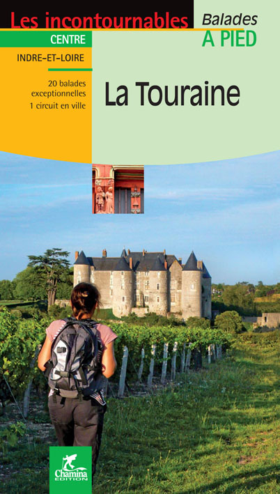
Wandelgids Touraine centre à pied - Ed. Chamina
20 wandelingen ontworpen om toeristische schatten te ontdekken
Korte omschrijving
Wandelgids - Touraine centre à pied - Ed. Chamina Productomschrijving: Het departement Indre-et-Loire komt bijna volledig overeenkomt met de voormalige provincie van Touraine. In dit Franse ...

Specificaties
- Uitgever: Chamina édition
- ISBN-13: 9782844665928
- HOOFDCATEGORIEËN: Wandelgids
- Activiteiten: Wandelen, Hiking & Trekking
- Regio: Centre Val de Loire, Frankrijk
- Land: Frankrijk
- Departement: Indre-et-Loire (37)
- Blz.: 48
- Afmeting: 12x21
- Taal: Frans
Volledige omschrijving
Wandelgids - Touraine centre à pied - Ed. Chamina
Productomschrijving: Het departement Indre-et-Loire komt bijna volledig overeenkomt met de voormalige provincie van Touraine. In dit Franse departement met hoge toeristische mogelijkheden is louter toe te schrijven aan de activa landschap, erfgoed en cultuur van eerste keuze. 20 wandelingen in deze gids zijn ontworpen om de toeristische schatten te ontdekken
Franse omschrijving: Le département d’Indre-et-Loire correspond presque entièrement à l’ancienne province de Touraine, il compte 600.000 résidents permanents et se place parmi les départements français à fort potentiel touristique en raison d’atouts paysagers, patrimoniaux et culturels de premier choix. Les 20 balades de l’ouvrage ont été conçues pour découvrir ces richesses touristiques.
Le territoire concerné: Le département d’Indre-et-Loire correspond presque entièrement à l’ancienne province de Touraine, il compte 600.000 résidents permanents et se place parmi les départements français à fort potentiel touristique en raison d’atouts paysagers, patrimoniaux et culturels de premier choix.
Les 20 balades de l’ouvrage ont été conçues pour découvrir ces richesses touristiques :
- La Loire, patrimoine mondial de l’UNESCO
- La Touraine, jardin de la France
- Les châteaux de la Loire
- La vigne et le vin
- Le cœur historique de Tours
Le guide:
• 48 pages
• Format pratique : 12 x 21 cm
• Introduction générale avec présentation du territoire (plusieurs thèmes développés qui enrichissent la connaissance des sites traversés)
• 20 itinéraires de 2h00 à 5h00 pour une pratique familiale, incluant une découverte pittoresque du cœur historique de Tours
• Cartographie sur fond IGN au 1 : 25 000 pour se repérer facilement
• Détail des centres d’intérêts
• Renseignements pratiques pour randonner en toute sécurité
• Adresses utiles.
Locatie op kaart
Artikelen uit dezelfde regio

Wandelkaart 2318 SB Pithiviers & Puiseaux - IGN • 9782758547433
Wandelkaart 2318 SB - Pithiviers & Puiseaux Productomschrijving: Pithiviers & Puiseaux zijn gemeentes in het Franse departement Loiret in de regio Centre-Val de Loire. De plaats maakt deel uit van het arrondissement Pithiviers. Vlak bij het dorp Pithiviers ligt het dorpje Denainvilliers, met het schilderachtige dorpje bij de ruïne van het kasteel van Yèvre-le-Châtel. Tussen 2014 en 2018 ve…

Wandelkaart 2422 SB St-Satur- Léré & Vailly-sur-Sauldre - IGN • 9782758534235
Wandelkaart - St-Satur- Léré & Vailly-sur-Sauldre Productomschrijving: Deze topografische kaarten hebben een zeer nauwkeurige gronddetail, niet te vergeten de topografische hoogteprofielen, die het wandelen een stuk gemakkelijker maken. Saint-Satur is een gemeente in het Franse departement Cher (regio Centre). De plaats maakt deel uit van het arrondissement Bourges. Desciptive produit…

Wandelkaart 2831 SB Feurs & Boën Rhone-Alpes - IGN • 9782758535621
Wandelkaart - Feurs & Boën Rhone-Alpes Omvat: Feurs is een gemeente in het Franse departement Loire (regio Rhône-Alpes) De plaats maakt deel uit van het arrondissement Montbrison. In de gemeente ligt spoorwegstation Feurs. Productomschrijving: Tussen 2014 en 2018 vernieuwt IGN haar volledige collectie serie blauw. Een nieuwe toewijzing voor optimale leesbaarheid, met een grotere mate …

Wandelkaart 2425 SB Dun-sur-Aubron & Blet - IGN • 9782758552970
Wandelkaart Dun-sur-Aubron & Blet - IGN Productomschrijving: Dun-sur-Auron & Blet zijn gemeentes in het Franse departement Cher, in de regio Centre-Val de Loire. De plaats maakt deel uit van het arrondissement Saint-Amand-Montrond. Omvat: Dun-sur-Auron, Blet, Bussy, Osmery, Ignol, Chalivoy-Milon, Annoix, Lantan, Saint-Denis-de-Palin, Le Pondy, Raymond, Thaumiers, Bannegon, Jussy-Champ…

Wandelkaart 2323 SB St-Martin-D'Auxigny & Foëcy - IGN • 9782758534181
Wandelkaart 2323 SB - St-Martin-D'Auxigny & Foëcy Productomschrijving: Deze topografische kaarten hebben een zeer nauwkeurige gronddetail, niet te vergeten de topografische hoogteprofielen, die het wandelen een stuk gemakkelijker maken. Saint-Martin-d'Auxigny is een gemeente in het Franse departement Cher (regio Centre). De plaats maakt deel uit van het arrondissement Bourges. Descipt…


