
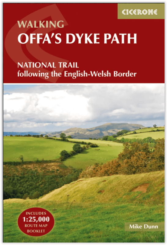
Wandelgids The Offa's Dyke Path - England & Wales - Cicerone
283 km tussen Sedbury (bij Chepstow) en Prestatyn
Korte omschrijving
Wandelgids The Offa's Dyke Path - Wales - Cicerone Productomschrijving: Deze gids beschrijft het Offa's Dyke Path National Trail, een langeafstandswandeling van 283 km langs de Engels-Welshe...

Specificaties
- Uitgever: CICERONE Press
- ISBN-13: 9781852847760
- HOOFDCATEGORIEËN: Wandelgids
- Activiteiten: Wandelen, Hiking & Trekking
- Auteur: Mike Dunn
- Regio: Gloucestershire, Egland, Herefordshire, England, Shropshire West Midlands
- Land: England, Wales
- Lange afstand wandelroutes: Offa's Dyke Path (285 km)
- Blz.: 192
- Schaal: 1:25000
- Afmeting: 12x17
- Editie: 1
- Taal: Engels
Volledige omschrijving
Wandelgids The Offa's Dyke Path - Wales - Cicerone
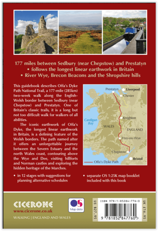
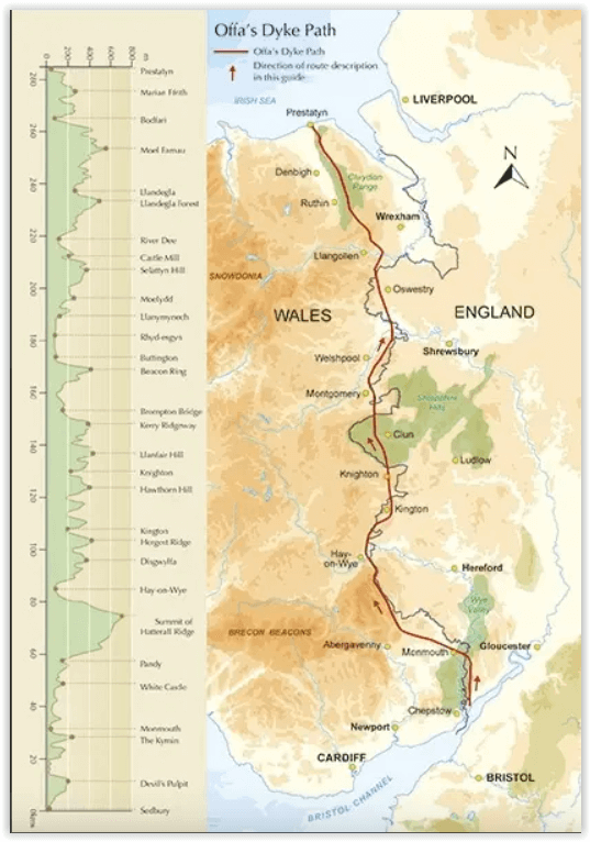
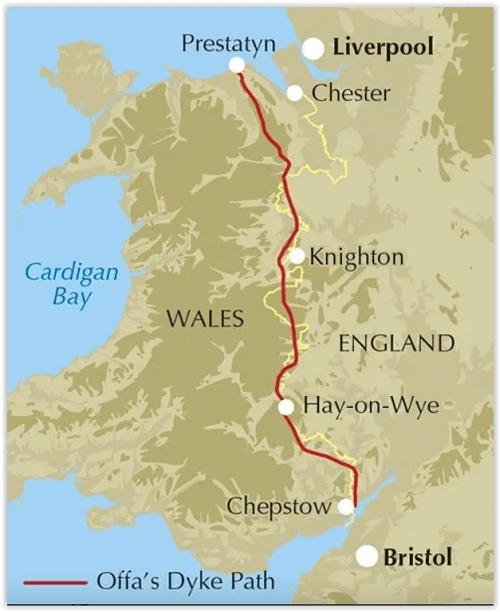
Productomschrijving: Deze gids beschrijft het Offa's Dyke Path National Trail, een langeafstandswandeling van 283 km langs de Engels-Welshe grens tussen Sedbury (bij Chepstow) en Prestatyn. De gids is opgedeeld in 12 etappes met suggesties voor het plannen van alternatieve routes. Met 1:25K OSI (Ordnance Servey) kaart boekje.
Engelse omschrijving: This guidebook describes Offa's Dyke Path National Trail, a 177 mile (283km) long-distance walk along the English and Welsh border between Sedbury (near Chepstow) and Prestatyn. The guidebook is split into 12 stages with suggestions for planning alternative itineraries. With 1:25K OS map booklet.
Seasons:
This walk is exceptional in all seasons, though the Black Mountains and Clwydian range deserve respect in winter conditions, and especially in mist, since there are few landmarks on the Black Mountain ridge.
Centres:
Chepstow, Hay-on-Wye, Kington, Bishops Castle, Montgomery, Welshpool, Oswestry, Llangollen, Denbigh, Prestatyn.
Difficulty:
The trail includes a couple of unavoidably long stages and there are some mountain and moorland stages, but the route poses no special difficulties and caters for walkers of all levels of ability provided that sensible advance planning is undertaken.
Must See:
Geology - limestone gorge of the lower Wye, igneous intrusions around Hergest ridge, Breidden Hills dolerite, limestone escarpments north of Llangollen Uplands - Black Mountain moorlands, remote Clun Forest, Clwydian ridge Lowlands - orchards and meadows, Montgomery canal, broad Severn valley Historical attractions - Tintern abbey and Llanthony priory, border castles, Pontcysyllte aqueduct.
Gekoppelde artikelen

Wandelgids Offa's Dyke Path Map Booklet - Cicerone • 9781852848941
standaard versieWandelkaart boekje - Offa's Dyke Path - Cicerone Productomschrijving: Kaartboekje van het 177 mijl (283 km) lange Offa's Dyke Path National Trail, tussen Sedbury (bij Chepstow) en Prestatyn. Het pad is in 2 weken te lopen en is geschikt voor wandelaars van alle ervaringsniveaus. Dit compacte boekje met OS 1:25,000 kaarten toont de volledige route en biedt alle kaarten die u nodig heeft, e…
Artikelen uit dezelfde regio

Wandelgids 50 walks in Shropshire England - AA • 9780749583750
50 walks in Shropshire England - AA Productomschrijving: Shropshire, een van de meest ongerepte en rustige graafschappen in Engeland, ligt in de West Midlands en grenst aan Wales. Het is een paradijs voor wandelaars, met zijn glooiende heuvels, charmante dorpen en rijke geschiedenis. De wandelgids "50 Walks in Shropshire" neemt je mee door de diverse landschappen en culturele schatten van …

Wandelkaart 167 Thornbury- Dursley & Yate - England- OSI • 9780319243602
Wandelkaart Thornbury- Dursley & Yate - Gloucestershire Omvat ook: Berkeley & Wotton-under-Edge Productomschrijving: Kaart nummer 167 in de OS Explorer kaarten reeks omvat het gebied ten noorden van Bristol langs de rivier de Severn tussen Engeland en Wales. Hoogtepunten van het gebied: forest of Avon, de Cotswolds en de Wye Valley, met inbegrip van de Cotswold way, Offa's Dyke Path en…

Wandelkaart 217 Long Mynd & Wenlock Edge- Schropshire- OSI • 9780319475492
Wandelkaart Long Mynd & Wenlock Edge - Schropshire England Engelse omschrijving: The Long Mynd is a heath and moorland plateau that forms part of the Shropshire Hills in Shropshire AONB, England. The high ground, which is designated as an Area of Outstanding Natural Beauty, lies between the Stiperstones range to the west and the Stretton Hills and Wenlock Edge to the east. Much of it is ow…

Wandelkaart 168 Stroud- Tetbury & Malmesbury - OSI • 9780319243619
Wandelkaart Stroud- Tetbury & Malmesbury - Gloucestershire Omvat ook: De Cotswolds AONB- the Cotswold Way & The Monarch Way Productbeschrijving: Kaart nummer 168 in de OS Explorer kaarten reeks omvat Stroud, Tetbury, Malmesbury en Nailsworth. Hoogtepunten van het gebied zijn onder andere: de Cotswolds AONB, Cotswold Way, Monarch Way en the Thames Path. De OS Explorer kaart voor Stroud,…

Wandelkaart 203 Ludlow Tenbury Wells - OSI • 9780319470756
Wandelkaart Ludlow- Tenbury Wells & Cleobury Mortime Omvat ook: de Shropshire Hills AONB Productbeschrijving: Na de rivier Teme, en met het zuiden van de Shropshire Hills Area of Outstanding Natural Beauty AONB, kunt u onder meer de Hertfordshire Trail en Shropshire Way, verkennen. Ook vindt u de middeleeuwse ommuurde stad van Ludlow en Ludlow kasteel uit de 11e eeuw. De OS Explorer ka…