
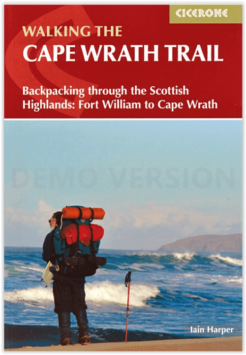
Wandelgids The Cape Wrath trail - Cicerone
through the Scottish Highlands from Fort William to Cape Wrath
Korte omschrijving
Cape Wrath trail - Fort William to Cape Wrath - Cicerone Productomschrijving: Een gids voor de Cape Wrath Trail, een lange afstandstocht door de Schotse Hooglanden van Fort William naar Cap...

Specificaties
- Uitgever: CICERONE Press
- ISBN-13: 9781786311344
- HOOFDCATEGORIEËN: Wandelgids
- Activiteiten: Wandelen, Hiking & Trekking
- Auteur: Lain Harper
- Regio: Highlands, Schotland
- Land: Schotland
- Lange afstand wandelroutes: Cape Wrath trail (370km)
- Blz.: 176
- Afmeting: 12x17
- Editie: 4
- Taal: Engels
Volledige omschrijving
Cape Wrath trail - Fort William to Cape Wrath - Cicerone
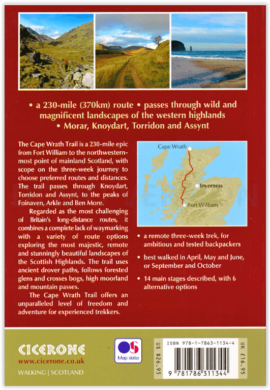
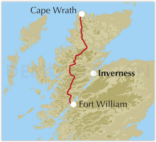
Productomschrijving: Een gids voor de Cape Wrath Trail, een lange afstandstocht door de Schotse Hooglanden van Fort William naar Cape Wrath. De Cape Wrath Trail is een 370 km lange, 3 weken durende uitdaging door wilde en prachtige landschappen, zoals Morar, Knoydart, Torridon en Assynt. Het doorkruist zo'n leeg land, het is alleen voor de ervaren backpacker.
Engelse omschrijving: A guidebook to the Cape Wrath Trail, a long-distance trek through the Scottish Highlands from Fort William to Cape Wrath. The Cape Wrath Trail is a 230 mile, 3-week challenge through wild and magnificent landscapes, such as Morar, Knoydart, Torridon and Assynt. Crossing such empty country, it is for the experienced backpacker only.
Seasons:
April, May and June are ideal months to walk the trail. September and October are also good, but there may be diversions due to deer stalking and military operations at the cape. In July and August the days are superbly long and the weather can be fine, but midges will be in full flight. The limited accommodation along the trail may also be booked up at this time of year.
Centres:
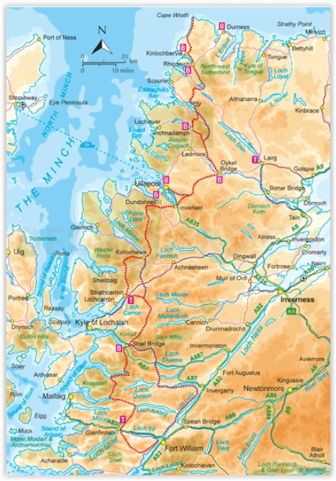
Fort William, Glenfinnan, Barisdale, Kinloch Hourn, Shiel Bridge, Strathcarron, Kinlochewe, Dundonnell, Ullapool, Bridge of Orchy, Inchnadamph, Kylesku, Rhiconich, Kinlochbervie, Durness.
Difficulty:
The Cape Wrath Trail is regarded as the toughest long distance backpacking trail in Britain. It crosses remote, sparsely populated, potentially dangerous mountain country. There are no pack carrying services and often no clear paths. Limited re-supply points require self sufficiency for many days together. Not a route for beginners or those unfamiliar with remote, rugged mountain areas.
Must See:
Glenfinnan monument and viaduct, the gloriously remote rough bounds of Knoydart, Barisdale, Forcan ridge, Falls of Glomach, Beinn Eighe, Lochan Fada, Shenavall, An Teallach, Glen Douchary, Glen Oykel, Ben More, Glencoul, Arkle, Foinaven, Sandwood Bay, Cape Wrath lighthouse.
Locatie op kaart
Artikelen uit dezelfde regio
Wandelkaart OL50 Ben Alder- Loch Ericht & Loch Laggan - OSI • 9780319469682
Wandelkaart Ben Alder- Loch Ericht & Loch Laggan - Highland's Omvat ook: Dalwhinnie Productbeschrijving: OS Explorer kaart OL 50 toont Loch Ericht, Loch Laggan en 16 van de omliggende Munros, evenals een deel van het Cairngorms National Park. Deze kaart vervangt de vorige OS Explorer kaart 393 voor dit gebied. De OS Explorer kaart voor Ben Alder, Loch Ericht & Loch Laggan is beschikbaa…

Wandelkaart L041 Ben Nevis- Fort William & Glen Coe - OSI • 9780319475836
Wandelkaart Ben Nevis- Fort William & Glen Coe - Schotland Productomschrijving: Waterbestendige kaart nummer 41 in de OS Landranger-kaartenserie is de ideale kaart om te gebruiken bij het plannen van een reis naar de regio Ben Nevis, Fort William en Glen Coe. Het gebied staat bekend om zijn spectaculaire uitzichten en uitdagende wandelingen. Het is een geweldige plek om er even helemaal tu…
Wandelkaart 26 Inverness & Loch Ness- Schotland - OSI • 9780319261248
Wandelkaart Inverness & Loch Ness - Highland's Schotland Productbeschrijving: Kaart nummer 26 in de OS Landranger kaarten reeks is de ideale kaart voor planning dag excursies en vakanties in het Noord Oosten van Schotland. Ontdek de beroemde Loch Ness, en de Great Glen way van Inverness. Andere plaatsen op de kaart opgenomen zijn Dingwall, Beauly Firth, Strathglass en Balmacaan Forest. …
Wandelgids The John Muir Way - Rucksack Readers • 9781913817145
The John Muir Way - Rucksack Readers Productomschrijving: De John Muir Way loopt over een afstand van 215 km, van kust tot kust door centraal Schotland, van Helensburgh aan de Clyde naar Dunbar aan de Noordzee. De route is net zo geschikt voor fietsers als voor wandelaars en kan van kust tot kust worden afgelegd of in delen - tien voor wandelaars of vijf voor fietsers. De aantrekkingsk…
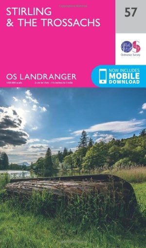
Wandelkaart 57 Stirling & The Trossachs NP Schotland - OSI • 9780319261552
Wandelkaart Stirling & The Trossachs NP - Schotland Productbeschrijving: OS Landranger kaart 57 van Stirling & The Trossachs, omvat ook Ben Vorlich, Mor Bheinn, Ling Hill, Ben Ledi, Venachar Loch, Loch Katrine, Loch Ard evenals deel van de Loch Lomond en de Trossachs nationaal park. Stirling en het kasteel is zeker een bezoekje waard, terwijl het nabijgelegen Wallace Monument in een indruk…