
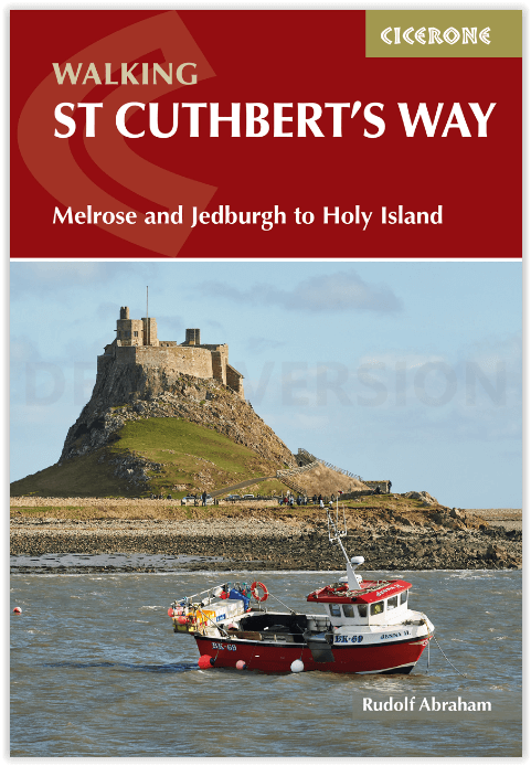
Wandelgids St Cuthbert's Way - Cicerone
Melrose tot Holy Island (Lindisfarne) of verder naar Berwick-upon

Korte omschrijving
Wandelgids St Cuthbert's Way - Cicerone Productomschrijving: Deze wandelgids beschrijft de lange afstand St Cuthbert's Way door het ongerepte landschap van Northumberland en de Borders. De 1...

Specificaties
- Uitgever: CICERONE Press
- ISBN-13: 9781786311566
- HOOFDCATEGORIEËN: Wandelgids
- Activiteiten: Wandelen, Hiking & Trekking
- Auteur: Rudolf Abraham
- Regio: Northumberland, Engeland
- Land: England
- Lange afstand wandelroutes: St. Cuthbert's Way (100 km)
- Nationale parken: Northumberland NP, England
- AONB - Area of Outstanding Beauty: Northumberland coast AONB
- Blz.: 112
- Afmeting: 12x17
- Editie: 1
- Taal: Engels
Volledige omschrijving
Wandelgids St Cuthbert's Way - Cicerone
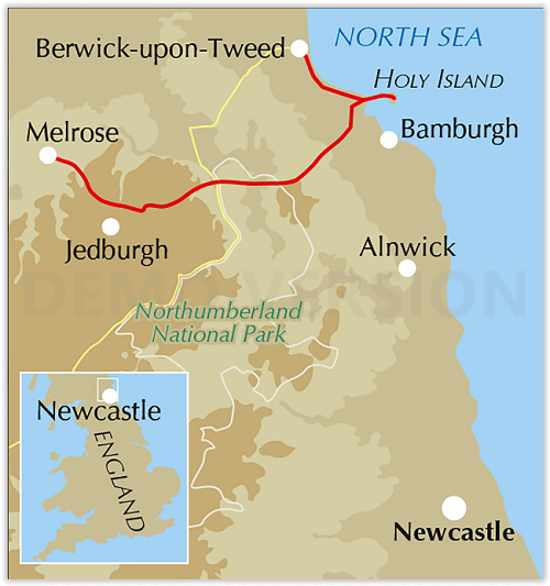
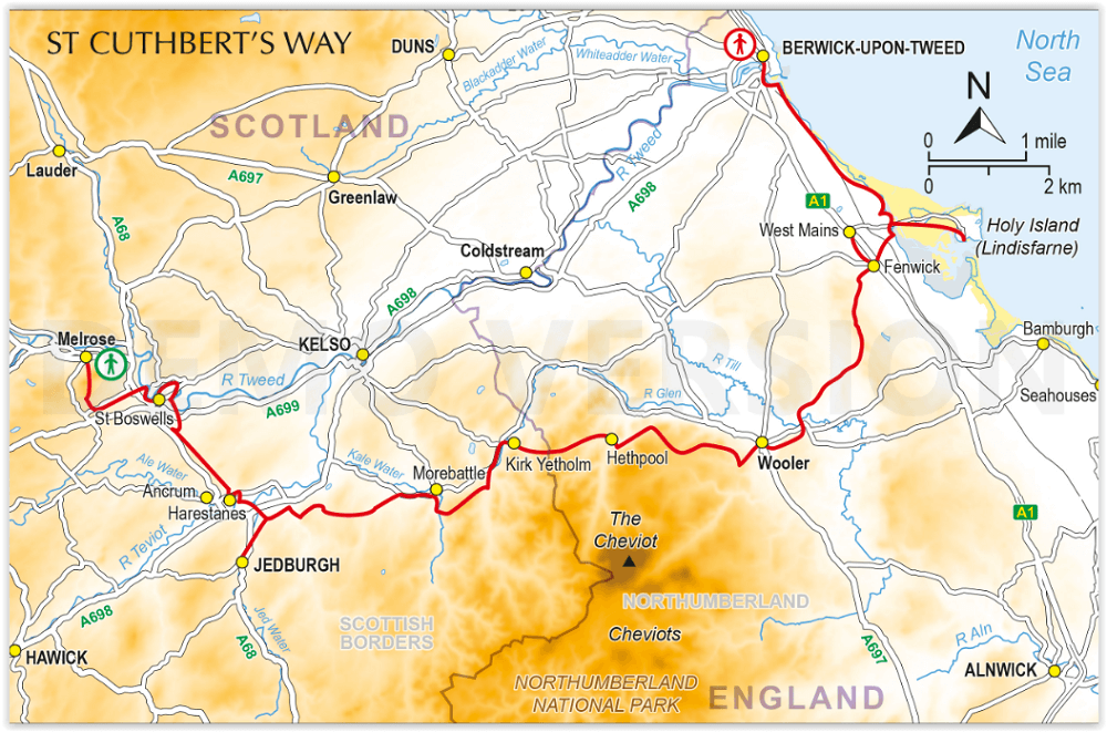
Productomschrijving: Deze wandelgids beschrijft de lange afstand St Cuthbert's Way door het ongerepte landschap van Northumberland en de Borders. De 100 km lange route begint in Melrose en doorkruist de ruige rotsen en heidevelden van de Cheviot Hills, gaat door het Northumberland National Park naar het sfeervolle Lindisfarne (Holy Island). De tocht kan binnen een week worden gelopen, hoewel er ruimte is om de etappes in te korten of te verlengen, afhankelijk van de route. Inclusief een optie om door te gaan naar Berwick-upon-Tweed op de laatste etappe van het Northumberland Coast Path.
Omvat: Holy Island, Lindisfarne Castle and Priory, Northumberland Coast AONB, Melrose Abbey, Jedburgh Abbey, the Cheviots, Northumberland National Park, Eildon Hills, River Tweed, Kirk Yetholm, Wideopen Hill, College Valley, Yeavering Bell, St Cuthbert’s Cave, Scottish Borders.
Engelse omschrijving: This guide describes the long-distance St Cuthbert's Way through the unspoilt scenery of Northumberland and the Borders. The 100km (62 mile) route begins at Melrose and crosses the rugged crags and heather moorland of the Cheviot Hills, passing through Northumberland National Park to the atmospheric Lindisfarne (Holy Island). It can be walked within a week, although there is scope for shortening or lengthening the stages to suit different itineraries. Includes an option to continue to Berwick-upon-Tweed on the final stage of the Northumberland Coast Path.
The guidebook is crammed with interesting snippets of information, alongside indispensable practical details of transport and accommodation in the area. With varied scenery and a rich history encompassing spectacular castles, medieval abbeys and Roman remains, this is one of Britain's most beautiful corners to explore on foot.
Seasons
Spring, summer, autumn, with temperatures at their highest in July; late autumn for birdlife; expect snow on higher ground in winter
Centres
Melrose, Jedburgh, Kirk Yetholm, Wooler, Holy Island (Lindisfarne), Berwick-Upon-Tweed
Difficulty
There are no special difficulties to encounter when walking St Cuthbert’s Way, though a reasonable level of fitness is assumed. Keep an eye on weather forecasts when crossing the Cheviots. Crossing to Holy Island must be timed to coincide with low tide.
Must See
Holy Island (Lindisfarne), Lindisfarne Castle and Priory, Northumberland Coast AONB, Melrose Abbey, Jedburgh Abbey, the Cheviots, Northumberland National Park, Eildon Hills, River Tweed, Kirk Yetholm, Wideopen Hill, College Valley, Yeavering Bell, St Cuthbert’s Cave, Scottish Borders.
Artikelen uit dezelfde regio
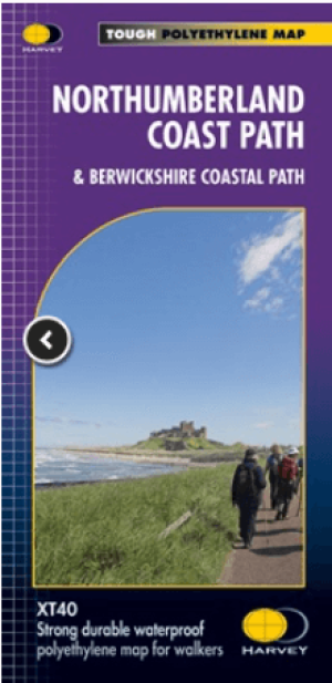
Wandelkaart Northumberland - Harvey Maps • 9781851376681
Wandelkaart Northumberland - Harvey Maps Productomschrijving: De Gehele route op één kaart! - Het Northumberland Coast Path strekt zich uit over 103 km van Cresswell in het zuiden naar Berwick-upon-Tweed in het noorden, waarna het Berwickshire Coastal Path 48 km (28 m) verdergaat naar Cockburnspath. Beide routes staan op deze kaart en ze maken deel uit van het Noordzeepad. Het Northumb…
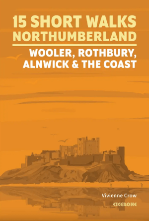
Wandelgids Northumberland short walks - Cicerone • 9781786312013
Northumberland short walks - Cicerone Productomschrijving: Wil je het beste van Wooler, Rothbury, Alnwick en de kust van Northumberland ontdekken? Deze gids bevat 15 van de beste korte wandelingen in Northumberland (3 uur of minder, tussen 3 en 14 km), waaronder Holy Island (Lindisfarne), de Simonside Hills, Alnwick Castle, Craster, Dunstanburgh Castle, Bamburgh en Berwick-upon-Tweed. …

Wandelgids Park Rangers Favourite Walks Northumberland - Collins • 9780008462710
Park Rangers Favourite Walks Northumberland - Collins Productomschrijving: Wandelgids voor het Northumberland National Park, met 20 van de beste routes uitgekozen door de parkwachters. Elke wandeling varieert in lengte van 2 tot 10 km en kan in minder dan 4 uur worden afgelegd. Engelse omschrijving: Walking guide to the Northumberland National Park, with 20 best routes chosen by the pa…

Wandelkaart 340 Holy Island & Bamburgh - OSO • 9780319263907
Wandelkaart Holy Island & Bamburgh - OSI Productomschrijving: Holy Island en Bamburgh zijn 2 aan de kust liggende eilanden/archipel die de interesse trekt van velen in het teken van natuur bezoek, wandelen of fietsen. De locatie is zeer mooi wat de natuur betreft. Omvat: Cheswick, Ancroft, Haggerston, Bowsden, Beal, Fenwick; Holy Island, Holburn, Doddington, Belford, Waren Mill, Bambur…

Wandelgids Hadrian's Wall Path - Trailblazer • 9781912716371
Hadrian's Wall Path 135 km - Trailblazer Productomschrijving: Hadrian's Wall Path is een lange-afstandwandelroute in het noorden van Engeland. De route loopt voor 135 km van Wallsend op de East coast van Engeland tot Bowness-on-Solway op de West kust. Voor het meeste van de route loopt het pad dicht bij Hadrian's Wall, die de defensieve muur omvat die gebouwd werd door de Romeinen op de no…