
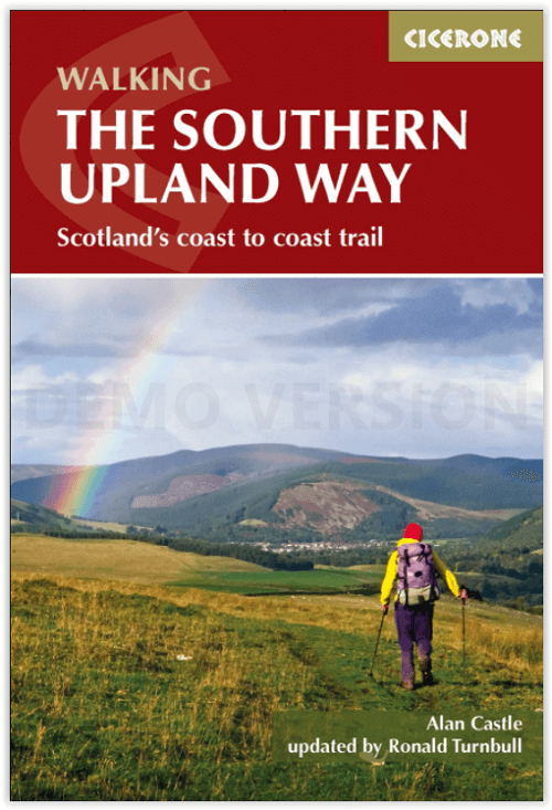
Wandelgids Southern Upland Way - Cicerone
Portpatrick aan de westkust tot Cockburnspath in het oosten
Korte omschrijving
Southern Upland Way Schotland - Cicerone Productomschrijving: Gids over de beroemde Schotse Southern Upland Way, een kust-tot-kust wandeling door Galloway en de Schotse Borders. De 347 km la...

Specificaties
- Uitgever: CICERONE Press
- ISBN-13: 9781852849931
- HOOFDCATEGORIEËN: Wandelgids
- Activiteiten: Wandelen, Hiking & Trekking
- Auteur: Alan Castle, Ronald Turnbull
- Regio: Schotse grenzen
- Land: Schotland
- Lange afstand wandelroutes: The Southern Upland Way, Schotland (338 km)
- Blz.: 192
- Afmeting: 12x17
- Editie: 2
- Taal: Engels
Volledige omschrijving
Southern Upland Way Schotland - Cicerone
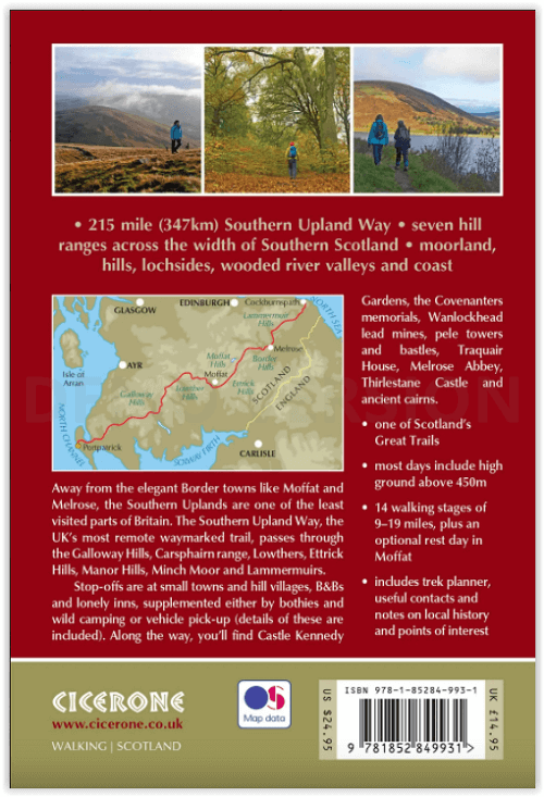
Productomschrijving: Gids over de beroemde Schotse Southern Upland Way, een kust-tot-kust wandeling door Galloway en de Schotse Borders. De 347 km lange route is een van de Great Trails van Schotland en verbindt Portpatrick aan de westkust met Cockburnspath in het oosten, door afwisselende landschappen en met een rijk natuurlijk en historisch belang. De tocht kan in ongeveer twee weken worden afgelegd.
Engelse omschrijving: Guidebook to the Southern Upland Way, a coast to coast walk through Galloway and the Scottish Borders. One of Scotland's Great Trails, the 347km (215 mile) route links Portpatrick on the west coast to Cockburnspath on the east, through diverse landscapes and rich natural and historical interest. It can be completed in around a fortnight.
Seasons:
April to September, with May and June the best months of all.
Centres:
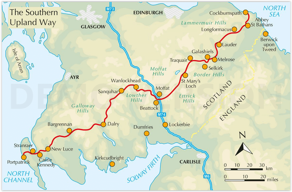
Portpatrick, Castle Kennedy, New Luce, Bargrennan, St John's Town of Dalry, Sanquhar, Wanlockhead, Beattock/Moffat, Traquair, Galashiels, Melrose, Lauder, Longformacus, Abbey St Bathans, Cockburnspath.
Difficulty:
The route is waymarked throughout, and paths are mostly good, but much of the hill country is remote and little frequented and in places the path is faint. Self-reliance and some navigation skills are required. For backpackers, the route has 5 bothies and unlimited wild camping possibilities. For walkers, maximum daily stages of up to 19 miles (30km) are assured by using vehicle pick-up services, as detailed in the book.
Must See:
Portpatrick coast path; Loch Trool; Lowther Hills; Minch Moor drove road; Lammermuir Hills; new official high-level route through the Ettrick Hills; Castle Kennedy Gardens; Wanlockhead Lead Mines; Melrose Abbey; Thirlstane Castle.
The route:
Stage 1 Portpatrick to Castle Kennedy
Stage 2 Castle Kennedy to New Luce
Stage 3 New Luce to Bargrennan
Stage 4 Bargrennan to the Glenkens
Stage 5 Across the Glenkens
Stage 6 The Glenkens to Sanquhar
Stage 7 Sanquhar to Dalveen Pass
Stage 8 Dalveen Pass to Beattock (Moffat)
Rest day – Moffat and environs
Stage 9 Beattock (Moffat) to Ettrick
Stage 10 Ettrick to Traquair (Innerleithen)
Stage 11 Traquair (Innerleithen) to Melrose
Stage 12 Melrose to Lauder
Stage 13 Lauder across the Lammermuir Hills to Longformacus
Stage 14 Longformacus to Cockburnspath
Artikelen uit dezelfde regio

Wandelkaart 339 Kelso Coldstream & lower Tweed Valley - OSI • 9780319472118
Wandelkaart Kelso- Coldstream & lower Tweed Valley - Schotland Omvat ook de lower Tweed Valley Productbeschrijving: Kaart nummer 339 dekt Kelso en Coldstream. Hoogtepunten zijn Northumberland National Park & de Borders Abbeys Way. Omvat ook de rivier Tweed, Newtown St. Boswells, Norham en Doddington. De OS Explorer kaart voor Kelso, Coldstream & lagere Tweed Vallei is beschikbaar in zo…

Wandelkaart 338 Galashiels- Selkirk & Melrose - OSI • 9780319245903
Wandelkaart Galashiels- Selkirk & Melrose - Schotish Borders Productbeschrijving: St Boswell’s & Lauder. 338 / Galashiels, Selkirk & Melrose, Scotish Borders - Kaart nummer 338 dekt Galashiels, Selkirk en Melrose. Hoogtepunten zijn onder meer Eilon en Leaderfoot, Southern Upland Way en Borders Abbeys Way. Omvat ook Lauder, St. Boswells, Bloomfield en Fountainhall. De OS Explorer kaart …

Wandelgids St-Cuthbert's Way Schotland - Rucksack Readers • 9781913817138
St-Cuthbert's Way Schotland - Rucksack Readers Productomschrijving: Volg in de voetsporen van St Cuthbert in deze gemakkelijke wandeling van 101 km, van Melrose Abbey in de Schotse Borders naar het Heilige Eiland Lindisfarne in Northumberland. St Cuthbert's Way is een van de Great Trails van Schotland en ook een van de Great Trails van Engeland. De route begint bij de ruïnes van Melrose Ab…

Wandelgids Walking in the Southern Uplands - Cicerone • 9781852847401
Walking in the Southern Uplands - Cicerone Press Productomschrijving: Deze gids omschrijft 44 routes en meer dan 100 toppen in de zuidelijke Highland's van Schotland, die zich ten zuidwesten uitstrekken van Edinburgh tot de Engelse grens, met de Galloway en Pentland Hills inbegrepen. De wandelingen variëren van 2 tot 18 mijl en zijn geschikt voor wandelaars van alle niveaus. Hoogtepunt…

Wandelkaart 337 Peebles & Interleithen Schotish Borders - OSI • 9780319245897
Wandelkaart Peebles & Interleithen - Schotish Borders Omvat ook: Eddleston & Ettrickbridge Traquair & Yarrow Productomschrijving: OS Explorer kaart 337 omvat Peebles, Zeist en de omliggende dorpen. Deze kaart toont een deel van de Southern Upland Way en het einde van de Peebles van John Buchan way, samen met deel van de bovenste Tweeddale National Scenic Area. De OS Explorer kaart voor…