
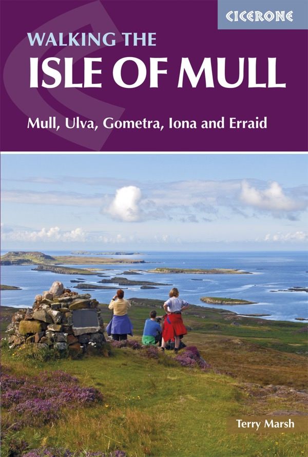
Wandelgids Isle of Mull walking guide - Cicerone
Omvat Mull- Ulva- Gometra- Iona & Erraid

Korte omschrijving
Wandelgids - Isle of Mull walking guide - Cicerone Productomschrijving: Guidebook describing over 40 walking routes on Scotland's beautiful Isle of Mull, as well as neighbouring Ulva, Gometr...

Specificaties
- Uitgever: CICERONE Press
- ISBN-13: 9781852849610
- HOOFDCATEGORIEËN: Wandelgids
- Activiteiten: Wandelen, Hiking & Trekking
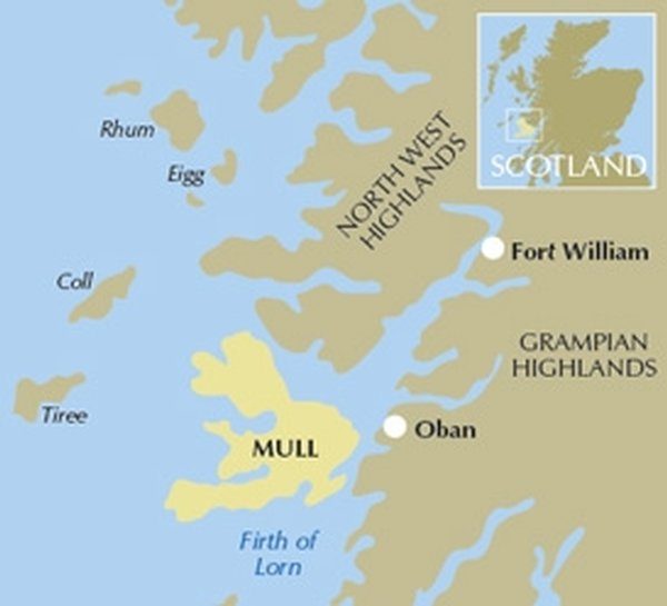
- Regio: Inner hybrids (Binnen-Hebriden), Schotland
- Land: Schotland
- Blz.: 208
- Afmeting: 12x17
- Editie: 2
- Taal: Engels
Volledige omschrijving
Wandelgids - Isle of Mull walking guide - Cicerone
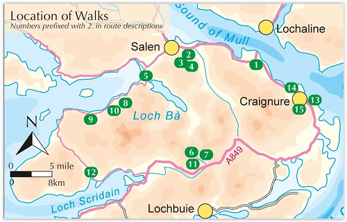
Productomschrijving: Guidebook describing over 40 walking routes on Scotland's beautiful Isle of Mull, as well as neighbouring Ulva, Gometra, Iona and Erraid. Walks range from 2 to 16 miles and from short circuits to demanding mountain traverses, but without technical difficulties. The Isle of Mull is wild, rugged and great for wildlife spotting.
Product description: A comprehensive walking guide to the Isle of Mull. The 47 routes described range from 3 to 14 miles long and from short circuits to demanding mountain traverses, but there are few technical difficulties and experienced, properly equipped walkers will find them hugely rewarding. Mull boasts wild, rugged scenery and a spectacular coastline, as well as outstanding opportunities for observing wildlife, including deer, otters, golden and sea eagles, dolphins and harbour porpoise.
The book includes walks on the neighbouring islands of Ulva, Gometra, Iona and Erraid, and is also full of information about all the islands' history and their much-studied and endlessly fascinating geology and will appeal to those who know Mull well as much as those who are discovering it for the first time. Step by step route description is accompanied by OS mapping and information on local points of interest. The Isle of Mull is easily accessible from Oban on the west coast of Scotland and will appeal to walkers seeking secluded routes, with inspiring views around almost every corner.
Seasons:
Walking possible throughout the year, although the winter months call for winter mountaineering skills and equipment on the higher mountains.
Centres:
Tobermory; smaller settlements at Dervaig, Salen, the ferryport Craignure, Bunessan and Ffionphort, the ferry point for Iona; accommodation plentiful, but camp sites and budget hostels few and far between.
Difficulty:
Few technical difficulties; walks cross rough, trackless terrain requiring walkers to be properly equipped and able to use map and compass
Must See:
Mull's only Munro, Ben More, and a fine cast of lower heights; great glens for linear walks as good as anything on mainland Scotland; spectacular coastline; wildlife.
Locatie op kaart
Artikelen uit dezelfde regio

Wandelkaart 61 Jura & Colonsay - Inner Hybrids - OSI • 9780319473849
Wandelkaart Jura & Colonsay - Inner Hybrids Schotland Productbeschrijving: OS Landranger kaart 61 toont de eilanden Jura en Colonsay in de Binnen-Hebriden aan de westkust van Schotland, evenals een deel van het eiland Islay. De Paps Jura zijn drie heuvels, tot 785m hoog, die het zuidelijke deel van het eiland domineren, met meerdere routes naar een of meer van de pieken. U kunt ook tijd ui…
Wandelkaart 409 Raasay- Rona & Scalpay- Inner Hybrids - OSI • 9780319246443
Wandelkaart Raasay- Rona & Scalpay - Inner Hybrids - OSI Productbeschrijving: De Explorer-serie heeft vervangt de vroegere, groen-cover Pathfinder-kaarten. De Explorer-serie is nu compleet en heeft betrekking op ganns Engeland, Wales & Schotland. Sommige kaarten omvatten populaire gebieden zoals de nationale parken, die zijn nog steeds gebrandmerkt als Outdoor Recreatie outdoor kaarten, ma…

Wandelkaart 48 Iona & West Mull Inner Hybrids - OSI • 9780319473719
Wandelkaart Iona & West Mull - Inner Hybrids Schotand Productbeschrijving: Kaart nummer 48 in de OS Landranger kaarten reeks heeft betrekking op de west-kust van het Isle of Mull, met inbegrip van de eilanden van Ulva en Iona, tal van Lochs, evenals de steden van Bally Gown, Sal, Uisken en Carsaig. De OS Landranger kaarten reeks heeft betrekking op Groot-Brittannië met 204 gedetailleerde k…

Wandelkaart 353 Islay North- Inner hybrids Schotland - OSI • 9780319472248
Wandelkaart Islay North - Inner hybrids Schotland Omvat ook: Port Askaig, Bridgend & Port Charlotte. Productbeschrijving: Met het noordelijke deel van Islay in de Binnen-Hebriden, is OS Explorer kaart 352 ideaal voor alle buitenactiviteiten. Hoogtepunten van het gebied zijn de gateway naar het eiland, Post Askaig en Loch Gorm. De OS Explorer kaart voor Islay Noord is beschikbaar in zow…

Wandelgids Walking on Jura- Islay and Colonsay - Cicerone • 9781852849795
Walking on Jura- Islay and Colonsay - Cicerone press Productomschrijving: Deze wandelgids over de Schotse Jura, Scarba, Islay en Colonsay op de Binnen-Hebriden beschrijft 14 uitdagende dagwandelingen plus een 5-daagse 77 km lange kustwandeling op Jura. De dagroutes variëren van 5 tot 30 km en bestrijken een veelheid aan ruw terrein dat geschikt is voor fitte, bekwame wandelaars. Zelfs de k…