Wandelgids Hebridean Way long-distance walking route - Cicerone
Strekt zich uit voor 247 km (155 mijl) van Sao naar Stornaway
Korte omschrijving
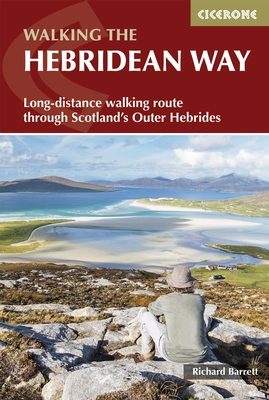
Wandelgids - Hebridean Way long-distance walking route - Cicerone Productomschrijving: Gelanceerd in 2017, biedt de Hebridean Way onze wandelaars de mogelijkheid om de magie van de Schotse H...

Specificaties
- Uitgever: CICERONE Press
- ISBN-13: 9781852847272
- HOOFDCATEGORIEËN: Wandelgids
- Activiteiten: Wandelen, Hiking & Trekking
- Regio: Outer Hibrids
- Land: Schotland
- Lange afstand wandelroutes: Hebridean Way, Schotland (247 km)
- Blz.: 192
- Afmeting: 12x17
- Editie: 1
- Taal: Engels
Volledige omschrijving
Wandelgids - Hebridean Way long-distance walking route - Cicerone
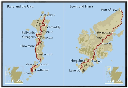
Productomschrijving: Gelanceerd in 2017, biedt de Hebridean Way onze wandelaars de mogelijkheid om de magie van de Schotse Hebriden in een inspirerende reis ervaring te ontdekken. De bewegwijzerde route strekt zich uit voor 247km (155 mijl) van Sao naar Stornaway, en koppelt 10 van de belangrijkste eilanden van het archipel door middel van straatwegen en twee ferry overtochten: Sao Barra, Eriskay, South Uist, Benbecula, Grimsay, North Uist, Berneray, Harris & Lewis. Geschikt voor de meeste wandelaars met een gematigde fiziek. De route kan worden afgelegd in 8-14 dagen en is rijk aan natuurlijke, historische en culturele bezienswaardigheden.
Product description: Launching in 2017, the Hebridean Way offers walkers the opportunity to experience the magic of Scotland's Outer Hebrides in one inspirational journey. The waymarked route stretches 247km (155 miles) from Vatersay to Stornaway, linking ten major islands of the archipelago by means of causeways and two ferry crossings: Vatersay, Barra, Eriskay, South Uist, Benbecula, Grimsay, North Uist, Berneray, Harris and Lewis. Suitable for most walkers with a moderate level of fitness, it can be completed in 8–14 days and is rich in natural, historical and cultural interest.
Seasons:
Best walked between April and October, when the days are longer; the weather is at its best and the ground underfoot is likely to be drier.
Centres:
Starting at Vatersay, the routes crosses Barra, Eriskay, South Uist, Benbecula, Grimsay, North Uist, Berneray, Harris and Lewis to its current end in Stornoway.
Difficulty:
The Hebridean Way is mostly a low-level, waymarked route that never ventures far from a road. However it requires careful planning as it crosses stretches of wild moor where there is no clear path and there are limited facilities near the route. As yet there is no baggage transfer provider.
Must See:
247km (155 mile) waymarked trail over rugged hills and along dazzling white shell beaches the length of the Outer Hebrides, from Vatersay in the south to Stornoway in the north, passing through 10 islands linked by causeways and ferries.

Locatie op kaart
Artikelen uit dezelfde regio

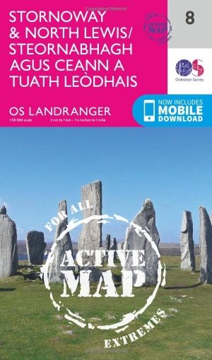
Wandelkaart 8 Stornoway & North Lewis- Outer Hybrids - OSI • 9780319473313
Wandelkaart Stornoway & North Lewis - Outer Hybrids Schotland Productbeschrijving: OS Landrangerkaart nummer 8 dekt Stornoway en Noord Lewis, en omvat ook Bac, Tunga, Arnol, Siadar, Beinn Dhail, Muirneag, Stacaiseal en port Nis. Steòrnabhagh is de grootste stad in de Buiten-Hebriden en de belangrijkste veerboot-haven, dus heeft het een goede locatie voor het verkennen van de eilanden. Top …

Wandelkaart 454 North Uist & Berneray Schotland - OSI • 9780319473061
Wandelkaart North Uist & Berneray - Outer Hybrids Schotland Productbeschrijving: Kaart nummer 454 in de OS Explorer kaarten reeks is ideaal voor het ontdekken van het 10e grootste Schotse eiland van North Uist. North Uist en Berneray, in de Buiten-Hebriden, bieden de mogelijkheid om hun natuurlijke landschappen op een voornamelijk platte eilanden te ontdekken. Het dorp van Lochmaddy herber…

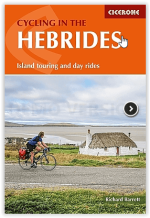
Fietsgids Cycling in the Hebrides in Schotland - Cicerone • 9781852848279
Cycling in the Hebrides in Schotland - Cicerone Press Productomschrijving: Fietsen in de Hebriden, is een uitgebreide gids met routes, dagtochten en voorgestelde fietstochten door de Binnen- en Buiten-Hebriden en de Firth of Clyde met dienstregelingen en tijdstippen van de veerboten. De routes variëren van ritten die geschikt zijn voor een weekendje weg tot een uitdagende tocht van 600 mij…

Wandelkaart 456 North Harris & Loch Seaforth Outer Hibrids - OSI • 9780319246993
Wandelkaart North Harris & Loch Seaforth - Outer Hibrids Schotland Productbeschrijving: OS Explorer kaart 456 toont North Harris (Na Hearadh), Scarp en Loch Seaforth op de Buiten-Hebriden. Het grootste deel van dit gebied is een nationale Scenic Area, met verspreide dorpen en aanzienlijke pieken. Er zijn enkel een paar wegen, en de meeste ervan zijn slechts een spoor, waardoor veel ruimte …

Wandelkaart 457 South East Lewis- Outer Hybrids Schotland - OSI • 9780319247082
Wandelkaart South East Lewis - Outer Hybrides Schotland Omvat ook: Loch Eireasort & Shiant Islands. Productbeschrijving: Kaart nummer 457 dekt Zuid-Oosten van Lewis op de Buiten hybrids in Schotland, als ook Loch Eireasort en de Shiant eilanden. Hoogtepunten van het gebied zijn Zuid-Lewis, Harris en North Uist. Ook Eisgein, Eirasort Loch, Loch Sealg en Lemreway zijn vertegenwoordigd. D…


