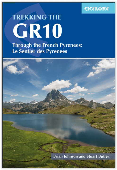
Wandelgids GR10 Trail - CIcerone
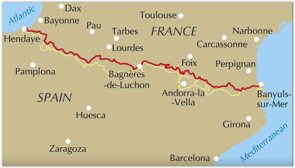
Through the French Pyrenees - Hendaye naar Banyuls-sur-Mer 955km
Korte omschrijving
Wandelgids GR10 Trail en wandelroute - CIcerone Productomschrijving: Wandelgids overde GR10, de Sentier des Pyrénées, een 955 km lange tocht door de Franse Pyreneeën van Hendaye aan de Atlan...

Specificaties
- Uitgever: CICERONE Press
- ISBN-13: 9781786311160
- Activiteiten: Wandelen, Hiking & Trekking
- Auteur: Brian Johnson, Stuart Butler
- Regio: Franse Pyreneeën, Frankrijk
- Land: Frankrijk
- Lange afstand wandelroutes: GR10 Traversé des Pyrenées (950 km)
- Blz.: 320
- Afmeting: 12x17
- Editie: 2
- Taal: Engels
Volledige omschrijving
Wandelgids GR10 Trail en wandelroute - CIcerone
Productomschrijving: Wandelgids overde GR10, de Sentier des Pyrénées, een 955 km lange tocht door de Franse Pyreneeën van Hendaye aan de Atlantische kust naar de Middellandse Zeekust bij Banyuls-sur-Mer. Het boek beschrijft 55 etappes, met informatie over planning, transport, accommodatie en faciliteiten. Loop de hele GR10 in ongeveer 45 dagen of in kortere tochten.
Engelse omschrijving: Guidebook to walking the GR10, the Sentier des Pyrénées, a 955km trek across the French Pyrenees from Hendaye on the Atlantic Coast to the Mediterranean coast at Banyuls-sur-Mer. The book describes 55 stages, with information on planning, transport, accommodation and facilities. Walk the entire GR10 in around 45 days or in shorter trips.
Seasons:
Best July to October (June in a low snow year).
Centres:
Hendaye-Plage on the Atlantic coast to Banyuls-sur-Mer on the Mediterranean through the French Pyrenees.
Difficulty:
The GR10 is extremely well waymarked following good mountain paths with short sections of boulderfield and occasional very easy scrambling. It is tough because there is more steep climb and descent than on many long-distance paths. Good network of inexpensive accommodation for those who prefer not to camp. Frequent resupply possible. In early season (May/June) ice-axe and crampons may be required.
Must See:
The GR10 starts with the rolling hills of the Basque country leading to the High Pyrenees including Pic du Midi d'Ossau, Vignemale and Gavarnie. The remote Ariège with Mont Vallier follows and Canigou dominates the approach to the Mediterranean. Wildflower meadows are magnificent throughout.

Artikelen uit dezelfde regio

Wandelgids 30 Randonnées Sur Les GR® Du Sud - Ed. Ouest-France • 9782737388521
30 Randonnées Sur Les GR® Du Sud - Ed. Ouest-France Productomschrijving: Een vervolg op de zeer succesvolle "70 randonnées sur les GR® de France" en "30 randonnées sur les GR® de Bretagne"! Een gids met 30 wandelingen, van 2 tot 4 dagen, in Lozère, Aveyron, Hérault, Lot, Tarn-et-Garonne, Aude en alle departementen van de Pyreneeën. Een ontsnapping naar ongelooflijke plaatsen: Conques, Mont…

Wandelgids Pyrenäen GR10 - Rother • 9783763346295
Wandelgids GR10 Franse pyreneeën - Rother Productomschrijving: In het uiterste zuidwesten van Frankrijk strekt de imposante bergketen van de Pyreneeën zich uit naar de hemel. Het vormt de natuurlijke grens met buurland Spanje. Als een van de drie grote langeafstandswandelroutes door de Pyreneeën wordt de GR 10 beschouwd als de gemakkelijkste en de best gemarkeerde. De Rother wandelgids "Py…

Wandelkaart 003 Forêt d'Irati - Sua Editions • 9788482165998
TOPO Wandelkaart Forêt d'Irati Productomschrijving: Het bosgebied dat Irati vertegenwoordigt, is één van de meest uitgebreide beukenbossen in Europa. Dit enorme bosrijke gebied strekt zich uit over de Navarra-valleien van Aezkoa en Salazar, de vallei van de lagere Navarrese van Cize en de Larrau-vallei in Soule. - De routes omvatten excursies voor het hele gezin en beklimmingen naar de top…

Wandelgids Pyrénéens Randonnées vers cols d'Antan - Rando Ed. • 9782344040669
100 passages Pyrénéens vers cols d'Antan Productomschrijving: Bruno Mateo en Bruno Valcke wandelen graag in de Pyreneeën en geven betekenis aan hun wandelingen. Zij nodigen u uit hen te volgen op deze routes, die sinds mensenheugenis zijn gebruikt door de plaatselijke bevolking, legers, kooplieden, pelgrims, vluchtelingen en deserteurs, maar ook door Pyreneeërs. Zo reist u mee met de smokk…

Fietsgids Katharen-Baskenroute - Narbonnen tot Biarritz - Pirola • 9789064559297
Katharen Baskenroute - Narbonne naar Biarritz - Pirola Productomschrijving: Proef de sfeer van de middeleeuwen als de dreigende contouren van een Katharenburcht plotseling hoog boven je opdoemen in de ochtendmist. Geniet van het welverdiende uitzicht vanaf zo’n burcht, na een stevige klim in het kleinste verzet, gevolgd door een fikse wandeling naar de top. Bezoek de levendige stadjes …


