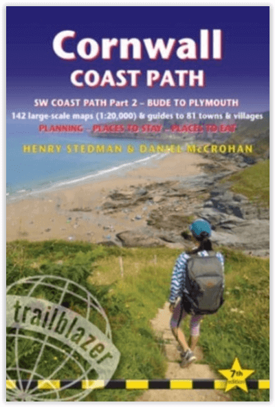
Wandelgids DEEL 2 Coast Path Bude to Plymoith - Trailblazer
SWCP 2 - From Bude to Plymouth in Cornwall and Devon
Korte omschrijving
Wandelgids DEEL 2 - Bude to Plymoith - Trailblazer Productomschrijving: Cornwall Coast Path (South-West Coast Path Part 2 - SWCP 2) - Deze gids voor het kustpad van Bude naar Plymouth (288¼ ...

Specificaties
- Uitgever: Trailblazer Publications
- ISBN-13: 9781912716265
- HOOFDCATEGORIEËN: Wandelgids
- Activiteiten: Wandelen, Hiking & Trekking
- Regio: Cornwall, England
- Land: England
- Lange afstand wandelroutes: South West Coast Path - SWCP (1014 km)
- Blz.: 368
- Afmeting: 12x18
- Editie: 7
- Taal: Engels
Volledige omschrijving
Wandelgids DEEL 2 - Bude to Plymoith - Trailblazer
Productomschrijving: Cornwall Coast Path (South-West Coast Path Part 2 - SWCP 2) - Deze gids voor het kustpad van Bude naar Plymouth (288¼ mijl - 460 km) beslaat het tweede deel, Cornwall, van het 630 mijl (1014 km) lange South-West Coast Path.
Dit is een van de beste kustwandelingen in Europa. Het wandelpad voert langs kleine vissersdorpjes, rotsachtige landtongen, bruisende badplaatsen, beboste riviermondingen en gouden, door de branding omzoomde stranden. Het is een gebied dat rijk is aan wilde dieren, met zeevogels, wilde bloemen, dolfijnen en zeehonden. Het pad is volledig opnieuw bewandeld en alle informatie is gecontroleerd voor de nieuwe 5e editie.
Engelse omschrijving: Cornwall Coast Path (South-West Coast Path Part 2 - SWCP 2) - This guide to the coast path from Bude to Plymouth (288¼ miles - 460km) covers the second section, Cornwall, of the 630-mile (1014km) South-West Coast Path.
This is some of the best coastal walking in Europe. The footpath takes in tiny fishing villages, rocky headlands, bustling resorts, wooded estuaries and golden surf-washed beaches. It is an area rich in wildlife, with seabirds, wild flowers, dolphins and seals. The path has been completely rewalked and all the information checked for the new 5th edition.
- Bude to Plymouth - 142 detailed walking maps & town plans- 30 colour photos & colour flower and bird sections
- 120mm x 180mm, 5" x7" - Includes 142 detailed walking maps: the largest-scale maps available - Unique mapping features
- Itineraries for all walkers
- Detailed public transport information for all access points
- Practical information for all budgets

Locatie op kaart
Artikelen uit dezelfde regio

Wandelgids Short Walks in Cornwall - Cicerone • 9781786311733
Short Walks in Cornwall - Cicerone Productomschrijving: 15 van de beste korte wandelingen in Cornwall rond Falmouth en de Lizard. Onze gids is voorzien van goed leesbare Ordnance Survey-kaarten en duidelijke routebeschrijvingen, perfect als je voor het eerst gaat wandelen of op zoek bent naar iets waar je met het hele gezin van kunt genieten. Omvat: St-Agnes Beacon and Wheal Coates, Tr…

Wandelgids Short walks in Cornwall - Cicerone • 9781786311740
Wandelgids Short walks in Cornwall - Cicerone Productomschrijving: Wenst u het beste van Land's End en Penzance te ontdekken? Deze gids bevat 15 van de beste korte wandelingen in Cornwall (tussen 2,5 en 8,5 km), waaronder St Ives, Mousehole, Penzance, Newlyn, Nine Maidens, Mên-an-Tol, Pendeen Watch, St Michael's Mount, St Just, Gurnard's Head en Botallack Head. De wandelingen zijn allemaal…

Wandelkaart 204 Truro & Falmouth- Cornwall England - OSI • 9780319263969
Wandelkaart Truro & Falmouth- Cornwall - OSI Productomschrijving: In het uiterste zuidwesten van Engeland omvat de OS Landranger 204 van Truro & Falmouth ook St Austell, Dodman Point, Gillan, Penryn, Feock, Ladock, Trispen, Coldharbour, Portloe en een deel van het South West Coast Path. Cornwall trekt al eeuwenlang bezoekers, die onder de indruk zijn van het milde klimaat, de glooiende heu…

Wandelkaart 102 Land's End - OSI • 9780319263648
Wandelkaart 102 Explorer Land's End - OSI Productomschrijving: Kaart nummer 102 in de OS Explorer kaartenserie is de perfecte kaart voor het ontdekken van het beroemde gebied rond Land's End, Penzance en St Ives. Het gebied staat bekend als het meest extreem zuidwestelijke punt van Groot-Brittannië. Hoogtepunten zijn: Penzance, Land's End, Mousehole, en Cape Cornwall. Inclusief mobiele…

Reisgids Cornwall's Top 10 - William Fricker - Goldeneye • 9781859653098
Reisgids Cornwall's - Goldeneye Productomschrijving: Only the best will do when time is short... Ervaren reisschrijver en inwoner van Cornwall, William Fricker, en zijn team bij Goldeneye geven hun mening over de beste stranden om te bezoeken, de beste havens om te bezoeken en de mooiste stukken van het kustpad. Een heel scala aan activiteiten om aan deel te nemen; van het kopen van kunst …


