Wandelgids Coniston walking guide - Cicerone Press
23 toppen in de Southern Fells of the Lake District
Korte omschrijving
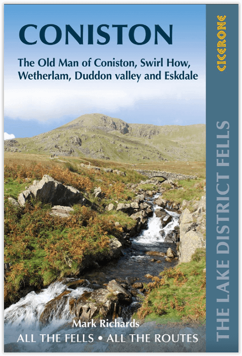
Wandelgids - Coniston walking guide - Cicerone Press Productomschrijving: Lakeland Fellranger-gids met 23 toppen in de Southern Fells of the Lake District, met een breed scala aan beklimming...

Specificaties
- Uitgever: CICERONE Press
- ISBN-13: 9781786310392
- HOOFDCATEGORIEËN: Wandelgids
- Activiteiten: Wandelen, Hiking & Trekking
- Auteur: Mark Richards
- Regio: Cumbria, England
- Land: England
- Nationale parken: Lake District NP, Cumbria England
- Blz.: 240, 256
- Afmeting: 13x20
- Editie: 2
- Taal: Engels
Volledige omschrijving
Wandelgids - Coniston walking guide - Cicerone Press
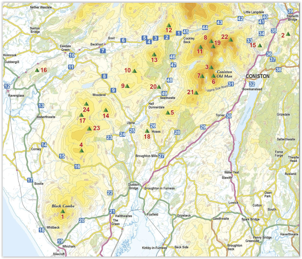
Productomschrijving: Lakeland Fellranger-gids met 23 toppen in de Southern Fells of the Lake District, met een breed scala aan beklimmingen. Er zullen hier grote valdagen zijn, tussen de passen van Wrynose en Hardknott, Black Combe in het zuiden en Muncaster in het westen, met heuvels waaronder Coniston Old Man, Wetherlam en Stickle Pike.
Engelse omschrijving: Lakeland Fellranger guidebook covering 23 summits in the Southern Fells of the Lake District, with a wide range of ascents. Great fell days are to be had here, between Wrynose and Hardknott passes, Black Combe in the south and Muncaster in the west, with fells including Coniston Old Man, Wetherlam and Stickle Pike.
Seasons:
Suitable all-year round walks. Winter walking, even on the lower fells of the Lakes, is not for the inexperienced or under-equipped.
Centres:
Great Langdale, Ambleside, Borrowdale, Keswick, Wasdale Head.
Difficulty:
Straightforward, short ascents, often not on clear paths, to be used as a basis for readers' own walks. Navigational skills needed but no specialist equipment. Any scrambling is easy and non-scrambling options are always provided.
Must See:
A fresh perspective on classic Lakeland summits like Scafell Pike, Bowfell and the Crinkles, and inspiring introduction to lesser-known fells such as Hard Knott, Rossett Pike and Whin Rigg, with crystal-clear Harvey mapping and the author's detailed elevation diagrams and panoramas.

Artikelen uit dezelfde regio

Fietsgids The Coast to Coast Cycle Route - Cicerone • 9781786311184
The Coast to Coast Cycle Route - Cicerone Press Productomschrijving: Coast to Coast fietsroute of Sustrans fietsroute. De 140 mijl (160 km) lange route van Whitehaven of Workington naar Tynemouth of Sunderland gaat voornamelijk over fietspaden, bospaden en secundaire wegen, maar er worden ook off-road mogelijkheden en dagtochten beschreven. De fietsvriendelijke route is geschikt voor alle …

Fietsgids Hadrian's Cycleway - Cicerone • 9781786310422
Fietsgids - Hadrian's Cycleway - Cicerone Productomschrijving: Hadrian's Cycleway, een dikke 250 km lange kust tot kust fietsroute over noordelijk Engeland, die de route volgt voor zover mogelijk natuurlijk, langs de bekende Hadrian's Wall World Heritage Site. Deze route loopt van Ravenglass in Cumbria doorheen Northumberland to South Shields aan de oostkust van Engeland, met een eventuele…

Wandelkaart 85 Carlisle & Solway Firth- Cumbria England - OSI • 9780319261835
Wandelkaart Carlisle & Solway Firth - Cumbria England Productbeschrijving: Deze kaart van Carlisle & Solway Firth omvat ook Gretna Green, Annan, Canonbie, Brydekirk, Dalton, Kirkbride, Silloth, Wigton, Thursby evenals deel van het Lake District National Park en deel van Hadrianus Wall path. De OS Landranger kaarten reeks heeft betrekking op Groot-Brittannië met 204 gedetailleerde kaart…

Reisgids Lake district NP England - Rough Guides • 9780241256114
Reisgids Lake district NP England - Rough Guides Productomschrijving: The Rough Guide to the Lake District is the best all-purpose guide to the English Lake District, beautifully illustrated with colour photos and full-colour maps. Comprehensive, lively reviews outline the finest places to stay and eat for every budget, all fully revised for this seventh edition by our Lakes expert. W…

Wandelkaart 303 Whitehaven & Workington- England - OSI • 9780319471753
Wanedlkaart Whitehaven & Workington - Cumbria England Omvat ook: Cockermouth & Egremont Productbeschrijving: OS Explorer kaart 303 toont omvat Workington en Cockermouth tot Calderbridge, de westelijke rand van het Lake District National Park. Hoogtepunten zijn Ennerdale Water, Whitehaven Harbour en Lank Rigg, op 541 m. De OS Explorer kaart voor Whitehaven & Workington is beschikbaar in…


