
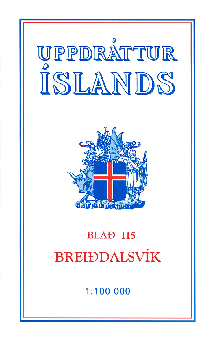
TOPO Wandelkaart 115 - Breiddalsvik Iceland - Ferdakort
Goed gedetailleerde kaarten van het vuurland bij uitstek
Korte omschrijving
Wandelkaart 115 - Breiddalsvik Iceland - Ferdakort Productomschrijving: Deze serie topografische kaarten van IJsland zijn goed gedetailleerd. Alle topografische details zijn erop terug te vi...

Specificaties
- Uitgever: Idnu Bokautgafa (Ferdakort)
- ISBN-13: 5690000234755
- HOOFDCATEGORIEËN: Wandelkaart
- Activiteiten: Wandelen, Hiking & Trekking
- Regio: Austurland, IJsland, Oostland
- Land: Ijsland
- Schaal: 1:100000
- Afmeting: 11x20
- Taal: Engels
Volledige omschrijving
Wandelkaart 115 - Breiddalsvik Iceland - Ferdakort
Productomschrijving: Deze serie topografische kaarten van IJsland zijn goed gedetailleerd. Alle topografische details zijn erop terug te vinden.
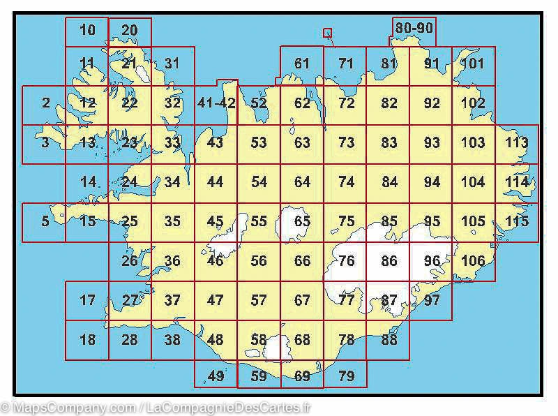
This is one of the maps in the topographic survey of Iceland with the scale 1:100,000. The series was last revised in the early eighties. Contour interval is 20 meters. In addition to the usual features shown on survey mapping, the maps also include a large amount of information indicating the type of the terrain and land use (block or smooth surfaced lava, clay, boulders, sand and dunes, cultivated area, meadows, pastures, bogs, wetlands, etc.) and details not often found on maps: physicians' residences, parsonages, etc. Each map covers an area of 44 x 40 km / 27 x 25 miles. Margin ticks give latitude and longitude in steps of 6'. Map legend includes English.
Locatie op kaart
Artikelen uit dezelfde regio

Wandelkaart 26 Borgarfjordur Iceland - Ferdakort • 5690000234069
Wandelkaart 26 - Borgarfjordur Iceland - Ferdakort Productomschrijving: Deze kaarten zijn niet direkt op voorraad. De levertijd is echter normaal gezien slechts enkele dagen. De kaarten die u niet kunt vinden op ons overzicht, zijn niet leverbaar. Deze serie topografische kaarten van IJsland zijn goed gedetailleerd. Alle topografische details zijn erop terug te vinden. This is one of t…

Wandelkaart 81 Oxarfjordur Iceland - Ferdakort • 5690000234526
Wandelkaart 81 - Oxarfjordur Iceland - Ferdakort Productomschrijving: Deze serie topografische kaarten van IJsland zijn goed gedetailleerd. Alle topografische details zijn erop terug te vinden. This is one of the maps in the topographic survey of Iceland with the scale 1:100,000. The series was last revised in the early eighties. Contour interval is 20 meters. In addition to the usual …

TOPO Wandelkaart 103 - Utherad Iceland - Ferdakort • 5690000234694
Wandelkaart 103 - Utherad Iceland - Ferdakort Productomschrijving: Deze serie topografische kaarten van IJsland zijn goed gedetailleerd. Alle topografische details zijn erop terug te vinden. This is one of the maps in the topographic survey of Iceland with the scale 1:100,000. The series was last revised in the early eighties. Contour interval is 20 meters. In addition to the usual fea…

Wandelkaart 105 Hamarsfjordur Iceland - Ferdakort • 5690000234717
Wandelkaart 105 - Hamarsfjordur Iceland - Ferdakort Productomschrijving: Deze serie topografische kaarten van IJsland zijn goed gedetailleerd. Alle topografische details zijn erop terug te vinden. This is one of the maps in the topographic survey of Iceland with the scale 1:100,000. The series was last revised in the early eighties. Contour interval is 20 meters. In addition to the usu…

Wandelkaart 85 Kverkfjoll Iceland - Ferdakort • 5690000234564
Wandelkaart 85 - Kverkfjoll Iceland - Ferdakort Productomschrijving: Deze serie topografische kaarten van IJsland zijn goed gedetailleerd. Alle topografische details zijn erop terug te vinden. This is one of the maps in the topographic survey of Iceland with the scale 1:100,000. The series was last revised in the early eighties. Contour interval is 20 meters. In addition to the usual …