Reisgids Vancouver pocket guide - Lonely Planet
West End- Gastown- Chinatown- Yaletown- Granville Island
Korte omschrijving
Vancouver pocket guide van Lonely Planet Productomschrijving: Voor zoveel of dat "Second Hollywood" Vancouver groot is, is Vancouver Island minstens even groot. Omvat: Downtown, West End...

Specificaties
- Uitgever: Lonely Planet Publications
- ISBN-13: 9781838699253
- Auteur: John Lee
- Regio: British Colombia, Canada
- Land: Canada
- Blz.: 160
- Editie: 5
- Taal: Engels
Volledige omschrijving
Vancouver pocket guide van Lonely Planet
Productomschrijving: Voor zoveel of dat "Second Hollywood" Vancouver groot is, is Vancouver Island minstens even groot.
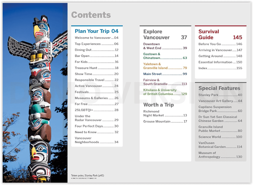
Omvat: Downtown, West End, Gastown, Chinatown, Yaletown, Granville Island, Fairview, South Granville, Kitsilano, University of British Columbia
Engelse omschrijving: Lonely Planet’s Pocket Vancouver is your passport to the most relevant, up-to-date advice on what to see and skip, and what hidden discoveries await you. Stroll around Stanley Park’s dramatic forest and mountain-framed seawall, peruse deli treats and arts and crafts stalls at Granville Island Public Market or all with your trusted travel companion. Get to the heart of the best of Vancouver and begin your journey now!
Inside Lonely Planet’s Pocket Vancouver:
- Full-colour maps and images throughout
- Highlights and itineraries help you tailor your trip to your personal needs and interests
- Insider tips to save time and money and get around like a local, avoiding crowds and trouble spots
- Essential info at your fingertips - hours of operation, phone numbers, websites, transit tips, prices
- Honest reviews for all budgets - eating, sleeping, sight-seeing, going out, shopping, hidden gems that most guidebooks miss
- Free, convenient pull-out Vancouver map (included in print version), plus over 10 colour neighbourhood maps
- User-friendly layout with helpful icons, and organised by neighbourhood to help you pick the best spots to spend your time

Artikelen uit dezelfde regio

Travelguide - British Columbia & the Canadian Rockies - LP • 9781787013650
Travelguide - British Columbia & the Canadian Rockies - LP Covers: Alberta, British Columbia, Yukon Territory and more Product description: Sigh-inducing mountains, mist-shrouded forests and epic tooth-and-claw wildlife: this is Canada’s legendary outdoor wonderland. And it’s served alongside a full menu of distinctive, ever-inviting communities. Lonely Planet will get you to the heart…

Reisgids Canada - insight guide • 9789066554849
Reisgids - Canada - insight guide Productomschrijving: Canada is het op één na grootste land ter wereld en strekt zich uit over een afstand van 5500 km tussen de Atlantische Oceaan en de Grote Oceaan. De variatie van landschappen is dan ook ongekend groot en ondanks deze enorme afmetingen zijn de auteurs en fotografen op de bekende, onovertroffen en veelvuldig bekroonde Insight Guide-wijze…

Reisgids Canada Ouest 24-2025 - Le Routard • 9782017888352
Reisgids West-Canada - Hachette Productomschrijving: Ondoordringbare bossen bewoond door zwarte beren, hoge bergen met besneeuwde toppen weerspiegeld in smaragdgroene meren, adembenemende panorama's... Of je nu in de voetsporen van de pioniers treedt of de nationale parken van de Rocky Mountains bezoekt, je zult een ontmoeting hebben met het Grote Westen die de mythe waarmaakt! Franse …


Reisgids Wat & Hoe West-Canada - Kosmos • 9789043932530
Reisgids West-Canada - Kosmos Productomschrijving: Met deze Wat & Hoe Reisgids West-Canada ga je voorbereid onderweg. Bezoek het multiculturele Vancouver, ontdek de moderne architectuur van Calgary of trek de Canadese Rocky Mountains in. Ook de prachtige nationale parken van Canada, zoals Banff of Jasper, zijn het bezoeken meer dan waard. Wat krijg je: - Een gids met perfect reisfo…

Wandelkaart 14 Lake O'Hara- BC Canada - Gemtrek • 9781895526950
Wandelkaart 14 - Lake O'Hara - Gemtrek Productomschrijving: Dit is een gedetailleerde kaart van het gebied rond Lake O'Hara, in British Colombia. Op de voorkant staat een 1:20, 000-schaal topografische kaart die betrekking heeft op het gehele Lake O'Hara trail netwerk met al de beschikbare ingetelende wandelpaden en alpine routes. De contour-interval op de kaart is 25 meter (80 voet). …


