
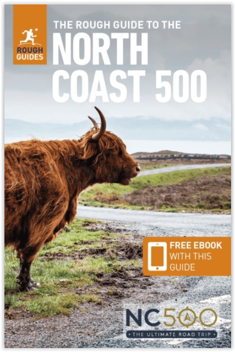
Reisgids The North Coast 500 - Rough Guides
The Highlands- John O' Groats- Ullapool- Inverness- Black Isle
Korte omschrijving
The North Coast 500 van Rough Guides Productomschrijving: Omvat de 500 km lange noord Schotse kustlijn thv de Highlands. Een serieus eigenaardige plaats. Engelse omschrijving: Discover t...

Specificaties
- Uitgever: Rough Guides
- ISBN-13: 9781839058530
- Regio: Highlands Noord, Schotland, Schotland
- Land: Schotland
- Blz.: 88
- Afmeting: 13x20
- Editie: 3
- Taal: Engels
Volledige omschrijving
The North Coast 500 van Rough Guides
Productomschrijving: Omvat de 500 km lange noord Schotse kustlijn thv de Highlands. Een serieus eigenaardige plaats.
Engelse omschrijving: Discover the North Coast 500 with this compact, entertaining, 'tell it like it is' Rough Guide, packed with invaluable practical guidance and honest expert recommendations across 86 information-packed pages. Whether you plan to take a photo with the John O' Groats sign or visit the fishing town of Ullapool, The Rough Guide to the North coast 500 will show you the top places to explore, sleep, eat and drink along the way.
Regional route coverage: provides practical information for every step of this 500-mile loop around Scotland's stunning north Highlands. Routes/regions covered include: Inverness to Black Isle, the road to John O'Groats, Thurso and Lochinver.
Honest independent reviews: written with Rough Guides' trademark blend of humour, honesty and expertise, and independent recommendations you can truly trust, our writers will help you get the most from your trip along the North Coast 500.
Meticulous mapping: Navigate the North Coast 500 without needing to get online - features easy-to-follow colour maps covering the loop.
Fabulous full-colour photography: includes a richness of inspirational colour photography.
Things not to miss: Rough Guides' rundown of the Castle of Mey, Dunrobin Castle, Inchnadamph Bone Caves and Fortrose Cathedral.
Itineraries: carefully planned routes will help you organise your trip, and inspire and inform your on-the-road experiences.
Basics section: includes essential pre-trip information, from when to go, getting there and getting around, to where to stay, eat and drink.
Background information: fascinating 'Moments in History' section provides a pithy overview of prehistory, the Celts and the Picts, Bonnie Prince Charlie's rebellion, the Highland Clearances, and the Highlands today.

Artikelen uit dezelfde regio

Wandelkaart 451 Thurso & John o' Groats - Schotland - OSI • 9780319246948
Wandelkaart Thurso & John o' Groats - Northern Highland's Omvat ook: Dunnet Head Productbeschrijving: OS Explorer kaart 451 toont het uiterste noord-oosten van Schotland. John o'Groats is technisch gezien niet het meest noordelijke dorp, maar dat houd het niet tegen om een belangrijke toeristische attractie te zijn. Thurso is een gemoedelijk dorp en een uitstekende uitvalsbasis in …

Wandelkaart 12 Thurso & Wick Highland's - OSI • 9780319261101
Wandelkaart Thurso & Wick - Highland's Schotland - OSI Productbeschrijving: OS Landranger kaart 12 omvat John O'Groats, Thurso en Wick in het noorden van Schotland. De iconische wegwijzer markeert het punt van het begin (of einde) van de John O'Groats Land's End route. De OS Landranger kaarten reeks heeft betrekking op Groot-Brittannië met 204 gedetailleerde kaarten, perfect voor dagto…

Wandelkaart 448 Strath Naver Strath Nabhair - OSI • 9780319246917
Wandelkaart Strath Naver- Strath Nabhair & Loch Loyal Omvat ook: Bettyhill. Productbeschrijving: Aan de Noord kust van Schotland volgt OS Explorer kaart 448 Strath Naver, van Loch Naver tot aan de kust. Dit gebied omvat ook Loch Tongue en Tongue bay en één Munro, evenals de Ben Klibreck (962 m) in het uiterste zuidwesten van de kaart. De OS Explorer kaart voor Strath Naver & Loch loyaa…

Wandelkaart 15 Loch Assynt Northern Highland's- Schotland • 9780319473382
Wandelkaart Loch Assynt - Northern Highland's Schotland Productbeschrijving: Kaart nummer 15 in de reeks van de OS Landranger kaarten is de ideale kaart voor planning dagtrips en vakanties in de Noordwestelijke Highlands van Schotland. Ontdek de schoonheid van de vele lochs opgenomen in het gebied waaronder Loch Assynt en Loch More. Andere hoogtepunten zijn de steden van Lochinver, Kylesku…

Wandelkaart 450 Wick & The Flow Country - OSI • 9780319246931
Wandelkaart Wick & The Flow Country - Northern Highland's Omvat ook: Lybster, Latheron & Dunbeath. Productbeschrijving: OS Explorer kaart 450 behandelt Wick en de Moray Firth, met inbegrip van Lybster, Latheron en Dunbeath. Wick bestaat al sinds ten minste 1266 en heeft 's werelds kortste straat, Ebenezer plaats. De Flow Country is een groot gebied van moerassig, laaggelegen land. De O…