
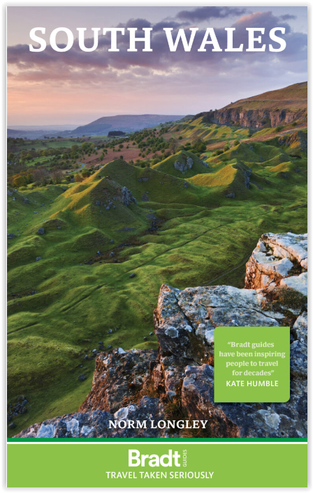
Reisgids South Wales - Bradt Travel Guides
Monmouthshire- Glamorgan- Carmarthenshire & Pembrokeshire
Korte omschrijving
Reisgids Wales South - Bradt Productomschrijving: Deze nieuwe Bradt-gids is de eerste die uitsluitend gewijd is aan een specifiek deel van Wales en omvat het zuidelijke derde deel van het la...

Specificaties
- Uitgever: Bradt guides
- ISBN-13: 9781784778378
- Activiteiten: Toerisme
- Auteur: Norm Longley
- Regio: South Wales
- Land: Wales
- Blz.: 256, 336
- Afmeting: 14x22
- Editie: 1
- Taal: Engels
Volledige omschrijving
Reisgids Wales South - Bradt
Productomschrijving: Deze nieuwe Bradt-gids is de eerste die uitsluitend gewijd is aan een specifiek deel van Wales en omvat het zuidelijke derde deel van het land. Deze gids bestrijkt Monmouthshire, Glamorgan, Carmarthenshire, Pembrokeshire en het Brecon Beacons National Park en biedt een diepgaande beschrijving van een breed scala aan attracties. Voor wandelaars, liefhebbers van erfgoed, natuurliefhebbers, gezinnen, mountainbikers, fijnproevers en stadsliefhebbers biedt deze gids alle praktische informatie die u nodig heeft om uw verblijf in Zuid-Wales te plannen en te genieten.
De regio beschikt over 400 mijl kustlijn, waarlangs enkele van de mooiste stranden van Groot-Brittannië zich nestelen tussen gezellige badplaatsen en traditionele vissersdorpen, waaronder in het dramatische Pembrokeshire Coast National Park. In het binnenland omvatten The Valleys een voormalige krachtcentrale van de Britse kolenmijnindustrie, waar verlaten mijnen zijn uitgegroeid tot bloeiende toeristische attracties in een landschap dat op de Werelderfgoedlijst staat.
Engelse omschrijving: This new Bradt guidebook is the first solely dedicated to a specific part of Wales, encompassing the country’s southern third. Covering Monmouthshire, Glamorgan, Carmarthenshire, Pembrokeshire and Brecon Beacons National Park, this guide provides in-depth coverage of a broad range of attractions. Catering for walkers, heritage aficionados, wildlife lovers, families, mountain bikers, foodies and city-lovers, it furnishes all the practical information you need to plan and enjoy time in South Wales.
The region boasts 400 miles of coastline, along which some of Britain’s finest beaches nestle between comely resorts and traditional fishing villages, including in the dramatic Pembrokeshire Coast National Park. Inland, The Valleys encompass a former powerhouse of the British coal-mining industry where abandoned collieries have become thriving tourist attractions in a World Heritage landscape.
Alternatively, enjoy peace and quiet in the Brecon Beacons, one of few British International Dark Sky Reserves, characterised by high peaks, wild moorland and thrashing waterfalls. From here, mountains extend east to the renowned book town of Hay-on-Wye. In South Wales, you can embrace history, landscape and culture in quick succession.
Hikers come from all over to walk the Wales Coast Path, the first footpath worldwide to extend the entire length of a country’s coastline. Bike Park Wales in Merthyr is Britain’s leading mountain-bike centre, while St David’s Peninsula offers thrilling coasteering and the Gower Peninsula exciting surfing. The region’s special wildlife ranges from puffins and deer on offshore islands to porpoises and dolphins powering across sheltered bays.
Urbanites will love the Welsh capital of Cardiff, fast becoming one of Britain’s most dynamic cities, following exciting regeneration crowned by the Millennium Centre. Wales is nicknamed the Land of the Castles, with more fortifications per square mile than any European country: South Wales boasts twenty where your imagination can run riot. Unexpected treats gather here too: visit Europe’s second-tallest sand dune (The Big Dipper in Merthyr Mawr), the UK’s smallest city (St David’s), or even vineyards and whisky distilleries.
Whether you are an adrenaline-seeker or culture-lover, a wildlife watcher or beach-goer, foodie or hiker, discover South Wales with Bradt’s comprehensive guide.
Locatie op kaart
Artikelen uit dezelfde regio

Wandelkaart 178 Llanelli- Ammanford & Rhydaman - OSI • 9780319243718
Wandelkaart Llanelli- Ammanford & Rhydaman - South Wales Productbeschrijving: Kaart nummer 178 dekt Llanelli, Ammanford en Kidwelly. Hoogtepunten zijn Brecon Beacons National Park. Omvat ook Lliedi Resr, Gorseinon, Burry Port, Llanddarog en Llangain. De OS Explorer kaart voor Llanelli & Ammanford is beschikbaar in zowel de standaard papieren versie als de weerbestendige 'Actief' versie. …

Wandelkaart 151 Cardiff & Bridgend - South Wales - OSI • 9780319470237
Wandelkaart Cardiff & Bridgend / Caerdydd a Phen-y-bont - Wales Omvat ook: Vale of Glamorgan. Productbeschrijving: Kaart nummer 151 in de OS Explorer kaarten reeks heeft betrekking op Cardiff en Bridgend in Zuid-Wales. Dit populaire gebied van Wales omvat steden waaronder Porthcawl, Cowbridge en Barry, met inbegrip van wandelingen door de Valeways Millenium heritage Trail, Bridgend cir…
Wandelkaart XT25 Brecon Beacons NP - West - Harvey maps • 9781851375721
Wandelkaart XT25 - Brecon Beacons NP - West - Harvey maps Productomschrijving: De westelijke range vormt het centrale deel van het Brecon Beacons National Park, een benaming die ook de ranges zowel naar het oosten en het westen van "het centrale Beacons" bevat. Dit veel groter gebied wordt ook vaak aangeduid als "de Brecon Beacons", en het omvat de Black Mountains Nieuwe generatie HARV…

Wandelkaart 198 Cardigan & New Quay- South Wales - OSI • 9780319470701
Wandelkaart Cardigan & New Quay - Aberaeron South Wales Productbeschrijving: Deze ' dubbel zijdige OS Explorer kaart 198 dekt Cardigan (Aberteifi) in het westen tot Aberaeron in het Oosten in Mid Wales. De Ceredigion Coast Path (Llwybr Arfordir Ceredigion) start vanaf hier, en geeft gemakkelijke toegang tot de kust. De OS Explorer kaart voor Cardigan & New Quay is beschikbaar in zowel de s…

Wandelkaart 166 Rhondda & Merthyr - Wales - OSI • 9780319470381
Wandelkaart Rhondda & Merthyr & Merthyr Tudful - Wales Productbeschrijving: Kaart nummer 166 in de OS Explorer kaarten reeks is ideaal voor het ontdekken van het gebied van Rhondda en Merthyr Tydfil in Zuid-Wales. Dit gebied ligt net ten zuiden van de Brecon Beacons, met bijzonder hoge natuurlijke schoonheid en vele wandelingen. Hoogtepunten van het gebied zijn onder andere: Aberdare, Bar…