
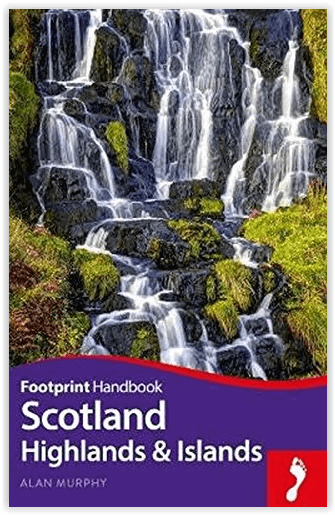
Reisgids Handbook Schotland Highlands & Islands - Footprint
The Highlands - Europa's laatste grote wildernis
Korte omschrijving
Reisgids Handbook Schotland/Scotland Highlands & Islands - Footprint Productomschrijving: Als de regen ophoudt met vallen en de mist opklaart, is er geen mooiere plek op aarde dan de Schotse...

Specificaties
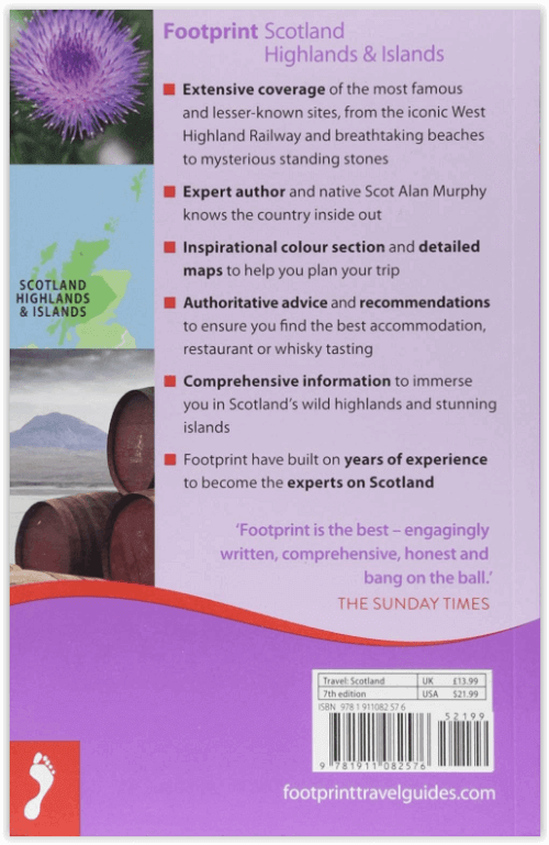
- Uitgever: Footprint Travel Guides
- ISBN-13: 9781911082576
- HOOFDCATEGORIEËN: Reisgids
- Activiteiten: Toerisme
- Auteur: Alan Murphy
- Regio: Highlands, Schotland
- Land: Schotland
- Blz.: 464
- Afmeting: 12x19
- Taal: Engels
- Reeks: Footprint handboek
Volledige omschrijving
Reisgids Handbook Schotland/Scotland Highlands & Islands - Footprint
Productomschrijving: Als de regen ophoudt met vallen en de mist opklaart, is er geen mooiere plek op aarde dan de Schotse Hooglanden en Eilanden. Footprint's Schotland Highlands & Islands geeft je alles wat je nodig hebt om het meeste uit Europa's laatste grote wildernis te halen: de mooiste glens en lochs, de spookachtigste plekken, de meest suggestieve kastelen en de meest glorieuze stranden.
Engelse omschrijving: When the rain stops falling and the mist clears there is no more beautiful place on earth than Scotland's Highlands and Islands. Footprint's Scotland Highlands & Islands gives you everything you need to get the most out of Europe's last great wilderness: the loveliest glens and lochs, the spookiest places, the most evocative castles and most glorious beaches.
- Great coverage of all the jaw-dropping scenery including national parks, mountains, castles, glens and lochs.
- Comprehensive listings from B&Bs, bothies and baronial castles to where to enjoy a wee dram of malt whiskey
- Loaded with information and suggestions on how to get off the beaten track, from puffin-spotting to horse riding
- Includes fantastic mapping and inspiring colour section to help you plan your way around the vibrant cities, stunning highlands and hundreds of islands.
Locatie op kaart
Artikelen uit dezelfde regio

Wandelkaart 409 Raasay Rona & Scalpay Schotland - OSI • 9780319472644
Wandelkaart Raasay- Rona & Scalpay - Highland's Schotland Productbeschrijving: Kaart nummer 409 in de OS Explorer kaart reeks is ideaal voor het verkennen van de Isle of Skye, Raasay, Rona en Scalpay. Hoogtepunten van het gebied zijn onder andere: Dun Caan, Brochel castle, clear Hebridean waters, & The Storr. De OS Explorer kaart voor Raasay, Rona & Scalpay is beschikbaar in zowel de stand…

Wandelkaart 57 Stirling & The Trossachs NP Schotland - OSI • 9780319261552
Wandelkaart Stirling & The Trossachs NP - Schotland Productbeschrijving: OS Landranger kaart 57 van Stirling & The Trossachs, omvat ook Ben Vorlich, Mor Bheinn, Ling Hill, Ben Ledi, Venachar Loch, Loch Katrine, Loch Ard evenals deel van de Loch Lomond en de Trossachs nationaal park. Stirling en het kasteel is zeker een bezoekje waard, terwijl het nabijgelegen Wallace Monument in een indruk…

Wandelgids Schotland Great Mountain Days - Cicerone • 9781852846121
Wandelgids - Schotland Great Mountain Days - Cicerone Productomschrijving: Inspirerende gids over 50 uitdagende routes voor bergbeklimmers, scramblers, hillwalkers en wandelaars. Velen, lang genoeg om de rugzak voor meer dan 2 dagen mee te moeten nemen, vooral in de winter (12 tot 25 mijl). Met op maat gemaakte OS (Ordnance Servey) toewijzing. Schotland's bergen behoren tot de wildste in E…

Mountainbikegids West & Norh West Schotland - Cicerone • 9781852847463
Mountainbikegids - West & Norh West Schotland - Cicerone Productomschrijving: Deze gids beschrijft 25 mountainbike routes in Noord- en Noord West Schotland, een gebied met inbegrip van Fort William, Rannoch Moor, Glen Spean, Invergarry, Loch Sunart, Strathfarrar, Kinlochewe, Sutherland, de Buiten-Hebriden en de bergen van Torridon. De routes variëren van 19,5 km tot 73.25 km, blauw, rood o…

Mountainbikegids Southern & Central Schotland - Cicerone • 9781852847470
Mountainbikegids - Southern & Central Schotland - Cicerone Productomschrijving: Deze gids beschrijft 21 mountainbike fietsroutes in Midden- en Zuid-Schotland, met inbegrip van de 7 stanes in Dumfries and Galloway, en crosscountry-routes in de Campsie Fells, Pentland Hills en Lammermuirs, de Galloway Forest, Tweed Vallei, Cheviots en Lowther Hills. De routes variëren van 16,5 tot 66km inged…