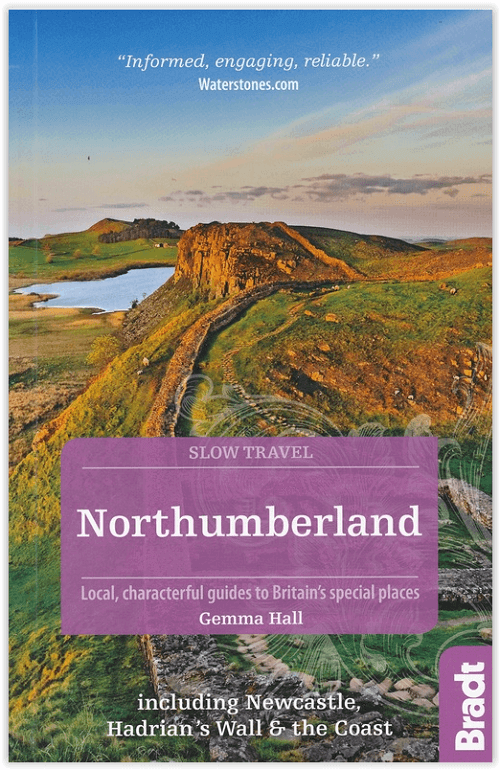
Reisgids Go Slow Northumberland - Bradt Travel guides
40 wandelingen langs stranden & Northumberland NP
Korte omschrijving
Reisgids Northumberland England - Bradt Productomschrijving: Deze nieuwe, grondig bijgewerkte tweede editie van Bradt's bestseller, uitgebreide gids voor Northumberland inclusief Newcastle, ...

Specificaties
- Uitgever: Bradt guides
- ISBN-13: 9781784776084
- HOOFDCATEGORIEËN: Reisgids
- Activiteiten: Toerisme
- Auteur: Gemma Hall
- Regio: Northumberland, Engeland
- Land: England
- Nationale parken: Northumberland NP, England
- Blz.: 320
- Afmeting: 14x22
- Editie: 2
- Taal: Engels
- Reeks: Go slow, Bradt guides
Volledige omschrijving
Reisgids Northumberland England - Bradt
Productomschrijving: Deze nieuwe, grondig bijgewerkte tweede editie van Bradt's bestseller, uitgebreide gids voor Northumberland inclusief Newcastle, Hadrian's Wall & the Coast blijft de betrouwbare bron van informatie voor het ontdekken van het uiterste noordoosten van Engeland, een gebied dat Europa's grootste beschermde nachthemel herbergt - en Engelands eerste Dark Sky Park, een uitgestrektheid van 572 vierkante mijl in Northumberland National Park.
Nu met meer dan 40 wandelingen langs stranden, over heuvels en door valleien, evenals speciale hoofdstukken over onder andere Northumberland National Park, Hadrian's Wall, de kust en Newcastle, is Bradt's Northumberland inclusief Newcastle, Hadrian's Wall & the Coast de ideale metgezel voor een geslaagd bezoek.
Engelse omschrijving: This new, thoroughly updated second edition of Bradt's best-selling, comprehensive guide to Northumberland including Newcastle, Hadrian's Wall & the Coast remains the reliable source of information for discovering the far northeast of England, an area which is home to Europe's largest area of protected night sky - and England's first Dark Sky Park, a 572-square-mile expanse in Northumberland National Park.
Now including over 40 walks along beaches, over hills and through valleys, as well as dedicated chapters on Northumberland National Park, Hadrian's Wall, the coast and Newcastle, among others, Bradt's Northumberland including Newcastle, Hadrian's Wall & the Coast is the ideal companion for a successful visit.
Northumberland is well-known for its beaches, castles, wildlife, islands and desolate upland scenery, but despite all the attention and accolades ('most tranquil county', 'darkest night skies in England', 'Best UK County/Region [Silver Award']), Northumberland remains for the most part wonderfully crowd-free. It is the ultimate place in England to get away from it all, where you can walk all afternoon over moorland and not meet anyone, skinny-dip in lakes, or picnic on pristine sands with no one else around. Northumberland is also home to Hadrian's Wall, 'the most important Roman monument in Britain' (English Heritage), while heritage enthusiasts will find a number of world firsts and unique museums such as Tanfield Railway, where you can marvel at 19th-century steam engines in the oldest engine shed in the world.
Bradt's Northumberland encourages visitors to slow down and explore the green lanes, footpaths, rivers and cycle trails that link Northumberland's 'Castle Coast' with the heather-topped hills, Roman fortresses and villages of the interior. A guide to Newcastle is found in the chapter on Tyne & Wear. Local knowledge of historic towns, heritage sites, wildlife-watching spots and countryside walks, and words and tips from local heritage experts make this an authoritative guide - and as much an entertaining armchair read as a practical guide, perfect for walkers, birdwatchers, cyclists, families, and those interested in Roman archaeology, industrial heritage and medieval castles.
Locatie op kaart
Artikelen uit dezelfde regio

Wandelkaart St-Oswald's Way - Harvey maps • 9781851375233
Wandelkaart St-Oswald's Way - Harvey maps Productomschrijving: Van Holy Island naar Heavenfield, verbindt de 97 mijl lange St. Oswald's way enkele van de plaatsen die zijn gekoppeld aan St Oswald, die de koning van Northumbria in de vroege 7e eeuw was. De route loopt via het natuurpark van Northumbria langs de prachtige kust van Northumberland en loopt in het binnenland door via het platte…

Wandelkaart 340 Holy Island & Bamburgh - OSO • 9780319263907
Wandelkaart Holy Island & Bamburgh - OSI Productomschrijving: Holy Island en Bamburgh zijn 2 aan de kust liggende eilanden/archipel die de interesse trekt van velen in het teken van natuur bezoek, wandelen of fietsen. De locatie is zeer mooi wat de natuur betreft. Omvat: Cheswick, Ancroft, Haggerston, Bowsden, Beal, Fenwick; Holy Island, Holburn, Doddington, Belford, Waren Mill, Bambur…

Wandelkaart XT25 Cheviot Hills - Harvey Maps • 9781851376094
Wandelkaart Cheviot Hills - Harvey Maps Productomschrijving: Ideaal voor The Cheviot, Windy Gyle en het noordelijke deel van Northumberland National Park. Omvat: Wooler, Kirk Yetholm, Breamish Valley en Harthope Valley - Lichtgewicht, gedetailleerd, duidelijk en makkelijk te lezen - Geprint op sterk, 100% watervast en scheurbestendig papier - Toont de horeca voor na je dagtrip …

Wandelgids Hadrian's Wall Path - Trailblazer • 9781912716371
Hadrian's Wall Path 135 km - Trailblazer Productomschrijving: Hadrian's Wall Path is een lange-afstandwandelroute in het noorden van Engeland. De route loopt voor 135 km van Wallsend op de East coast van Engeland tot Bowness-on-Solway op de West kust. Voor het meeste van de route loopt het pad dicht bij Hadrian's Wall, die de defensieve muur omvat die gebouwd werd door de Romeinen op de no…

Wandelgids St-Cuthbert's Way Schotland - Rucksack Readers • 9781913817138
St-Cuthbert's Way Schotland - Rucksack Readers Productomschrijving: Volg in de voetsporen van St Cuthbert in deze gemakkelijke wandeling van 101 km, van Melrose Abbey in de Schotse Borders naar het Heilige Eiland Lindisfarne in Northumberland. St Cuthbert's Way is een van de Great Trails van Schotland en ook een van de Great Trails van Engeland. De route begint bij de ruïnes van Melrose Ab…


