
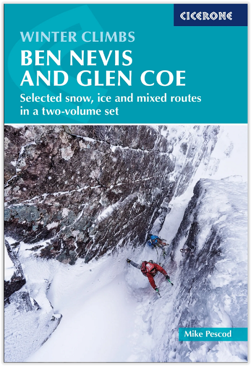
Klimgids Ben Nevis & Glen Coe - Winter climbs - Cicerone
Winter climbing routes around Ben Nevis and Glen Coe

Korte omschrijving
Klimgids Ben Nevis & Glen Coe - Cicerone Productomschrijving: De klimgids met de beste winter-klimroutes rond Ben Nevis en Glen Coe, met bijna 1000 beschreven steunberen, richels en geulen, ...

Specificaties
- Uitgever: CICERONE Press
- ISBN-13: 9781786311009
- HOOFDCATEGORIEËN: Klimgidsen
- Activiteiten: Wandelen, Hiking & Trekking
- Auteur: Mike Pescod
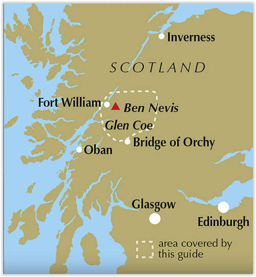
- Regio: Highlands, Schotland
- Land: Schotland
- Toepasselijke bergketen: Grampian gebergte Schotland
- Blz.: 176, 208
- Afmeting: 12x17
- Editie: 8
- Taal: Engels
Volledige omschrijving
Klimgids Ben Nevis & Glen Coe - Cicerone
Productomschrijving: De klimgids met de beste winter-klimroutes rond Ben Nevis en Glen Coe, met bijna 1000 beschreven steunberen, richels en geulen, allemaal geïllustreerd met foto-topografieën. De beste routes en toegangspunten en een ruime keuze aan opties voor alle gradaties en soorten klimmen. Schots winterklimmen op Ben Nevis, de toppen van Glen Coe en andere bergen.
Engelse omschrijving: Guidebook to the best winter climbing routes around Ben Nevis and Glen Coe, with nearly 1000 buttresses, ridges and gullies described, all illustrated with photo topos. The best routes and access points and a wide choice of options for all grades and types of climb. Scottish winter climbing on Ben Nevis, the peaks of Glen Coe and other mountains.
Seasons:
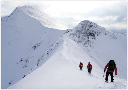
From October to May with February and March offering the most reliable climbing and April the unique ice climbing that Ben Nevis is famed for.
Centres:
Fort William and Glen Coe on the west coast of Scotland.
Difficulty:
Everything from first steps in grade I snow gullies to the hardest traditional winter climb in the world with information on how to judge the climbing conditions and choose the best route.
Must See:
From the classic climbs of Point Five Gully, the Aonach Eagach and Crowberry Gully to the modern masterpieces of The Secret and Anubis, on Ben Nevis, Aonach Mor and Beag, The Grey Coires and Mamores, Bidean nam Bian and Buachaille Etive Mor.
Locatie op kaart
Artikelen uit dezelfde regio

Wandelkaart 399 Loch Arkaig- Schotland - OSI • 9780319472590
Wandelkaart Loch Arkaig - Highlands Schotland Omvat ook: Fort William & Corpach Gairlochy, Achnacarry & Kingie. Productbeschrijving: OS Explorer kaart 399 toont Quoich Loch, Loch Arkaig Loch Lochy en Loch Eil. Dit gebied omvat ook deel van de Great Glen Way, evenals 2 Munro's: Gairich en Gaor Bheinn. De OS Explorer kaart voor Loch Arkaig is beschikbaar in zowel de standaard papieren ve…

Wandelkaart 19 Gairloch & Ullapool Highland's Schotland - OSI • 9780319261170
Wandelkaart Gairloch & Ullapool - Highland's Schotland Productbeschrijving: De schilderachtige vissersdorpjes van Gairloch en Ullapool verschijnen op deze OS Landranger kaart 19, en bieden een schat aan spectaculaire landschappen van Wester Ross. Kijk uit voor dolfijnen, bruinvissen en zeehonden en zorg voor een bezoek aan de enorme Loch Maree en een Teallach berg voor prachtige uitzicht. …

Wandelkaart 441 Lairg Bonar Bridge & Golspie - OSI • 9780319472934
Wandelkaart Lairg- Bonar Bridge & Golspie - Highland's Schotland Omvat ook: Dornoch & Brora. Productbeschrijving: Aan de Moray Firth toont OS Explorer kaart 441 de regio Brora naar Dornoch en het binnenland van Lairg bij Bonar Bridge. Verken rond Loch Fleet en Loch Brora of volg de rivier van Loch Shin naar Kyle of Sutherland. De OS Explorer kaart voor Lairg, Bonar Bridge & Golspie is …

Wandelkaart 398 Loch Morar & Mallaig Schotland - OSI • 9780319472583
Wandelkaart Loch Morar & Mallaig - Highlands Schotland Productbeschrijving: Het gebied rondom Loch Morar en het haven dorp Mallaig zijn wild, mooi en exteem. De A830 linkt Mallaig Glenfinnan met Fort William, maar afgezien daarvan zult u op ongemarkeerde land en ongemarkeerd paden wandelen - een goede kaart en navigatie vaardigheden zijn een must. Loch Morrar is het diepste zoetwater l…

Wandelkaart 390 Ardnamurchan- Schotland - OSI • 9780319472538
Wandelkaart Ardnamurchan - Highland's Schotland Omvat ook: Moidart, Sunart & Loch Shiel. Productbeschrijving: Deze twee-zijdige kaart toont het schiereiland Ardnamurchan en het eiland van Muck. Grotendeels ongerept, en met een lage menselijke populatie, dit gebied is een toevluchtsoord voor wilde dieren van alle soorten. De OS Explorer kaart voor Ardnamurchan is beschikbaar in zowel de…