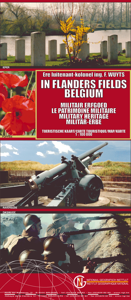
Historische kaart Flanders fields Belgium militair erfgoed
Omvat de locaties van de naoorlogse monumenten

Korte omschrijving
Historische kaart - Flanders fields Belgium militair erfgoed Productomschrijving: Het Westerse front in Vlaanderen op schaal 1:100 000 geeft de locatoies aan van verschillende monumenten, be...

Specificaties
- Uitgever: Nationaal Geografisch Instituut
- ISBN-13: 9789059347403
- HOOFDCATEGORIEËN: Wandelkaart
- Activiteiten: Wandelen, Hiking & Trekking
- Regio: Nord, Frankrijk, Vlaanderen
- Land: Frankrijk
- Schaal: 1:100000
- Afmeting: 12x28
- Editie: 2
- Taal: Nederlands
- Reeks: Toeristische kaarten, NGI
Volledige omschrijving
Historische kaart - Flanders fields Belgium militair erfgoed
Productomschrijving: Het Westerse front in Vlaanderen op schaal 1:100 000 geeft de locatoies aan van verschillende monumenten, begraafplaatsen, front linies, WWI sites, enz... Deze kaart is een dubbelzijdige kaart, maar alle WWI veldslagen van de Franse grens, tot voorbij Passendale staat samen op 1 zijde, voor een groot en duidelijk overzicht over de gebeurtenissen van die tijd.
Productdescription: The Western Front in Flanders on a detailed map at 1:100,000 highlighting locations of numerous monuments, cemeteries, front lines and other WWI-related sites, listed in the accompanying panels with, where appropriate, their phone numbers. The map is double-sided but all the main WWI battlefields from the French border to beyond Passendale/Paschendaele are together on one side.
The map shows the present-day road and rail networks in the province of West Flanders. Extensive overprint highlights locations of WWI-related sites, indicating whether open to the general public or by appointment only: museums, military cemeteries, war memorials and monuments to the missing soldiers, bunkers and battery remains, etc. Sites in France in the immediate vicinity of the Belgian border are also marked. The overprint also indicates battlefields and fortifications from other periods of history of Flanders, from the Middle Ages to WWI.
A small panel with a basic street plan of Ypres/Ieper highlights locations of 22 conflict-related sites including the Menin Gate and the Commonwealth War Graves Commission. The map is accompanied by extensive lists of museums, cemeteries and other sites, with where appropriate, contact details (but unfortunately not cross-referenced to their locations on the map itself). Four small insets show the changing front lines during various stages of WWI, and the map is illustrated by numerous colour photos of mostly WWI-related sites. Map legend and all the relevant text include English.
Locatie op kaart
Artikelen uit dezelfde regio

TOPO Wandelkaart 37 Tournai - NGI • 9789462351035
Wandelkaart Tournai - NGI Productomschrijving: De kaart voldoet aan hoge eisen op het vlak van kwaliteit (volledigheid, correctheid) en nauwkeurigheid. Ze geeft een overzichtelijk beeld van het grondgebied. De kaart bedekt een gebied van 640 km2. Deze kaart biedt u een overzicht van deel nr. 37 van de topografische TOPO50 reeks van onze eigen Nationaal geografisch instituut. De regio o…

Genieten aan het water in Vlaanderen - Lannoo • 9789401413947
Toeristische gids - Genieten aan het water in Vlaanderen Productomschrijving: Het Vlaamse landschap werd gevormd door de Noordzee en de rivieren. Zij hebben bovendien de economie gegenereerd, steden doen ontstaan, cultuur en welvaart gevoed. Talrijke watermolens, sluizen, bruggen, havengebouwen, schepen en andere monumenten getuigen van de menselijke bedrijvigheid langs het water door de e…


