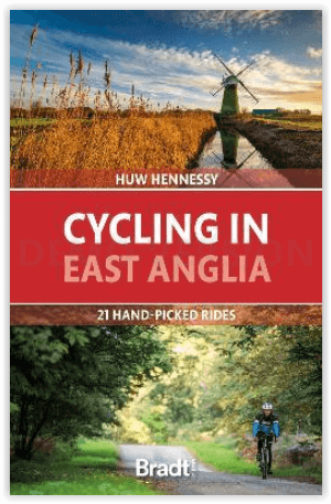
Fietsgids Cycling in East Anglia - Bradt guides
21 routes for beginners in Norfolk- Suffolk & Cambridgeshire
Korte omschrijving
Cycling in East Anglia - Bradt guides Productomschrijving: Volgens dezelfde opzet als Bradt's Cycling in Cornwall & the Isles of Scilly biedt deze nieuwe fietsgids voor East Anglia. 21 route...

Specificaties
- Uitgever: Bradt guides
- ISBN-13: 9781784778781
- HOOFDCATEGORIEËN: Fietsgids
- Activiteiten: Fietsen / VTT / MTB
- Auteur: Huw Hennessy
- Regio: Cambridgeshire, England, Norfolk East England, Suffolk East Anglia
- Land: England, United Kingdom, Great Britain
- Blz.: 232, 264
- Afmeting: 13x19
- Editie: 1
- Taal: Engels
Volledige omschrijving
Cycling in East Anglia - Bradt guides
Productomschrijving: Volgens dezelfde opzet als Bradt's Cycling in Cornwall & the Isles of Scilly biedt deze nieuwe fietsgids voor East Anglia. 21 routes voor beginners en 'recreatieve fietsers', die Norfolk, Suffolk en Cambridgeshire bestrijken. Elke tocht bevat een uitgebreide routebeschrijving en achtergrondinformatie over de plaatselijke geschiedenis, flora en fauna en cultuur. Alle routes zijn gekoppeld aan OS Explorer kaarten en relevante National Cycle Network routes (NCN), en bevatten National Grid Reference (NGR) coördinaten.
Engelse omschrijving: Following the same format as Bradt’s Cycling in Cornwall & the Isles of Scilly, this new cycling guide to East Anglia offers 21 routes for beginners and ‘leisure cyclists’, covering Norfolk, Suffolk and Cambridgeshire. Each ride includes comprehensive directions, as well as background features on local history, wildlife and culture. All are linked to OS Explorer maps and relevant National Cycle Network routes (NCN), and include National Grid Reference (NGR) coordinates. In addition, each route has been mapped on route planning and navigation app komoot, where readers can find detailed route insights including an elevation profile and waytype and surface information.
East Anglia, the snail-like bulge protruding off the back of the United Kingdom’s east coast, is a vast flatland of broads, fens and marshes, stretched out under a wide sky. Despite its proximity to London and the Midlands, and its continental ferry links, it is one of the quietest regions in the country. The ancient kingdom of the Angles is also its oldest inhabited region, from Paleolithic times to subsequent Viking and Roman invasions; its wetlands tamed with canals and windmills and built over with hundreds of medieval churches. With its level, traffic-free lanes, and network of dedicated cycle routes, this is also an ideal destination for exploring by bike.
Most of the rides are around 30 kilometres long, ideal for a half-day outing. 19 out of the 21 routes are loop circuits, making travel hassle-free, and several are adjacent so can be linked, for more energetic cyclists wanting a longer challenge. Places covered include Sandringham, Wells, Holkham, Norwich, the Norfolk Broads, Bungay, Thetford Forest, Ixworth, Diss, Southwold, Walberswick, Orford, Sutton Hoo, Ely, Newmarket and Graffham Water.
Its long, sandy beaches and traditional seaside resorts have made East Anglia one of the UK’s favourite holiday destinations. From rambles around sleepy villages to adrenalin-rush mountain bike circuits, , this guide will be packed with inspiration for cyclists of all ages and energy levels.
Locatie op kaart
Artikelen uit dezelfde regio

Wandelkaart 154 Cambridge & Newmarket - OSI • 9780319262528
Wandelkaart Cambridge & Newmarket - England Productbeschrijving: Cambridge is een wereldberoemde universiteitsstad die getuigd van een rijke geschiedenis en culturele levendigheid. OS Landranger kaart 154, geniet u van de sfeer van de rivier de Cam of van een bezoek aan een paar van de mooiste galeries van het land. De E2 Europese pad loopt door de stad, daarom bied deze veel mogelijkheden…

Wandelkaart 212 Woodbridge & Saxmundham- Suffolk - OSI • 9780319470848
Wandelkaart Woodbridge & Saxmundham - Suffolk East Midlands Omvat ook: Aldeburgh & Framlingham. Productbeschrijving: Kaart blad nummer 212 in de OS Explorer-reeks omvat Saxmundham, Woodbridge, Aldeburgh, Framlingham en Leiston. Hoogtepunten van het gebied zijn onder andere: Aldeburgh Bay, Orford Ness, de Suffolk Coast Path, rivers Deben en Alde en de kust van Suffolk en Heath AONB. De …

Wandelkaart 228 March- Ely- Chatteris & Littleport - OSI • 9780319244210
Wandelkaart March- Ely- Chatteris & Littleport - Cambridgeshire Omvat ook: Chatteris, Littleport, Welney & Denver Sluice Productomschrijving: OS Explorer kaart 228 omvat march en Ely, in Cambridgeshire. Deze platte regio is ideaal voor het fietsen en de lange geschiedenis van het gebied, waaronder Romeinse overblijfselen, maakt het een interessant plaats om te voet te verkennen. De jaa…

Wandelkaart 154 Cambridge & Newmarket England - OSI • 9780319474778
Wandelkaart Cambridge - Newmarket & Saffron Walden Productbeschrijving: Cambridge is een wereld-beroemde universiteitsstad en die doordrenkt is in een rijke geschiedenis en culturele levendigheid. Met OS Landranger kaart 154 kunt u genieten van de sfeer door te gaan punteren beneden de rivier de Cam, of door een bezoek te brengen aan enkele van de mooiste galeries van het land. De E2 Europ…

Wandelkaart 196 Sudbury- Hadleigh & Dedham Vale - OSI • 9780319470688
Wandelkaart Sudbury- Hadleigh & Dedham Vale - England Omvat ook: Lavenham & Long Melford. Productbeschrijving: Kaart nummer 196 in de OS Explorer kaarten serie omvat een oppervlakte van Essex, Suffolk, Sudbury, Hadleigh, Dedham en Lavenham. Hoogtepunten van het gebied zijn onder andere: Dedham Vale, een Area of Outstanding Natural Beauty AONB en de recreatieve paden Essex Way, St Edmun…


