
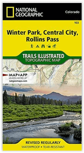
Wandelkaart 103 Winter Park, Central City & Rollins Pass
Met deel van het Roosevelt & Arapaho National Forest
Korte omschrijving
Wandelkaart Winter Park, Central City & Rollins Pass Productomschrijving: National Geographic's Trails Illustrated kaart van Winter Park, Central City en Rollins Pass biedt ongeëvenaarde det...

Specificaties
- Uitgever: National Geographic
- ISBN-13: 9781566952767
- HOOFDCATEGORIEËN: Wandelkaart
- Activiteiten: Wandelen, Hiking & Trekking
- Regio: Colorado, USA
- Land: Verenigde Staten van Amerika (USA)
- Schaal: 1:40000
- Afmeting: 10x19
- Taal: Engels
Volledige omschrijving
Wandelkaart Winter Park, Central City & Rollins Pass
Productomschrijving: National Geographic's Trails Illustrated kaart van Winter Park, Central City en Rollins Pass biedt ongeëvenaarde details voor outdoor enthousiastelingen die het hele jaar door willen genieten van de recreatieve mogelijkheden in de zuidelijke delen van Roosevelt en Arapaho National Forest. Deskundig onderzocht en gemaakt in samenwerking met lokale landbeheerders, bevat deze kaart nuttige contactinformatie, veiligheidstips, en nog veel meer. De kaart bevat vele belangrijke gebieden van belang, waaronder Indian, Vasquez en Byers Peaks Wilderness, Arapaho National Recreation Area en Eldora Ski Area.
Engelse omschrijving: National Geographic's Trails Illustrated map of Winter Park, Central City and Rollins Pass provides unparalleled detail for outdoor enthusiasts seeking to enjoy the year-round recreational opportunities in the southern parts of Roosevelt and Arapaho National Forest. Expertly researched and created in partnership with local land management agencies, this map includes helpful contact information, safety tips, and more. The map features many key areas of interest including Indian, Vasquez and Byers Peaks Wilderness, Arapaho National Recreation Area and Eldora Ski Area.
With miles of clearly marked trails that include mileage between intersections, this map will prove invaluable in your exploration of the area. The map base includes contour lines and elevations for summits, passes and many lakes. Whatever the season, you'll find this map a useful tool in pursuing a host of recreational activities. Recreation features are clearly marked, including areas for camping, hiking, downhill and alpine skiing, snowmobile riding, tubing, mountain biking and more.
Every Trails Illustrated map is printed on "Backcountry Tough" waterproof, tear-resistant paper. A full UTM grid is printed on the map to aid with GPS navigation. Other features found on this map include: Arapaho National Forest, Berthoud Pass, Byers Peak Wilderness, Indian Peaks Wilderness, James Peak Wilderness, Roosevelt National Forest, Vasquez Peak Wilderness.
Locatie op kaart
Artikelen uit dezelfde regio

Wandelkaart 131 Crested Butte- Pearl Pass - Nat geo • 9781566952477
TOPO Wandelkaart 131 - Crested Butte- Pearl Pass Colorado, USA - National geographic Productomschrijving: Crested Butte is een rustige wandel- en MTB uitvalsbasis in Gunnison County, Colorado, United States. Omvat de oude kool industrie, en noemt nu "the last great Colorado ski town". Crested Butte is aeveneens een locatie voor skiërs & mountainbiking, als ook een verzameling van andere ou…

Reisgids USA Southwest & National Parks - DK Eyewitness • 9780241365519
USA Southwest & National Parks Omvat: Arizona, Las Vegas, Southern Utah, the Four Corners & New Mexico. Productomschrijving: Staar naar de diepten van de Grand Canyon, ervaar de glitter en glamour van de Las Vegas strip, beklim de rotsachtige overspanningen van Arches National Park of wandel door het historische Santa Fe: alles wat u moet weten is overzichtelijk weergegeven in kleurgec…

Wandelkaart 1202 Colorado Trail Noord - Nat geo • 9781566956956
TOPO Wandelkaart 1202 - Colorado Trail Noord - Natgeo Productomschrijving: The Colorado Trail is een lange-afstands wandelroute van om en bij de 782 km. Deze loopt van de mond van Waterton Canyon ten zuidwesten van Denver tot Durango in Colorado. Zijn hoogste punt is 4,045 meter boven zeeniveau, en de overgrote meerderheid van de route loopt boven de 3,000 meter. Ondanks zijn hoog gelegen …

Wandelkaart 101 Cache La Poudre- Big Thompson Colorado - Nat Geo • 9781566953900
Cache La Poudre, Big Thompson Colorado - Nat Geo Productomschrijving: Canyon Lakes Ranger District, dat is het bezienswaardige bosgebied, of zeg maar wildernis gebied dat naast Fort Collins Colorado ligt. Outdoor enthousiastelingen die willen genieten van de recreatieve mogelijkheden net ten oosten van Rocky Mountain National Park zullen National Geographic's Trails Illustrated kaart van C…

Reisgids Colorado - Insight Guides ENG • 9781789198393
Reisgids Colorado USA - Insight Guides ENG Productomschrijving: Van het beslissen wanneer je gaat, tot het kiezen van wat te zien als je aankomt, deze gids voor Colorado is alles wat je nodig hebt om je perfecte reis te plannen, met insider informatie over must-see, top attracties zoals Denver Art Museum, Pikes Peak en het Old Fort National Historic Site, en culturele juweeltjes zoals de g…