
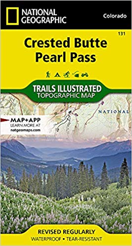
Wandelkaart 131 Crested Butte- Pearl Pass - Nat geo
Een rustige wandel- en MTB uitvalsbasis in Gunnison County
Korte omschrijving
TOPO Wandelkaart 131 - Crested Butte- Pearl Pass Colorado, USA - National geographic Productomschrijving: Crested Butte is een rustige wandel- en MTB uitvalsbasis in Gunnison County, Colorad...

Specificaties
- Uitgever: National Geographic
- ISBN-13: 9781566952477
- HOOFDCATEGORIEËN: Wandelkaart
- Regio: Colorado, USA
- Land: Verenigde Staten van Amerika (USA)
- Schaal: 1:40000
- Afmeting: 10x19
- Taal: Engels
Volledige omschrijving
TOPO Wandelkaart 131 - Crested Butte- Pearl Pass Colorado, USA - National geographic
Productomschrijving: Crested Butte is een rustige wandel- en MTB uitvalsbasis in Gunnison County, Colorado, United States. Omvat de oude kool industrie, en noemt nu "the last great Colorado ski town". Crested Butte is aeveneens een locatie voor skiërs & mountainbiking, als ook een verzameling van andere outdoor activiteiten. De 'Colorado General Assembly' noemt deze regio 'Crested Butte the Wildflower Capital of Colorado'.
Engelse omschrijving: National Geographic's Trails Illustrated map of Crested Butte and Pearl Pass offers unparalleled detail for outdoor enthusiasts seeking to enjoy the year-round recreational opportunities available in this mountainous area on the west side of the Continental Divide. Created in partnership with the U.S. Forest Service, Bureau of Land Management and others, this expertly researched map covers key areas of interest including Gunnison National Forest, Maroon Bells-Snowmass and Collegiate Peaks Wilderness areas, Crested Butte Ski Area, Elk Mountains, Taylor River, Taylor Park Reservoir, West Elk Loop Scenic Byway and the Continental Divide.
Trailheads will lead you to precisely mapped trails with clear mileage indicators, labeled according to their designated usage, whether your adventure involves hiking, cross-country skiing, biking, snowmobiling or using some other motorized vehicle. The map features shaded relief; contour lines with elevations; labeled passes, peaks and summits; and reservoirs, rivers and other water features. Some of the many recreation features include campgrounds, boat launch and river access points, and fishing areas. Every Trails Illustrated map is printed on "Backcountry Tough" waterproof, tear-resistant paper. A full UTM grid is printed on the map to aid with GPS navigation.
Other features found on this map include: Collegiate Peaks Wilderness, Gunnison National Forest, Maroon Bells-Snowmass Wilderness, Taylor Park Reservoir.
Locatie op kaart
Artikelen uit dezelfde regio

Wandelkaart 137 Pikes Peak & Cañon City - Nat Geo • 9781566953986
Pikes Peak & Cañon City Colorado - National Geographic Productomschrijving: De hoogste top in de zuidelijke Front Range van de Rocky Mountains, Pikes Peak torent boven Colorado Springs uit als een granieten schildwacht. Verken deze en andere geologische attracties zoals Garden of the Gods, Florrisant Fossil Beds en de Royal Gorge met National Geographic's Trails Illustrated kaart van Pikes…

Reisgids Colorado - Insight Guides ENG • 9781786715319
Colorado - Insight Guides ENG Productomschrijving: The Rocky Mountain State of Colorado offers soaring peaks, world-class skiing and vibrant cities that lure travellers from all over the world to America's alpine heartland. Be inspired to visit by the new edition of Insight Guide Colorado, a comprehensive full-colour guide to the state. Inside Insight Guide Colorado: A fully-overh…

Wandelkaart 1302 Colorado 14'ers- Noord - Nat geo • 9781566956994
TOPO Wandelkaart 1302 - Colorado 14'ers- Noord - Natgeo Productomschrijving: De Colorado 14'ers bestaat uit 14 van de meest indrukwekkende bergmassieven in Colorado, verdeeld over drie verschillende regio's als Front Range, Momsquito Tenmile Ranges en de Sawatch Range. een indrukwekkende locatie om te gaan trekken uiteraard. Front Range: Mount Bierstadt, Mount Evans, Grays Peak, Longs …

Wandelkaart 245 Black Canyon of the Gunnison NP - Natgeo • 9781566953689
TOPO Wandelkaart 245 - Black Canyon of the Gunnison NP - Nat Geo Productomschrijving: Het Black Canyon of the Gunnison National Park is een nationaal park in het westen van de Amerikaanse staat Colorado. Het beschermt 19 km van de 77 km lange kloof van de Gunnison River, een zijrivier van de Colorado River. Engelse omschrijving: The Black Canyon, 48 miles of awe-inspiring, steep-walle…

Wandelkaart 1203 Colorado Trail & Collegiate Loop- Natgeo • 9781566957229
Wandelkaart 1203- Colorado Trail & Collegiate Loop- Natgeo Productomschrijving: The Colorado Trail is een lange-afstands wandelroute van om en bij de 782 km. Deze loopt van de mond van Waterton Canyon ten zuidwesten van Denver tot Durango in Colorado. Zijn hoogste punt is 4,045 meter boven zeeniveau, en de overgrote meerderheid van de route loopt boven de 3,000 meter. Ondanks zijn hoog gel…