
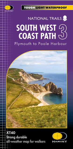
Wandelkaart South West Coast Path 3 - Harvey Maps
Laatste DEEL > Plymouth naar Poole Harbour (339 km)
Korte omschrijving
South West Coast Path - Harvey Maps Productomschrijving: Het South West Coast path is een dikke 1014 km lang en omvat het volledige South-West-England met daarin Devon & Corwall. Het pad is ...

Specificaties
- Uitgever: HARVEY MAPS
- ISBN-13: 9781851376834
- HOOFDCATEGORIEËN: Wandelkaart
- Activiteiten: Wandelen, Hiking & Trekking
- Regio: Cornwall, England, Devon, England, South West England
- Land: England
- Lange afstand wandelroutes: South West Coast Path - SWCP (1014 km)
- Schaal: 1:40000
- Afmeting: 13x27, 14x25
- Taal: Engels
- Reeks: National Trails, UK
Volledige omschrijving
South West Coast Path - Harvey Maps
Productomschrijving: Het South West Coast path is een dikke 1014 km lang en omvat het volledige South-West-England met daarin Devon & Corwall. Het pad is een National trail en behoort tot de langste routes van Engeland. De route start in Minehead in Somerset en loopt de volledige kust af tot in Poole in Dorset. OPGELET: deze kaart omvat het laatste deel van de route: van Plymouth naar Poole Harbour 339 km.
Engelse omschrijving: The South West Coast path is a 1014km (630mile) long distance path and the longest National Trail in England.
The whole path stretches from Minehead in Somerset to Poole in Dorset. (1014 km)
- This updated Trail Map covers the third and final section of the South West Coast Path from Plymouth to Poole Harbour which is 339 km (211 miles).
- Includes the Jurassic Coast World Heritage Site and Durdle Door, the famous sea arch in Dorset.
- The entire route on 3 sheets. This is map 3 of 3, a good two weeks? walking on one map.
- The XT40 is based on original HARVEY mapping with all the detail a walker would expect on a map at 1:40,000 scale.
- Clear and easy to read mapping which is uncluttered by information irrelevant to the walker.
- Printed on tough, light and 100% waterproof paper, less than half the weight of a laminated map.
- Shows facilities and services along the route
Overzichtskaarten

Harvey Maps - Mountain XT40 Maps
Harvey Maps - Mountain XT40 Maps

Producten op de overzichtskaart
Klik op een product om naar de detailpagina te gaan.
- Wandelkaart Yorkshire Dales NP - Harvey Maps
- Wandelkaart Assynt & Coigach - Harvey Maps
- Wandelkaart Ben Nevis and Glen Coe Schotland - Harvey maps
- Wandelkaart Brecon Beacons NP - Harvey maps
- Wandelkaart Cairngorms National Park - Harvey maps
- Wandelkaart Dark Peak- Peak District NP England - Harvey maps
- Wandelkaart Dartmoor National Park - Harvey maps
- Wandelkaart Knoydart - Kintail & Glen Affric - Harvey maps
- Wandelkaart Lake District - Harvey maps
- Wandelkaart en klimkaart - North Yorkshire Moors - Harvey maps
- Wandelkaart Schiehallion - Ben Lawers & Glen Lyon - Harvey maps
- Wandelkaart Snowdonia NP North - Harvey maps
- Wandelkaart Snowdonia NP South - Harvey maps
- Wandelkaart Torridon & remote Fisherfield Hills - Harvey maps
- Wandelkaart White Peak - Peak District NP - Harvey maps
- Wandelkaart South West Coast Path 2 - Harvey maps
- Wandelkaart South West Coast Path 3 - Harvey Maps
- Wandelkaart South Wales Coast Path 4 - Harvey Maps
- Wandelkaart Northumberland - Harvey Maps
Artikelen uit dezelfde regio

Reisgids Go Slow Devon North & Mid - Bradt travel guides • 9781784778842
Reisgids Go Slow Devon North & Mid - Bradt guides Productomschrijving: Een gloednieuwe titel, onderdeel van Bradt's bekroonde serie van Slow reisgidsen voor Britse regio's, met de meest diepgaande dekking beschikbaar voor Noord- en Midden Devon, misschien wel het mooiste en meest ongerepte landschap in het zuidwesten van Groot-Brittannië. Met een dekking per gebied, van Clovelly en de …

Wandelgids South West Coast Path North - Cicerone • 9781852849368
Wandelgids - South West Coast Path North - Cicerone Productomschrijving: Een eerste deel van het 1014km lange wandelpad die in deze gids loopt van Minehead tot St-Yves. Detail Uitgever: The South West Coast Path is Britain's longest National Trail, stretching some 630 miles (1014km) between Minehead in Somerset and Poole in Dorset. It takes in a National Park, 5 Areas of Outstanding Na…

Wandelkaart 202 Torbay South Dartmoor NP - OSI • 9780319263976
Wandelkaart Torbay - South Dartmoor NP - OSI Productomschrijving: De Landranger kaart nummer 202 is een kaart voor alle doeleinden, boordevol informatie om u te helpen een gebied echt te leren kennen. Elke kaart bestrijkt een gebied van 40 km bij 40 km. Deze kaart van Torbay & South Dartmoor omvat ook: Totnes, Salcombe, Totcross, Brixham, Paignton, Torquay, Newton Abbot, Ivybridge, Ho…

Reisgids Bath- Bristol & the S.W. pocket guide - Lonely Planet • 9781787016927
Bath & Bristol & the S.W. pocket guide - Lonely Planet Covers: Bath, Bristol, Wiltshire & Somerset Product description: Lonely Planet's Pocket Bath, Bristol & the Southwest is your passport to the most relevant, up-to-date advice on what to see and skip, and what hidden discoveries await you. Take in the beautiful views from Bath's majestic Royal Crescent, go on a street art and music …

Reisgids Time Out Devon & Cornwall - Crimson Pub. • 9781846702433
Reisgids - Time Out Devon & Cornwall - Crimson Pub. Productomschrijving: Devon en Cornwall zijn uniek, glorieus mooi en rijk aan geschiedenis en dieren in het wild. Ze bieden alles van traditionele vissersdorpen en zandstranden tot wandelingen in de wildernis en kastelen. Accommodaties variëren van campings en huisjes tot boerderijen en boetiekhotels. Of het nu gaat om gezinsvriendelijke o…