
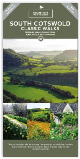
Wandelkaart Cotswold South AONB - Goldeneye
Verken de zuidelijke Cotswolds AONB te voet
Korte omschrijving
Wandelkaart Cotswold South - Goldeneye Productomschrijving: Verken de zuidelijke Cotswolds AONB, met deze waterdichte Cotswolds-wandelkaart. Met 10 cirkelvormige rondwandelingen en duidelijk...

Specificaties
- Uitgever: Goldeneye
- ISBN-13: 9781859652541
- HOOFDCATEGORIEËN: Wandelkaart
- Activiteiten: Wandelen, Hiking & Trekking
- Regio: Gloucestershire, Egland, Oxfordshire west England, Somerset South West England, Warwickshire, West Midlands, Wiltshire, West England, Worcestershire, West England
- Land: England
- AONB - Area of Outstanding Beauty: Cotswolds AONB
- Schaal: 1:32400
- Afmeting: 12x24
- Editie: 3
- Taal: Engels
Volledige omschrijving
Wandelkaart Cotswold South - Goldeneye
Productomschrijving: Verken de zuidelijke Cotswolds AONB, met deze waterdichte Cotswolds-wandelkaart. Met 10 cirkelvormige rondwandelingen en duidelijk gemarkeerde routes zal deze gebruiksvriendelijke kaart u helpen de Cotswolds te ontdekken. Stap in de Cotswolds met deze uitzonderlijk mooie wandelingen. Ontdek idyllische honingkleurige stenen dorpjes, typisch Engelse marktstadjes en spectaculaire uitzichten als u de rustige paden in en weg van de toeristische hotspots verkent. AONB betekend, Erea of Outstanding Natural Beauty, of regio van uitmunend natuurschoon.
De wandelingen in: Bibury - Coln St Aldwyns; Eastleach - Leach Valley; Uley - Uley Bury; Ozleworth; Haresfield Beacon; Cranham - Cranham Woods, Edgeworth - Misarden Park, Sapperton - Golden Valley, Painswick - Slad Valley, Chedworth - Chedworth Woods.
Engelse omschrijving: Explore the south Cotswolds with this waterproof Cotswolds walking map. With 10 circular, clearly-marked routes this easy-to-use map will help you discover the Cotswolds. Step into the Cotswolds with these exceptionally beautiful walks. Discover idyllic honey-coloured stone villages, quintessentially English market towns and spectacular views as you explore the quiet trails in and away from the tourist hotspots.
Each of the 10 walking tours include:
* All the practical information you need - how far, how much time to allow, what's the terrain like, is it suitable for dogs, where are the loos, where do I park, can I get a cream tea or a beer along the way.
* Features of interest - each map includes the highlights of what you can expect to see along the way.
* Clear navigational reference points - at each turn there is a clear description of what you should be able to see to ensure you select the correct route. With the walks starting from 4 miles, there's a walk for everyone here. Use the short description and photographs to help you decide whether the route suits you then strap on your boots and head out for a wonderful escape into the Cotswolds countryside.
The Walks: Bibury - Coln St Aldwyns; Eastleach - Leach Valley; Uley - Uley Bury; Ozleworth; Haresfield Beacon; Cranham - Cranham Woods, Edgeworth - Misarden Park, Sapperton - Golden Valley, Painswick - Slad Valley, Chedworth - Chedworth Woods.
Many of these walks join up and can make a figure-of-eight configuration. 47 photographs
Locatie op kaart
Overzichtskaarten

Area's of Outstanding Natural Beauty - AONB's UK
Area's of Outstanding Natural Beauty - AONB's UK

Producten op de overzichtskaart
Klik op een product om naar de detailpagina te gaan.
- Wandelgids - Guide to the Cotswolds AONB - AA
- Wandelkaart 24 - Chilterns AONB - AA
- Fietskaart- en Mtb kaart - The Cotswolds - Goldeneye
- Wandelgids - Cotswold classic walks guidebook - Goldeneye
- Wandelkaart - Cotswold South AONB - Goldeneye
- Wandelgids - Exploring the Cotswolds - Goldeneye
- Wandelgids - Cotswold Classic Walks - Goldeneye
- Wandelkaart - Cotswolds- Malverns & Forest of Dean - Goldeneye
- Wandelgids - The Cotswold Way 30 classic routes - Cicerone
- Wandelgids - Kent walking guide - Cicerone
- Wandelgids - North Downs Way Nat. trail - Cicerone
- Wandelgids - Chilterns walking guide - Cicerone
- Wandelgids - Suffolk coast & Heaths walks - Cicerone
- Wandelgids - North Downs Way - Map Booklet - Cicerone
- Wandelgids - North Pennines AONB walking guide - Cicerone
- Wandelgids - Ridgeway National Trail - Cicerone
- Wandelgids - Forest of Bowland & Pendle - Cicerone
- Wandelgids - Hampshire's Test Way walking guide - Cicerone
- Wandelgids & Fietsgids - The Cotswold AONB - Cicerone
- Wandelgids - Walking on the Gower - Cicerone
- Wandelgids - North Wessex Downs - Cicerone Press
- Wandelgids - Walking on the North Wessex Downs - Cicerone
- Wandelgids - Silverdale & Arnside AONB - Cicerone
- Wandelgids - The Kennet and Avon Canal walking guide - Cicerone
- Wandelgids - North Downs Way- 246 km - Trailblazer
- Wandelkaart OL2 - Yorkshire Dales- Southern & Western Areas - OSI
- Wandelkaart OL19 - Howgill Fells and Upper Eden Valley - OSI
- Wandelkaart OL21 - South Pennines - Yorkshire - OSI
- Wandelkaart OL31 - North Pennines- Teesdale & Weardale - OSI
- Wandelkaart OL40 - The Broads - OSI
- Wandelkaart OL41 - Forest of Bowland & Ribblesdale - OSI
- Wandelkaart OL45 - The Cotswolds AONB- Gloucestershire - OSI
- Wandelkaart 108 - Lower Tamer Valley & Plymouth- Cornwall- OSI
- Wandelkaart 115 - Exmouth & Sidmouth- Devon - OSI
- Wandelkaart 137 - Ashford- Kent downs AONB- England - OSI
- Wandelkaart 140 - Quantock Hills AONB- Somerset - OSI
- Wandelkaart 140 - Quantock Hills AONB & Bridgwater- Devon - OSI
- Wandelkaart 147 - Sevenoaks & Tonbridge- Kent - OSI
- Wandelkaart 164 - Gower AONB & Gwyr- South Wales - OSI
- Wandelkaart 164 - Gower AONB & Gwyr- Wales - OSI
- Wandelkaart 171 - Chiltern Hills West & Henley-on-Thames OSI
- Wandelkaart 171 - Chiltern Hills West AONB- Wycombe - OSI
- Wandelkaart 172 - Chiltern Hills East AONB- Wycombe - OSI
- Wandelkaart 181 - Chiltern Hills AONB North- England - OSI
- Wandelkaart 181 - Chiltern Hills North AONB- Wycombe - OSI
- Wandelkaart 190 - Malvern Hills & Bredon Hill - OSI
- Wandelkaart 190 - Malvern Hills AONB & Bredon Hill - OSI
- Wandelkaart 203 - Ludlow- Shropshire Hills AONB - OSI
- Wandelkaart 217 - Long Mynd & Wenlock Edge- Schropshire- OSI
- Wandelkaart 254 - Lleyn Peninsular East- North Wales - OSI
- Wandelkaart 261 - Boston- Lincolnshire AONB - OSI
- Wandelkaart 262 - Anglesey West- Wales AONB - OSI
- Wandelkaart 263 - Anglesey East AONB- Wales - OSI
- Wandelkaart 273 - Lincolnshire Wolds South AONB - OSI
- Wandelkaart 282 - Lincolnshire Wolds North AONB - OSI
- Wandelkaart 298 - Nidderdale AONB- Yorkshire - OSI
- Wandelkaart 298 - Nidderdale AONB North Yorkshire - OSI
- Wandelkaart 300 - Howardian Hills AONB - OSI
- Wandelkaart 300 - Howardian Hills AONB & Malton - OSI
- Wandelkaart - Mourne Mountains N. Ireland - Harvey maps
- Wandelkaart - Fietskaart Forest of Bowland - Harvey maps
- Wandelkaart XT40 - Anglesey Coastal Path N. Wales - Harvey Maps
- Wandelkaart XT40 - Pennine Way Noord - Harvey Maps
- Wandelkaart XT40 - Pennine Way Zuid - Harvey Maps
- Wandelgids Cotswold - Way Two-way trekking guide - Knife Edge
- Reisgids Oxford & the Cotswolds AONB - Edicola
- Reisgids Cotswolds England - Rough Guides
- Reisgids Go Slow- Sussex & the South Downs- Weald & Coast - Bradt
- Travelguide Oxford & The Cotswolds pocket guide - Lonely Planet
- Wandelgids - The Ridgeway National trail - Trailblazer
Artikelen uit dezelfde regio

Fietskaart & Mtb kaart The Cotswolds - Goldeneye • 9781859652589
Fietskaart en Mtb kaart - The Cotswolds - Goldeneye Productomschrijving: De Cotswolds is een AONB streek, (Area of Outstanding Natural Beauty) in centraal Engeland. Het gebied omvat de graafschappen Somerset, Warwickshire, Wiltshire, Oxfordshire & Worcestershire, maar het grootste deel ligt in Gloucestershire. Er wordt sinds eeuwen kalksteen uit de steengroeven gewonnen in deze regio, en d…

Wandelkaart 142 Shepton Mallet & Mendip Hills - OSI • 9780319470145
Wandelkaart Shepton Mallet & Mendip Hills East - Somerset Productbeschrijving: Kaart nummer 142 in de OS Explorer kaarten reeks omvat Midsomer Norton, Frome, Shepton Mallett en Strauss. Hoogtepunten van het gebied zijn onder andere: Westerse Cranbourne Chase en West Wiltshire Downs AONB, het zuidelijkste puntje van de Cotswolds AONB. Rivier de Frome, de rivier Brue, en het Oosten Mendip Wa…

Reisgids Oxford en quelques jours - Lonely Planet • 9782816179231
Reisgids Oxford en quelques jours - LP Déscription de produits: Un guide tout en couleurs, concis et ultrapratique pour découvrir Oxford et les Cotswolds Un guide complet permettant de combiner la découverte d’Oxford et l’exploration des Cotswolds AONB, l’une des plus belles campagnes d’Angleterre, aux portes de la ville Un découpage par quartier de la célèbre ville universitaire avec …

Wandelkaart 181 Chiltern Hills AONB North- England - OSI • 9780319470534
Wandelkaart Chiltern Hills AONB North - Oxfordshire Omvat ook: Aylesbury, Berkhamsted & Chesham. Productbeschrijving: Kaart nummer 181 in de OS Explorer reeks omvat Aylesbury, Wendover, Berkhamstead, Chesham, Princes Risborough en Tring. Hoogtepunten van het gebied zijn The Chiltern Hills, rivier Thame, The Chilterns AONB, Aylesbury Ring, de Ridgeway en de Chiltern way. De OS Explorer …

Fotoboek Cotswolds - The beauty of The Cotswolds AONB • 9781859652183
Fotoboek Cotswolds - The beauty of The Cotswolds AONB Productomschrijving: De eerste van een nieuwe serie van massamarkt souvenirboeken. Een Memento, een aandenken voor de duizenden toeristen die de Cotswolds, Cornwall, Lake District en Noord-Devon bezoeken. Dit fotoboek is een bewijs van William Fricker zijn lange geschiedenis met de Cotswoldheuvels. Deze beelden zijn vergaard geweest uit…